Saint-Martin-D'Entraunes
Saint-Martin-D'Entraunes
The best road cycling routes around Saint-Martin-D'Entraunes
4.7
(64)
4,439
riders
29
rides
Road cycling around Saint-Martin-D'Entraunes features routes through the Southern French Alps, characterized by high mountain passes, deep river gorges, and alpine valleys. The terrain includes significant elevation changes, with routes often traversing passes like Cayolle and Champs. This region offers a network of roads that wind through varied landscapes, from open mountain vistas to forested sections and historical sites.
Best road cycling routes around Saint-Martin-D'Entraunes
- The most popular road cycling route is Cayolle Pass – Champs Pass loop from Saint-Martin-d'Entraunes…
Last updated: July 9, 2026
5.0
(8)
610
riders
130km
07:40
3,250m
3,260m
Hard road ride. Very good fitness required. Mostly well-paved surfaces and easy to ride.
5.0
(2)
96
riders
38.2km
02:27
1,080m
1,080m
Hard road ride. Very good fitness required. Some segments of this route may be unpaved and difficult to ride.

Sign up for free
5.0
(2)
81
riders
66.0km
03:25
1,180m
1,180m
Hard road ride. Very good fitness required. Mostly well-paved surfaces and easy to ride.
5.0
(1)
66
riders
41.8km
02:41
1,230m
1,230m
Hard road ride. Very good fitness required. Some segments of this route may be unpaved and difficult to ride.
49
riders
22.7km
01:32
750m
750m
Moderate road ride. Good fitness required. Mostly well-paved surfaces and easy to ride.
Get access to more routes and recommendations from other explorers.
Sign up for free
Already have an account?
Our route recommendations are based on thousands of hikes, rides, and runs completed by other people on komoot.
Start today with a free account
Your next adventure awaits.
Login or Signup
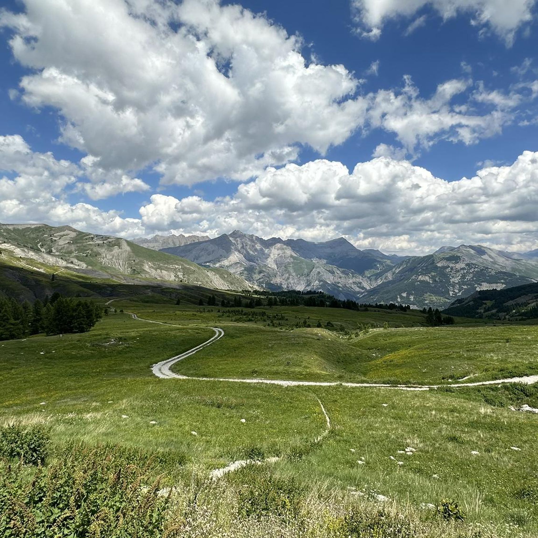
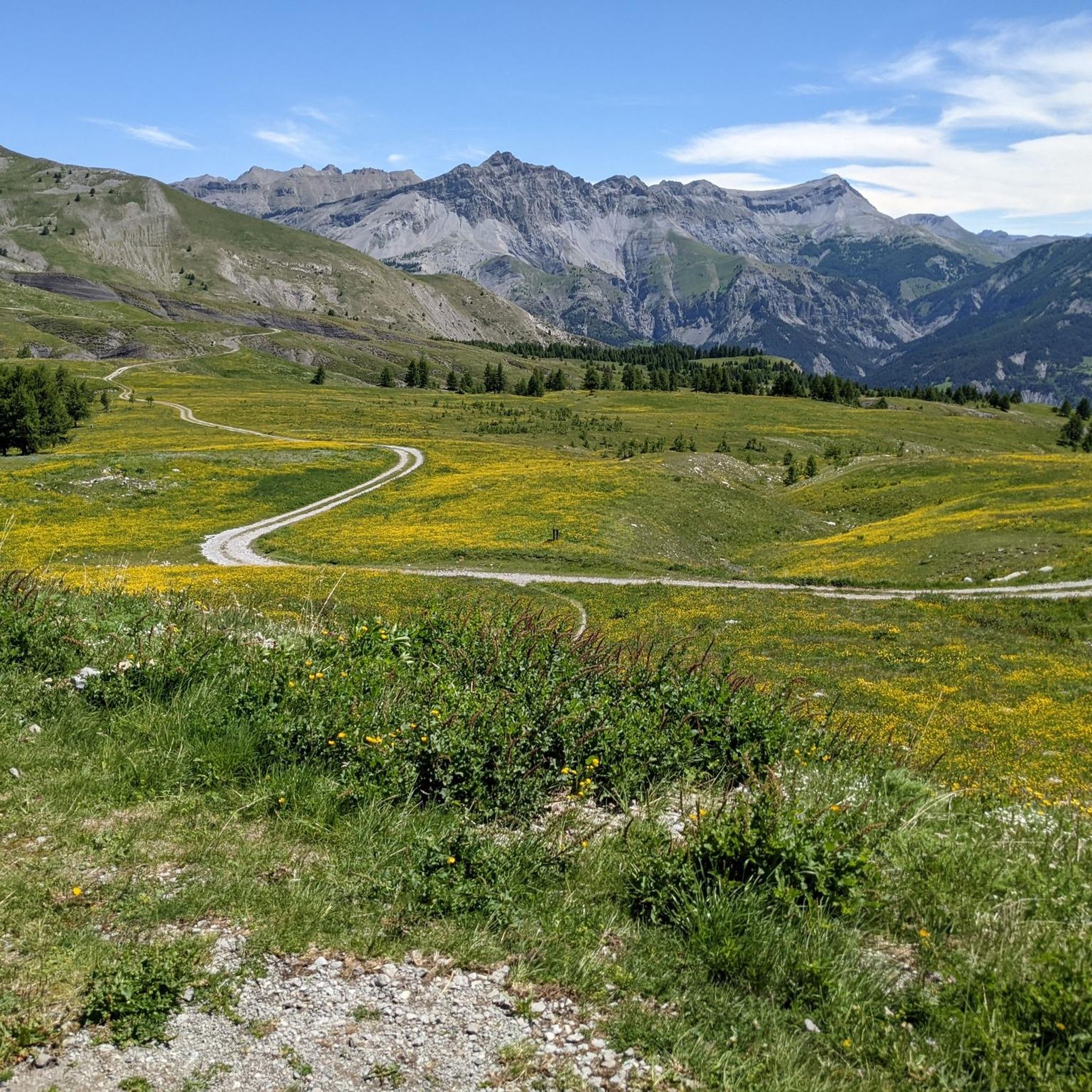
Tips from the Community

This crossing point is spectacular.
12
0

Tried and tested! There's still a long way to go to the top of the pass, so don't forget to stay hydrated.
0
1
Drinking water (tested and approved)!!
0
0


The Col des Champs is a mountain pass with an altitude of 2,087 meters and connects Haute-Provence with the Alpes-Maritimes, all within the Mercantour National Park. The pass is part of the so-called Route des Trois Cols, an interesting circular route with three passes above 2,000 meters. This route connects the Col d'Allos with the Col de la Cayolle via this pass, thus linking the Allos Valley (Haute-Verdon) with the Var Valley. Its two slopes share the ruggedness of a major Alpine pass.
0
0

spectacular, also very pleasant to ride up and down along the gorges
0
0

Highly recommended climb from Guillaumes to Valberg. The first stretch to Peonne is a bit flatter and then it goes through the forest through countless hairpin bends up to Valberg on a quiet road.
0
0

Frequently Asked Questions
How many road cycling routes are available around Saint-Martin-D'Entraunes?
There are nearly 30 road cycling routes around Saint-Martin-D'Entraunes, offering a variety of challenging rides through the Southern French Alps.
Are there any easy road cycling routes for beginners in Saint-Martin-D'Entraunes?
Road cycling around Saint-Martin-D'Entraunes is characterized by significant elevation changes and high mountain passes. The routes are generally moderate to difficult, with no easy trails suitable for beginners.
What are some of the longer road cycling routes in the region?
For those seeking a long-distance challenge, the Pont – Ascent to Peone - Valberg loop from Entraunes covers 80.7 miles (129.9 km) with substantial ascents. Another option is the Cayolle Pass – Champs Pass loop from Saint-Martin-d'Entraunes, which is 69.8 miles (112.4 km) and features two major alpine passes.
What kind of terrain can I expect on road cycling routes in Saint-Martin-D'Entraunes?
The terrain is defined by high mountain passes like Cayolle and Champs, deep river gorges, and alpine valleys. You'll encounter significant elevation changes, winding roads through varied landscapes, from open mountain vistas to forested sections.
What are the best seasons for road cycling in Saint-Martin-D'Entraunes?
The best seasons for road cycling are typically late spring, summer, and early autumn (May to October), when mountain passes are clear of snow and weather conditions are generally stable. Always check local weather forecasts, especially for high-altitude sections.
Are there any circular road cycling routes in the area?
Yes, many routes are designed as loops. Examples include the challenging Cayolle Pass – Champs Pass loop from Saint-Martin-d'Entraunes and the shorter Fort de Savoie – Fortifications of Colmars loop from Chaumie, which explores historical sites.
What are some scenic viewpoints or attractions along the road cycling routes?
The region offers numerous scenic spots. You can find stunning views from high passes like Cayolle Pass and Champs Pass. The Bride's Bridge – Daluis gorges loop from Villeneuve-d'Entraunes offers dramatic gorge scenery. You might also encounter beautiful alpine lakes such as Lake Allos or Little Cayolle Lake.
What do other road cyclists say about the routes in Saint-Martin-D'Entraunes?
The routes in Saint-Martin-D'Entraunes are highly rated by the komoot community, with an average score of 4.7 stars from over 60 reviews. Cyclists often praise the challenging climbs, the breathtaking mountain scenery, and the sense of accomplishment after conquering the high passes.
Are there any routes that pass through historical sites or fortifications?
Yes, the Fort de Savoie – Fortifications of Colmars loop from Chaumie is a notable route that leads through historical fortifications and river valleys, offering a blend of cycling and cultural exploration.
Can I find routes that include tunnels or unique geological features?
The Cayolle Pass – Tunnel de Bramus loop from Saint-Martin-d'Entraunes is an excellent option that incorporates the Tunnel de Bramus, adding a distinctive element to your ride through the alpine landscape.
What is the typical difficulty level for road cycling routes here?
The majority of road cycling routes around Saint-Martin-D'Entraunes are classified as difficult, with a smaller number being moderate. This reflects the mountainous nature of the region, featuring significant climbs and descents.
Most popular attractions around Saint-Martin-D'Entraunes

Get inspired with the komoot mobile app


Explore more
Browse the best Road cycling routes in other regions.
