The best running trails around Plounévézel
4.6
(8)
961
runners
106
runs
Jogging around Plounévézel offers diverse natural landscapes, including forests, valleys, and waterways. The region, situated in Finistère, France, provides varied terrain suitable for different running preferences. Key features include the ancient Huelgoat Forest with its unique rock formations and paths along the Aulne River and Nantes-Brest Canal. These natural elements create a stimulating environment for runners seeking varied routes.
Best jogging routes around Plounévézel
- The most popular jogging route is Poullaouen loop from Carhaix-Plouguer, a 12.8 miles (20.6 km)…
Last updated: October 13, 2026
8
runners
16.9km
01:51
140m
140m
Hard run. Very good fitness required. Mostly paved surfaces. Suitable for all skill levels.
10
runners
8.21km
00:52
100m
100m
Moderate run. Good fitness required. Mostly paved surfaces. Suitable for all skill levels.

9
runners
20.6km
02:23
170m
170m
Hard run. Very good fitness required. Mostly paved surfaces. Suitable for all skill levels.
5
runners
7.63km
00:53
70m
70m
Moderate run. Good fitness required. Mostly paved surfaces. Suitable for all skill levels.
6
runners
20.9km
02:22
330m
330m
Hard run. Very good fitness required. Mostly paved surfaces. Suitable for all skill levels.
Get access to more routes and recommendations from other explorers.
Already have an account?
Our route recommendations are based on thousands of hikes, rides, and runs completed by other people on komoot.
Start today with a free account
Your next adventure awaits.



Tips from the Community

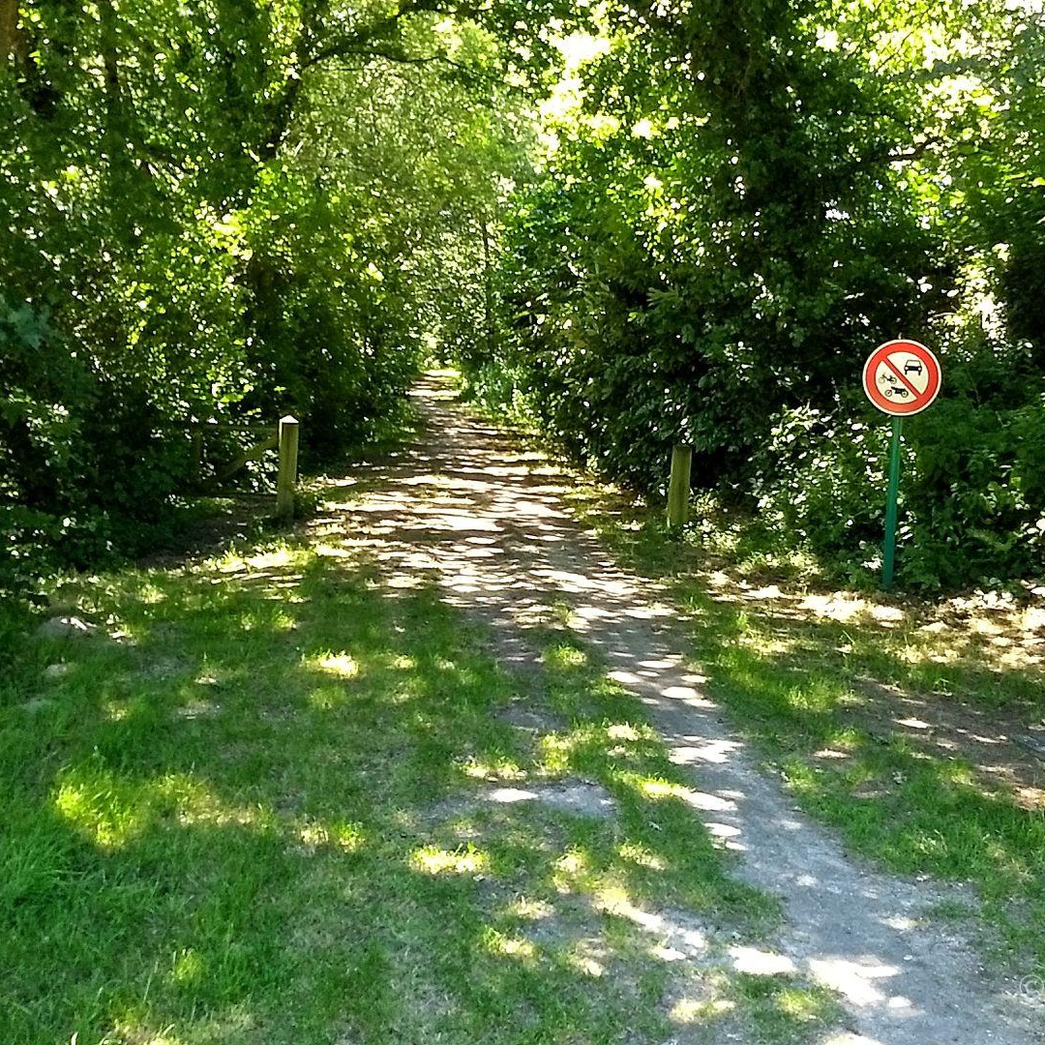
We are well in the shade, a well-maintained path
0
0

very pleasant
0
0

Carhaix-Plouguer (/kaʁɛ pluɡɛʁ/Note 1), commonly called Carhaix, is known to be one of the most flourishing cities of Gallo-Roman Armorica during Antiquity, then bearing the name Vorgium (Latin name of the capital of the Gallic and then Gallo-Roman people of the Osismes). It is today known for hosting, since 1992, the Vieilles Charrues festival, one of the main music festivals in Europe.
0
0
On this square in La Tour-d’Auvergne in Carhaix, the convent of the Hospitallers once stood. The Notre-Dame des Grâces chapel, located near the Post Office, is the last vestige. Victim in 1875 of a fire which almost destroyed it, the hospital was definitively abandoned in 1920 and its ruins were completely leveled. Probably used as a fairground since the Middle Ages, this ancient square adjoined the moat of the Carhaix castle. It was in 1841 that the bronze statue executed by the sculptor Charles Marochetti of Théophile Malo Corret de La-Tour-d'Auvergne was erected. This place was also called Martroy or Martret, a term which means market in old French. It therefore logically had to fulfill this function. Logical, given its location in the city.
0
0

Beautiful greenway, well maintained and marked. It follows the old railway lines and allows you to cross the valleys without any elevation changes.
2
0

Historic ensemble centered on the old city chateau, next to the monastery of the hospitalière order
0
0

Small bridge whose arc forms a semicircle, and whose reflection perfectly completes the circle. A beautiful shot to take along the Vélodyssée greenway.
0
0
Frequently Asked Questions
How many running routes are available around Plounévézel?
There are over 80 dedicated running routes around Plounévézel, offering a wide variety of distances and difficulty levels. This includes 6 easy routes, 66 moderate routes, and 8 more challenging options, ensuring there's something for every runner.
What kind of terrain can I expect on jogging routes near Plounévézel?
The jogging routes near Plounévézel offer diverse terrain, from the enchanting paths of the Huelgoat Forest with its unique rock formations and ancient trees, to serene trails along the Aulne River and the Nantes-Brest Canal. You'll find a mix of dense forests, valleys, and waterways, with some routes featuring gentle hills and others providing more significant elevation gains for a challenging experience.
Are there any interesting landmarks or natural features to see while running in Plounévézel?
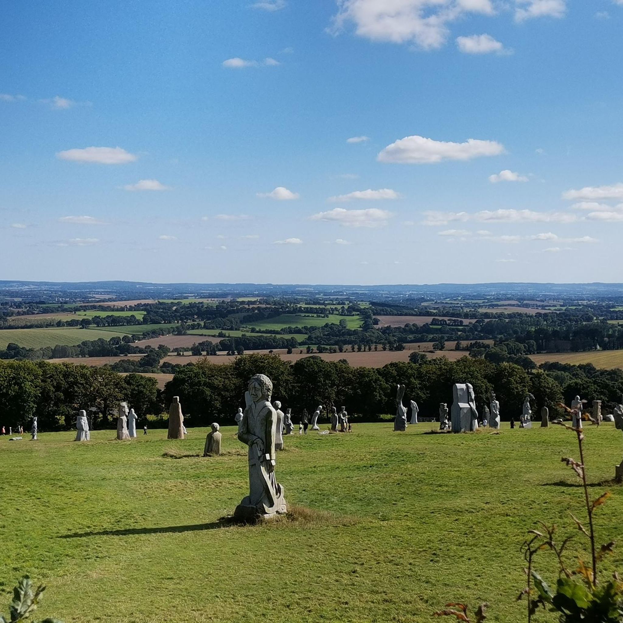
Absolutely! Many running routes in the area pass by significant natural and historical sites. You can explore the mystical Huelgoat Forest, known for its legendary rock formations like the Grotte du Diable. The Canal de la Mine Trail offers a unique forest walk with historical context. Additionally, the Valley of the Saints, with its monumental sculptures, is a notable attraction nearby.
What do other runners appreciate about the trails in Plounévézel?
The running trails in Plounévézel are highly rated by the komoot community, with an average score of 4.5 stars from over 7 reviews. More than 600 runners have explored the area using komoot, often praising the diverse natural landscapes, the variety of terrain, and the stimulating environment provided by the forests and waterways.
Are there family-friendly running routes in the Plounévézel area?
Yes, several routes are suitable for families. The region's greenways, such as sections of the Voie Verte Morlaix-Carhaix (Gars an Hore), offer well-maintained paths with no significant elevation changes, making them ideal for a relaxed run or walk with children. Look for the 'easy' graded routes for the most family-friendly options.
Can I bring my dog on the running trails around Plounévézel?
Many trails in the Plounévézel area are dog-friendly, allowing you to enjoy your run with your canine companion. However, it's always recommended to keep your dog on a leash, especially in nature reserves or areas with livestock, and to check for any specific local regulations or signage along the route.
Are there any circular running routes available?
Yes, many of the running routes around Plounévézel are designed as loops. For example, the Running loop from Plounévézel is a moderate 4.7-mile (7.6 km) trail that takes you through the local countryside, offering a convenient circular option.
Where can I find parking for the running routes?
Parking availability varies by route. For routes starting in or near towns like Carhaix-Plouguer, you'll typically find public parking areas. For trails deeper in natural areas like the Huelgoat Forest, designated parking lots are often available near trailheads. It's advisable to check the specific route details on komoot for parking information.
What is a good running route for someone looking for a challenge?
If you're seeking a challenging run, consider the Poullaouen loop from Carhaix-Plouguer. This difficult 12.8-mile (20.6 km) trail features a significant elevation gain and takes approximately 2 hours and 23 minutes to complete, offering a demanding experience for seasoned runners.
Are there any moderate running routes with varied scenery?
For a moderate run with varied scenery, the Carhaix-Plouguer – Place de la Tour d'Auvergne loop from Carhaix-Plouguer is an excellent choice. This 7.6-mile (12.3 km) path includes a hill climb and offers diverse views through the local landscape, making for an engaging run.
What are the best seasons for running in Plounévézel?
Plounévézel offers pleasant running conditions throughout much of the year. Spring and autumn provide mild temperatures and beautiful scenery, with vibrant foliage or blooming wildflowers. Summer is also suitable, especially in the shaded forest areas, though it's best to run in the mornings or evenings to avoid the midday heat. Winter runs can be invigorating, but be prepared for cooler, potentially wetter conditions.
Can I access running trails using public transport?
While Plounévézel itself is a smaller commune, routes starting from larger nearby towns like Carhaix-Plouguer may be more accessible via public transport. The region's network of greenways and canal paths often connects various villages, potentially offering public transport links to starting points. It's recommended to check local bus schedules for specific access points.
Most popular routes around Plounévézel
Most popular attractions around Plounévézel

Get inspired with the komoot mobile app


Explore more
Browse the best Running Trails & Routes in other regions.
