
The best running trails around Beuveille
4.5
(15)
741
runners
50
runs
Jogging around Beuveille offers opportunities to explore the natural features of this rural commune in the Grand Est region of France. The area is characterized by its position within the Meuse river basin, with the Crusnes river and Beuveille stream providing scenic riparian paths. Beuveille's topography ranges from 217 to 333 meters in altitude, presenting varied landscapes with gentle inclines and declines suitable for diverse running experiences. The green countryside and established paths for walks and hikes contribute to a…
Last updated: October 7, 2026
37
runners
8.95km
01:04
180m
180m
Moderate run. Good fitness required. Mostly paved surfaces. Suitable for all skill levels.
11
runners
13.8km
01:31
200m
200m
Moderate run. Good fitness required. Mostly paved surfaces. Suitable for all skill levels.

6
runners
10.1km
01:06
130m
130m
Moderate run. Good fitness required. Mostly paved surfaces. Suitable for all skill levels.
4.0
(1)
4
runners
9.94km
01:04
140m
130m
Moderate run. Good fitness required. Mostly paved surfaces. Suitable for all skill levels.
6
runners
5.73km
00:41
60m
60m
Moderate run. Good fitness required. Mostly paved surfaces. Suitable for all skill levels.
Get access to more routes and recommendations from other explorers.
Already have an account?
Our route recommendations are based on thousands of hikes, rides, and runs completed by other people on komoot.
Start today with a free account
Your next adventure awaits.

Frequently Asked Questions
How many running routes are available in Beuveille?
There are over 50 running routes available around Beuveille, offering a wide range of options for joggers. These include 7 easy routes, 42 moderate routes, and 4 more challenging trails, ensuring there's something for every fitness level.
What kind of terrain can I expect on the running trails around Beuveille?
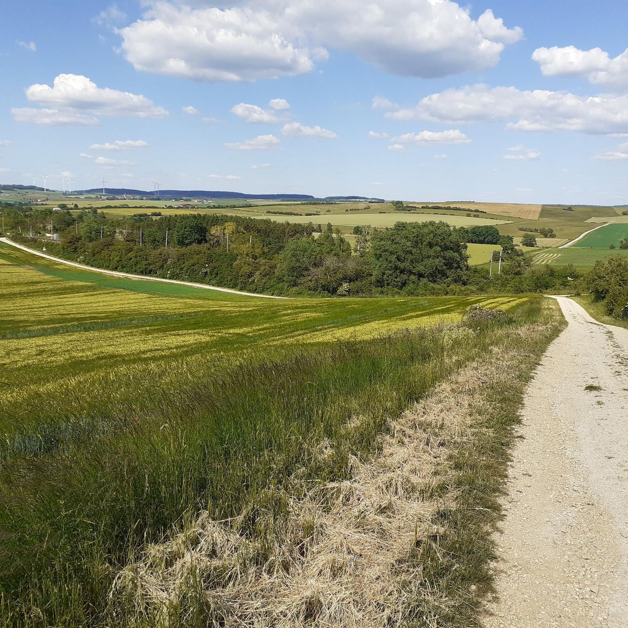
The running trails around Beuveille offer diverse terrain, characteristic of the Lorraine Regional Natural Park. You can expect a mix of dense forests, open panoramas of surrounding valleys, and paths alongside rivers like the Crusnes. The area features varied landscapes, from shaded forest paths to more open countryside routes, with gentle inclines and declines ranging from 217 to 333 meters in altitude.
Are there any easy or beginner-friendly running routes in the area?
Yes, Beuveille offers several easy running routes suitable for beginners or those looking for a more relaxed jog. There are 7 routes classified as easy, providing gentle paths through the green countryside. For example, the Étang de Profonde Fontaine loop from Longuyon is a moderate option that offers a pleasant experience around a natural water feature.
Can I find circular running routes near Beuveille?
Yes, many of the running routes around Beuveille are designed as circular loops, allowing you to start and finish in the same location. Popular options include the Étang de Profonde Fontaine loop from Longuyon, which circles a scenic pond, and the Cons-la-Grandville Castle loop from Ugny, offering varied countryside and historical sights.
What are some scenic highlights or landmarks I might see while running?
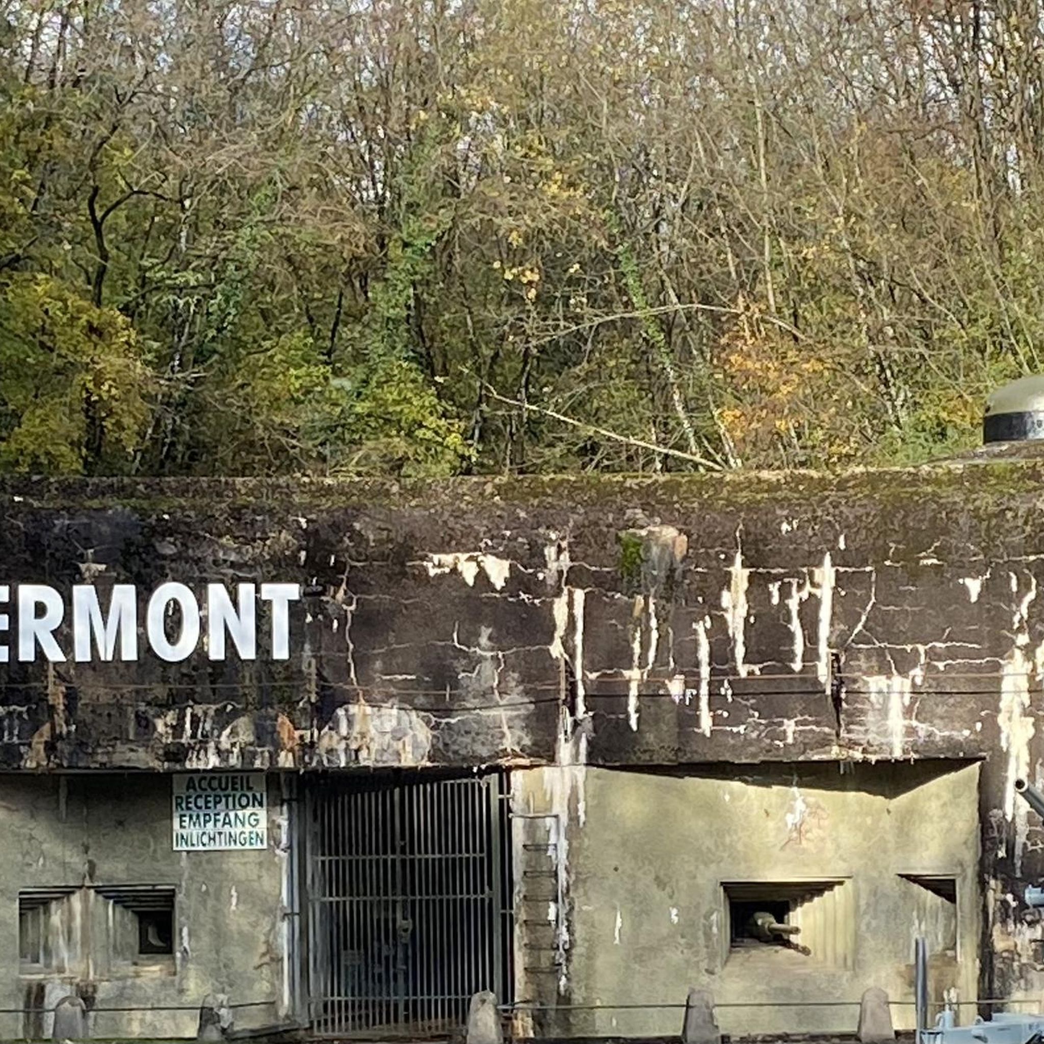
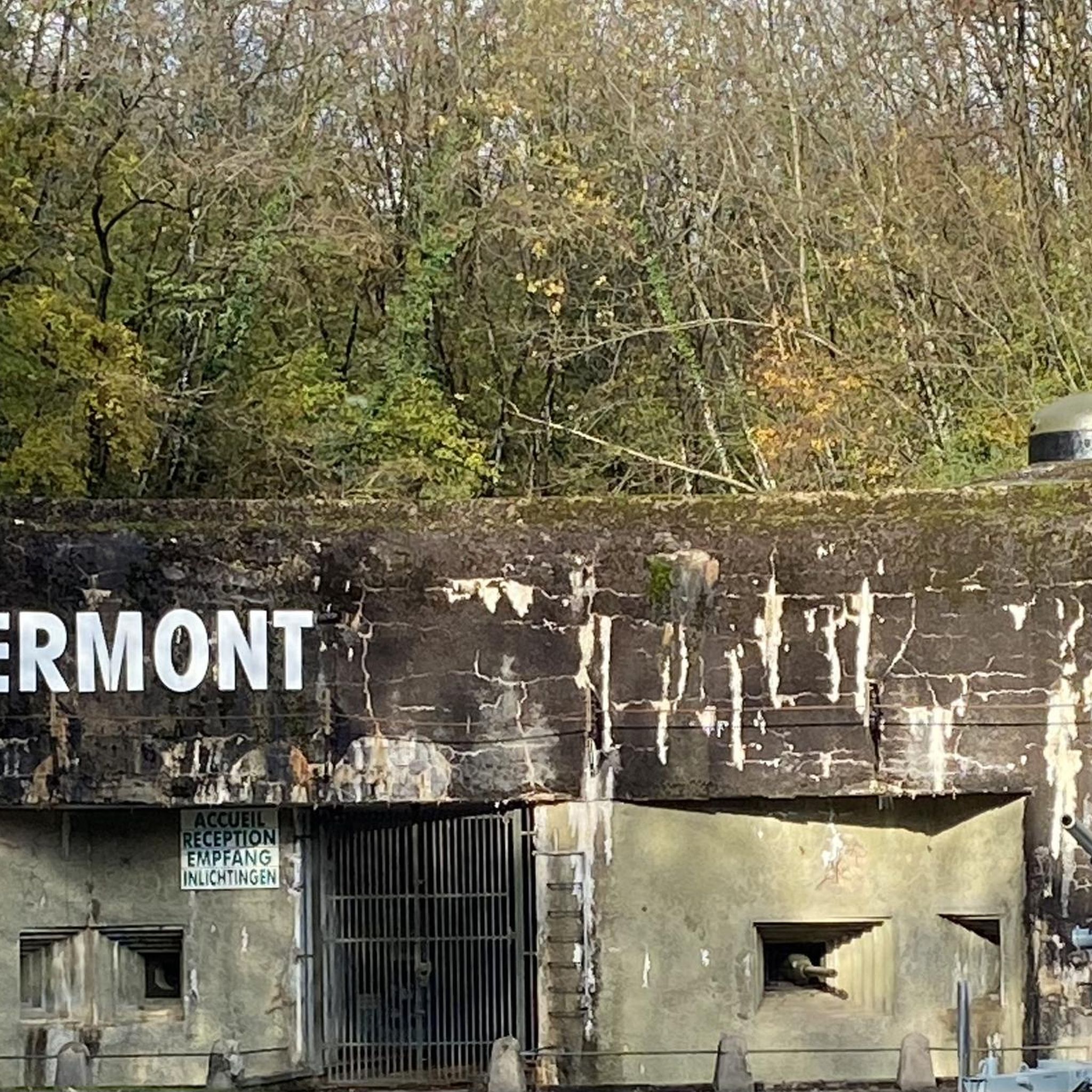
While running around Beuveille, you can encounter several scenic highlights and historical landmarks. The Cons-la-Grandville Castle loop from Ugny passes by the impressive Cons-la-Grandville Castle, a treasure of Lorraine's architectural heritage. You might also find routes that offer views of the Fort de Fermont, a well-preserved Maginot Line fortification just 5 km from Beuveille, or paths alongside the tranquil Crusnes river and Beuveille stream.
Are the running trails in Beuveille suitable for families?
Many of the running trails in Beuveille, particularly the easier and moderate routes, are suitable for families. The region's green countryside and established paths provide a tranquil environment. Consider routes with less elevation gain and shorter distances for a family-friendly experience. Always check the route details for specific difficulty and terrain before heading out.
Can I bring my dog on the running trails around Beuveille?
Generally, dogs are welcome on many of the outdoor trails in the Lorraine Regional Natural Park, which encompasses Beuveille. However, it's always advisable to keep your dog on a leash, especially in areas with wildlife or near agricultural land. Please respect local signage and ensure your dog's waste is properly disposed of to maintain the natural beauty of the trails.
What do other runners say about the trails in Beuveille?
The running routes in Beuveille are highly rated by the komoot community, with an average score of 4.5 stars from over 10 reviews. Runners often praise the varied terrain, the tranquil environment, and the scenic beauty of the natural waterways and green countryside. Over 700 runners have used komoot to explore Beuveille's diverse trails.
Is there parking available near the trailheads?
Yes, parking is generally available in the villages and towns that serve as starting points for many of the running routes around Beuveille, such as Longuyon or Ugny. While specific trailhead parking might vary, you can usually find suitable spots in or near these communes. It's always a good idea to check the route details on komoot for specific parking recommendations.
What is the best time of year for running in Beuveille?
The best time of year for running in Beuveille is typically during spring, summer, and early autumn. These seasons offer pleasant temperatures and lush natural scenery. Spring brings blooming flora, summer provides warm, long days, and autumn showcases beautiful fall colors. Winter running is possible but may require appropriate gear due to colder temperatures and potentially wet or icy conditions.
Are there any longer running routes for more experienced runners?
Yes, for more experienced runners looking for a greater challenge, Beuveille offers several longer and moderate routes. For instance, the Running loop from Ugny is a moderate 8.6-mile (13.8 km) path that traverses extensive rural landscapes. There are 42 moderate and 4 difficult routes in total, providing ample options for longer distances and more significant elevation changes.
Are there any routes that pass by water features or rivers?
Absolutely. The Beuveille area is characterized by its natural waterways, including the Crusnes river and the Beuveille stream. Many routes offer scenic paths alongside these features. The Étang de Profonde Fontaine loop from Longuyon, for example, provides a pleasant run around a natural pond, allowing you to enjoy serene waterside views.
Where can I find refreshments or places to eat after my run?
While Beuveille itself is a small rural commune, nearby towns like Longuyon and Ugny, which serve as starting points for many routes, offer options for refreshments. You can find local cafes, pubs, and restaurants in these areas to refuel and relax after your run. The local charm of the region also means you might discover quaint spots in surrounding villages.
Most popular attractions around Beuveille

Get inspired with the komoot mobile app


Explore more
Browse the best Running Trails & Routes in other regions.
