The best walks and hikes around Rehainviller
4.2
(126)
808
hikers
122
hikes
Hiking around Rehainviller offers a network of trails through varied terrain. The region is characterized by gentle hills, open countryside, and paths that often lead past historical sites. Elevation gains are generally modest, making many routes accessible for various fitness levels. The landscape provides opportunities for both shorter walks and longer excursions.
Best hiking trails around Rehainviller
- The most popular hiking route is Stanislas-Kléber Trail, a 2.9 miles (4.6 km) trail that takes 1 hour 11 minutes to complete.…
Last updated: July 5, 2026
6
hikers
4.62km
01:11
20m
20m
Easy hike. Great for any fitness level. Easily-accessible paths. Suitable for all skill levels.
4.3
(3)
35
hikers
5.67km
01:27
20m
20m
Easy hike. Great for any fitness level. Easily-accessible paths. Suitable for all skill levels.

Sign up for free
4.3
(4)
19
hikers
10.3km
02:51
170m
170m
Moderate hike. Good fitness required. Easily-accessible paths. Suitable for all skill levels.
4.0
(1)
17
hikers
17.6km
04:43
210m
210m
Moderate hike. Good fitness required. Easily-accessible paths. Suitable for all skill levels.
7
hikers
6.29km
01:36
10m
10m
Easy hike. Great for any fitness level. Easily-accessible paths. Suitable for all skill levels.
Get access to more routes and recommendations from other explorers.
Sign up for free
Already have an account?
Our route recommendations are based on thousands of hikes, rides, and runs completed by other people on komoot.
Start today with a free account
Your next adventure awaits.
Login or Signup



Tips from the Community

From the river Vezouse, a small canal was dug during the construction of the castle, which runs next to the Parc des petits bosquets. On the other side of the canal, you can park well at the quay. A small footbridge leads across the canal.
5
0
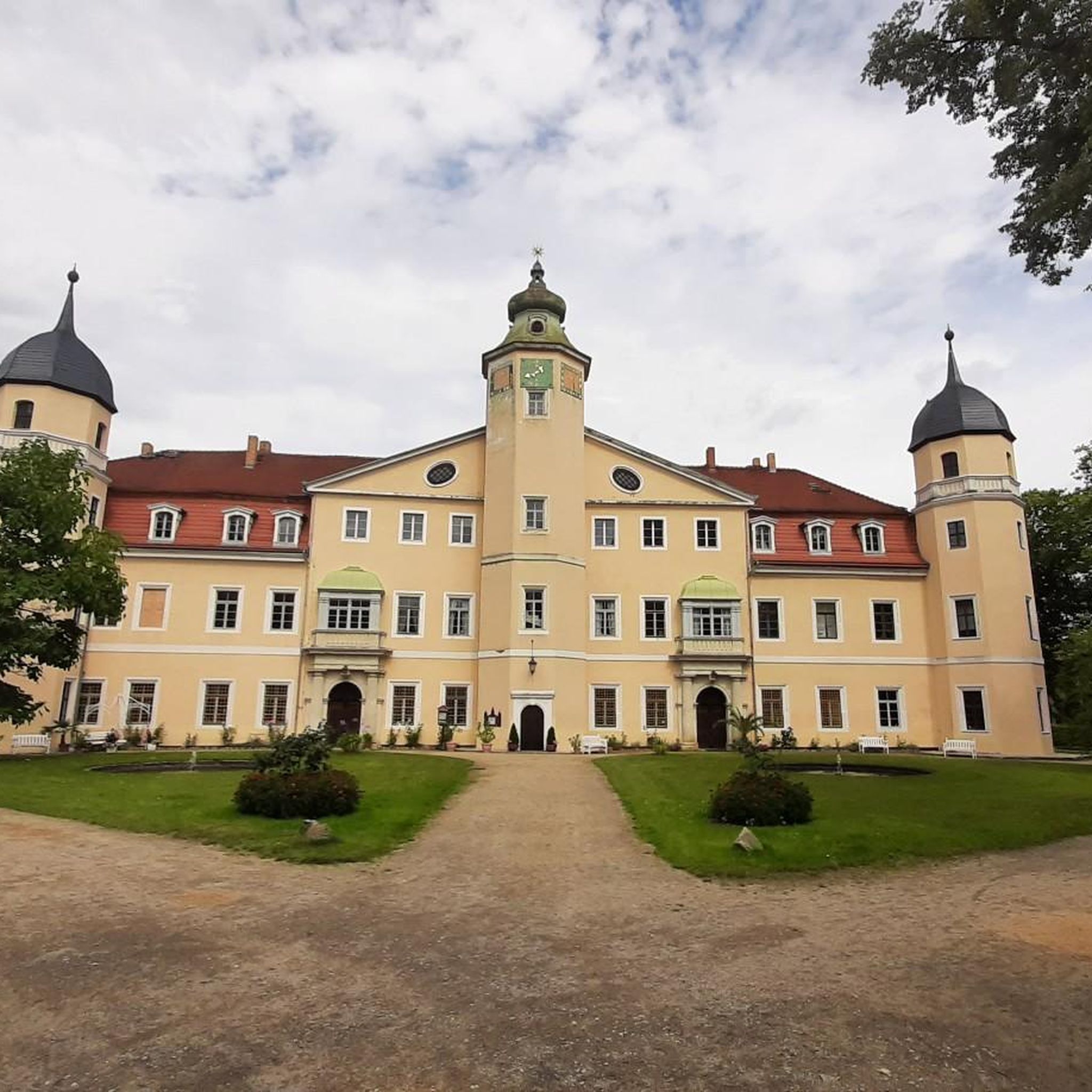
Beautiful building next to the church in the city center. The forecourt is beautifully designed with many flower beds.
5
0
The small, publicly accessible priest's garden next to the church was restored in 2005 and has since been a place dedicated to culture. Modern sculptures can also be found here. Concerts are occasionally performed.
5
0
The baroque castle of the Dukes of Lorraine is the largest in Eastern France and is considered the "Lorraine Versailles". It was severely damaged by a fire in 2003 and restored in the 2010s after high-profile fundraising campaigns. The castle and park are worth seeing.
5
0
The park behind the castle is huge, the entire castle complex covers 21 hectares. As is customary in the Baroque period, it is strictly geometric in the French style and offers many flower beds, ponds, statues, and much more.
5
0


The hill of Léomont offers a wide view over the countryside.
1
0
Frequently Asked Questions
How many hiking trails are available around Rehainviller?
There are over 110 hiking routes in the Rehainviller area, offering a wide variety of options for different preferences and fitness levels. These include 51 easy trails, 61 moderate trails, and a few more challenging options.
Are there any easy, family-friendly hikes in Rehainviller?
Yes, Rehainviller offers many easy trails suitable for families. An excellent option is the Chanteheux loop from Lunéville, an easy 6.2 km path that takes about 1 hour 35 minutes to complete through pleasant countryside.
What kind of views or landmarks can I expect on hikes near Rehainviller?
Hiking trails around Rehainviller often feature gentle hills, open countryside, and historical sites. You can enjoy views of the historic Lunéville Castle or panoramic vistas from Léomont Hill. Many routes also pass through charming villages and natural parks like Bosquets Park.
Are there any challenging hikes for experienced trekkers?
While most trails in Rehainviller are easy to moderate, there are a few longer routes that offer more of a challenge. For instance, the Château de Lunéville – Léomont Hill loop from Lunéville is a moderate 14.9 km hike with nearly 200 meters of elevation gain, taking around 4 hours to complete.
What is the best time of year to go hiking in Rehainviller?
The region around Rehainviller is enjoyable for hiking throughout much of the year. Spring brings blooming landscapes, while autumn offers beautiful foliage. Summer is ideal for longer days, and even winter can be pleasant for a crisp walk, though some paths might be muddy or icy.
Are there circular walks available in the Rehainviller area?
Yes, many of the hiking routes around Rehainviller are circular, allowing you to start and end at the same point without retracing your steps. Examples include the Lunéville Castle loop from Lunéville and the Panorama – Léomont Hill loop from Lunéville.
What do other hikers say about the trails in Rehainviller?
The hiking trails in Rehainviller are highly regarded by the komoot community, with an average rating of 4.3 stars from over 100 reviews. Hikers often praise the well-maintained paths, the variety of scenery from historical sites to open fields, and the accessibility for different fitness levels.
Is public transport available to reach hiking trailheads in Rehainviller?
While specific public transport options vary by trailhead, the town of Lunéville, which serves as a starting point for many routes, is generally well-connected. It's advisable to check local bus or train schedules to plan your access to specific trailheads.
Are there parking facilities near the hiking trails?
For many popular trailheads, especially those starting from towns like Lunéville, you can typically find public parking. However, for more remote starting points, parking might be limited. It's recommended to check the route details on komoot for specific parking information.
Can I bring my dog on the hiking trails in Rehainviller?
Most trails in the Rehainviller region are dog-friendly, allowing you to enjoy the outdoors with your canine companion. However, always keep your dog on a leash, especially near livestock or in nature reserve areas, and remember to clean up after them.
Are there any viewpoints along the hiking trails in Rehainviller?
Yes, the region offers several spots with rewarding views. The Panoramic View from Léomont Hill is a notable highlight, offering expansive vistas of the surrounding countryside. Many trails also provide scenic outlooks over the gentle hills and valleys.
Most popular routes around Rehainviller
Most popular attractions around Rehainviller

Get inspired with the komoot mobile app


Explore more
Browse the best Hikes in other regions.
