The best running trails in the Bridger Range
5.0
(9)
883
runners
113
runs
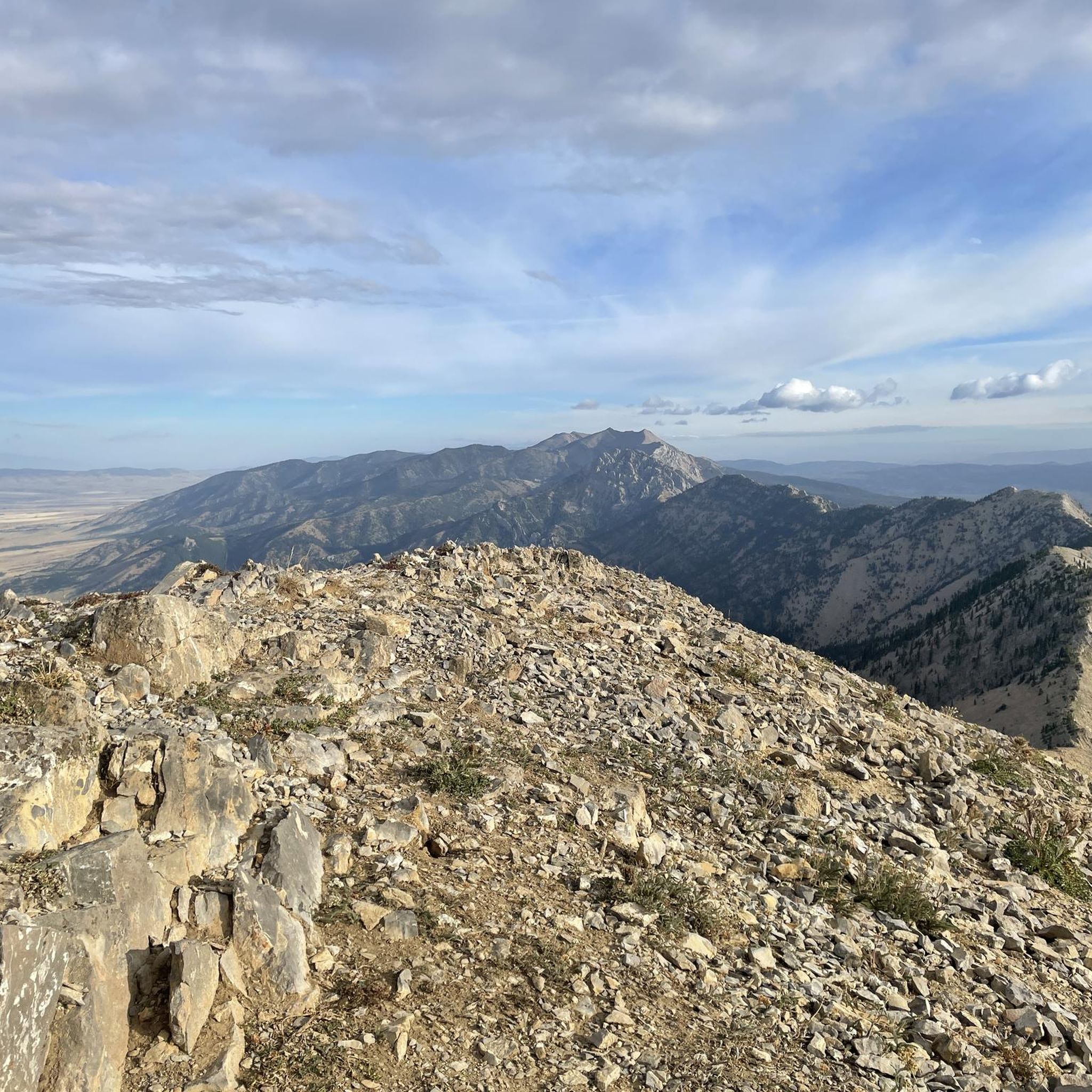
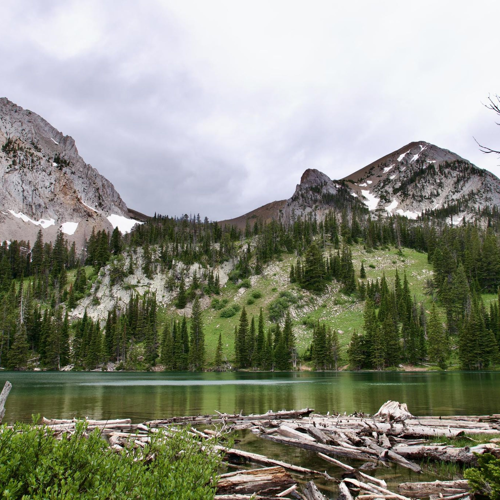
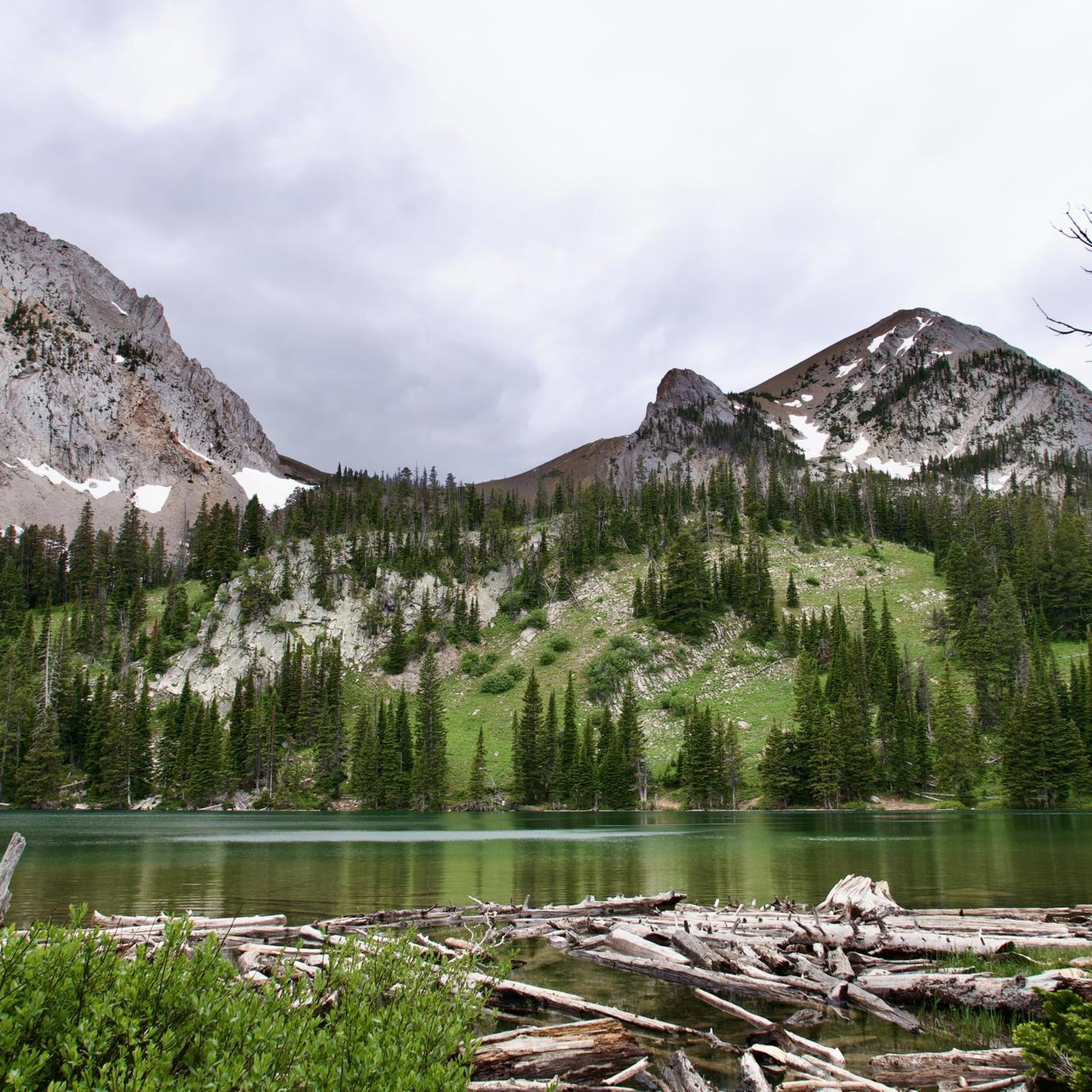
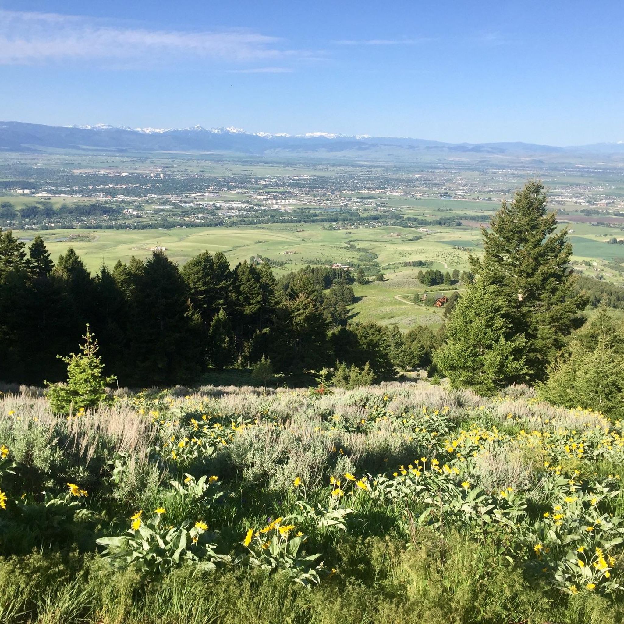
Jogging routes in the Bridger Range offer a diverse landscape for trail running enthusiasts. The region features exposed ridge lines, forested mountains, and high-elevation lakes, providing varied terrain just minutes from Bozeman. Runners can experience everything from gentle paths through wildflower meadows to challenging climbs along steep sections and technical trails. The range's natural features include trickling streams and panoramic views, making it a notable destination for outdoor activities.
Best jogging routes in the Bridger Range
- The most popular jogging…
Last updated: October 15, 2026
30
runners
8.90km
00:56
60m
60m
Moderate run. Good fitness required. Mostly paved surfaces. Suitable for all skill levels.
21
runners
3.95km
00:37
230m
230m
Moderate run. Good fitness required. Mostly paved surfaces. Suitable for all skill levels.

23
runners
12.5km
01:55
650m
650m
Hard run. Very good fitness required. Mostly paved surfaces. Suitable for all skill levels.
11
runners
17.4km
02:31
740m
740m
Hard run. Very good fitness required. Mostly paved surfaces. Suitable for all skill levels.
9
runners
19.3km
02:56
960m
960m
Hard run. Very good fitness required. Mostly paved surfaces. Suitable for all skill levels.
14
runners
3.13km
00:35
250m
250m
Moderate run. Good fitness required. Mostly paved surfaces. Suitable for all skill levels.
10
runners
20.9km
03:05
860m
860m
Hard run. Very good fitness required. Sure-footedness, sturdy shoes and alpine experience required.
7
runners
14.6km
01:35
90m
90m
Moderate run. Good fitness required. Mostly paved surfaces. Suitable for all skill levels.
Get access to more routes and recommendations from other explorers.
Already have an account?
Our route recommendations are based on thousands of hikes, rides, and runs completed by other people on komoot.
Start today with a free account
Your next adventure awaits.


Other adventures in the Bridger Range

Tips from the Community

The spur trail is well-maintained, finely crushed gravel.
0
0

Story Mill Community Park is Bozeman's largest nature park. It has 15 acres of wetlands, a playground, picnic area and walking trails.
0
0
Story Mill Nature Reserve is a 40 acre nature sanctuary that has several miles of trails that cut through a large green space. There are still remnants of the water-powered mill and grain elevator that used to be active on this land.
0
0

Parking for Middle Cottonwood trail. Road gets very icy in winter, drive with care.
0
0

Bozeman Fish Technology Center is a working fish hatchery that you can visit just outside of Bozeman, Montana in Bridger Canyon. You can view and feed the fish, learn about the important work and services that fish hatcheries provide, and hike one of over 2,100 miles of trails and boardwalks located near the facility.
0
0

The Gallatin Valley, now known as Bridger Canyon, was referred to as "The Valley of Flowers" by Native Americans long before Lewis and Clark's arrival. Despite being claimed by the Blackfoot, it was recognized by all Indian tribes as neutral ground, signifying its historical importance as a meeting place and symbol of unity. Along this route you will be able to see the stunning landscape of mountains, rivers, valleys and meadows.
0
0

Middle Cottonwood Trail is a true Montana trail; it crosses over a creek on several occasions (a couple of times with bridges, a couple of times getting your feet wet). The trail climbs steadily over rooty and rocky trails towards the higher mountain meadows. You can easily connect this trail to other trails in the area to make the hike longer.
0
0
Sypes Canyon Trail travels uphill from the neighborhood trailhead parking lot to its intersection with Bridge Ridge. The trail gets steeper the higher you climb; the section through the lower forest follows a creek for awhile and passes through multiple fields of wildflowers on its way up the canyon.
0
0
Frequently Asked Questions
How many running routes are available in the Bridger Range?
The Bridger Range offers a diverse network of over 15 running routes. These trails cater to various fitness levels, ranging from moderate loops to challenging, long-distance adventures through exposed ridge lines and forested mountains.
Are there any easy or moderate jogging routes for beginners in the Bridger Range?
Yes, while many routes are challenging, there are several moderate options suitable for those looking for a less strenuous run. For example, the College M Trail – Bridger Canyon loop from USFWS is a moderate 2.5-mile path that includes a climb to the 'M' with rewarding views. Another moderate option is the Bridger Canyon loop from USFWS, which is about 1.7 miles long.
What kind of views can I expect on the running trails in the Bridger Range?
The Bridger Range is renowned for its stunning natural beauty. Runners can enjoy panoramic views from exposed ridge lines, picturesque high-elevation lakes like Fairy Lake, and forested mountains. Trails often pass through beautiful wildflower meadows, offer glimpses of distant peaks like the Crazy Mountains, and provide views over Bridger Canyon.
Are there any circular running routes in the Bridger Range?
Yes, several routes in the Bridger Range are designed as loops, allowing you to start and finish at the same point. A popular challenging loop is the Bridger Ridge (lower) – Mt Baldy (summit) loop from USFWS, which covers 8.7 miles. For a moderate option, consider the College M Trail – Bridger Canyon loop from USFWS.
What are some notable landmarks or attractions along the running trails?
The Bridger Range offers several points of interest. You can run to Baldy Mountain Summit for expansive views, or explore the area around Fairy Lake, a beautiful high-elevation lake. The Drinking Horse Trailhead also provides access to loops suitable for various fitness levels.
What is the best time of year for trail running in the Bridger Range?
The warmer months are ideal for trail running in the Bridger Range, as the vast network of trails opens up for activities. During this time, you can experience beautiful wildflower meadows and the trickling sound of streams. While winter offers skiing at Bridger Bowl, many trails become snow-covered and require different gear or expertise for running.
Are there any long-distance or challenging running routes for experienced trail runners?
Absolutely. The Bridger Range is famous for its challenging terrain. The Bridger Ridge Traverse is a premier long-distance run known for its brutal climbing, descending, and exposure. For a significant challenge, consider the Middle Cottonwood Trail Parking – Saddle Peak southern summit loop from State Trust, which is over 13 miles with substantial elevation gain.
Is there parking available at the trailheads in the Bridger Range?
Many popular trailheads in the Bridger Range, such as those for the College M Trail and routes starting from USFWS (U.S. Fish and Wildlife Service) access points, typically offer parking. It's always a good idea to check specific route details for parking information before heading out.
What are the typical trail conditions like in the Bridger Range?
Trail conditions vary widely, from mostly flat paths to difficult routes with steep sections, rocks, and roots. The terrain can be tricky, especially on higher elevation and ridge line trails. You might encounter forested sections, open meadows, and exposed areas, so be prepared for diverse surfaces and potential weather changes.
Can I find routes that offer a sense of escape into nature, away from crowds?
The Bridger Range is known for offering a great escape into the outdoors just minutes from Bozeman. While popular trails like the College M Trail can see more traffic, many routes, especially those venturing deeper into the range or longer distances, provide a sense of solitude amidst stunning natural beauty, allowing you to enjoy the quiet of the mountains and forests.
Are there any running routes that feature water elements like creeks or lakes?
Yes, several routes incorporate water features. The Sypes Canyon Trail, for instance, has sections that follow a creek. Additionally, the area around Fairy Lake offers picturesque views of the high-elevation lake and a small nature trail around its banks, making for a scenic run.
What is the elevation gain like on running trails in the Bridger Range?
The Bridger Range trails are known for significant elevation changes, catering to runners seeking a challenge. For example, the Sypes Canyon Trail – College M Trail loop from State Trust involves nearly 3,133 feet (955 meters) of ascent. Even shorter routes like the College M Trail include a steep 850-foot climb, offering a good workout and rewarding views.
Most popular routes in the Bridger Range
Most popular attractions in the Bridger Range

Get inspired with the komoot mobile app


Explore more
Browse the best Running Trails & Routes in other regions.
