The best walks and hikes around Saint-Michel-Labadié
4.4
(153)
827
hikers
35
hikes
Hiking around Saint-Michel-Labadié offers exploration within the Ségala region, characterized by undulating schist plateaus and narrow valleys. The area is part of the Garonne basin, featuring a network of small waterways. A significant natural feature is the Ambialet Isthmus, formed by a dramatic meander of the Tarn River. This rural setting includes natural areas of ecological interest, providing diverse terrain for outdoor activities.
Best hiking trails around Saint-Michel-Labadié
- The most popular hiking route is Hiking loop from Ambialet, a…
Last updated: July 8, 2026
4.8
(26)
162
hikers
10.2km
03:26
410m
410m
Moderate hike. Good fitness required. Mostly accessible paths. Sure-footedness required.
4.9
(16)
118
hikers
10.1km
03:21
440m
440m
Moderate hike. Good fitness required. Mostly accessible paths. Sure-footedness required.

Sign up for free
5.0
(2)
12
hikers
5.09km
01:24
80m
80m
Easy hike. Great for any fitness level. Easily-accessible paths. Suitable for all skill levels.
4.5
(2)
13
hikers
1.97km
00:37
70m
70m
Easy hike. Great for any fitness level. Easily-accessible paths. Suitable for all skill levels.
4.0
(1)
9
hikers
9.10km
02:40
250m
250m
Moderate hike. Good fitness required. Easily-accessible paths. Suitable for all skill levels.
Get access to more routes and recommendations from other explorers.
Sign up for free
Already have an account?
Our route recommendations are based on thousands of hikes, rides, and runs completed by other people on komoot.
Start today with a free account
Your next adventure awaits.
Login or Signup

Tips from the Community

The Priory of Ambialet is no longer occupied by a religious community, but it houses the Oder Café, where you can drink a coffee while enjoying a delicious homemade pastry.
0
0


The devil is in the detail, but the view makes up for everything!
0
0

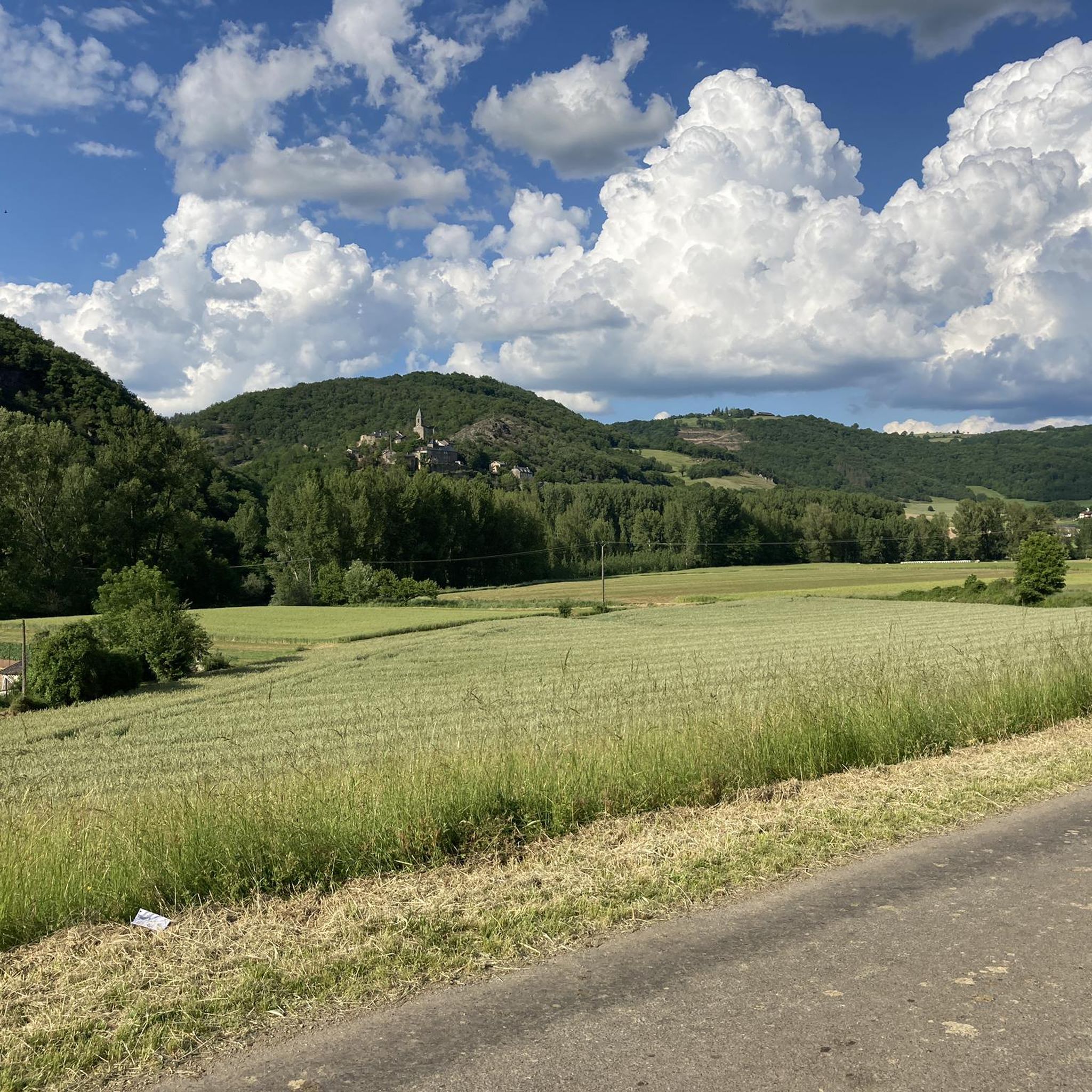
Superb view of Ambialet and its peninsula, created naturally by a meander of the Tarn, which embraces it for three kilometers. It is dominated by an old priory, perched on a shale ridge. At the level of the dam, the narrowest isthmus in Europe is located!
1
0
The Tarn valley is steep enough that leaving it involves a nice climb, 5 to 6 km with passages at 10%. And multiple routes around Ambialet.
1
0

As you come down the D74 road and around the last corner before entering town, you get a splendid view of the village of Ambialet and the old hilltop Cathar fortress. Both look as if they have naturally emerged from the local rock-bed over the past few centuries. There is one restaurant and two cafes in town as well as a cafe and small hotel just over the bridge on the other side of town.
0
0

If the peninsulas formed by meanders are relatively common, here the isthmus which prevents the Tarn from shooting straight is only about ten meters wide, which makes it the narrowest and most spectacular of Europe. It is a safe bet that in a few millennia, erosion will eventually lead the Tarn to cross it and thus abandon its arm, as is sometimes the case (cf. Cirque de Navacelle). This geological particularity was in any case exploited from the very beginning of the 1900s for the production of electricity with a factory with magnificent architecture that can be visited.
0
0
Frequently Asked Questions
How many hiking trails are available in Saint-Michel-Labadié?
There are over 30 hiking routes around Saint-Michel-Labadié, offering a variety of experiences through the Ségala region's distinctive landscapes.
What are the difficulty levels of hiking trails in Saint-Michel-Labadié?
The trails around Saint-Michel-Labadié cater to various fitness levels. You'll find about 10 easy routes, 19 moderate routes, and a couple of more challenging options for experienced hikers.
Are there any easy hikes suitable for beginners or families in Saint-Michel-Labadié?
Yes, Saint-Michel-Labadié offers several easy hikes perfect for beginners or families. An example is the Ambialet – Prieuré d'Ambialet loop from Ambialet, an easy 2.8-mile (4.6 km) path that leads through varied terrain near the Broncarié stream.
What kind of landscapes can I expect to see while hiking in Saint-Michel-Labadié?
Hiking in Saint-Michel-Labadié means exploring the Ségala region, characterized by undulating schist plateaus and narrow, winding valleys. The area is also part of the Garonne basin, featuring a network of small waterways like the Broncarié and Ruisseau del Loup, which add to the scenic beauty.
Are there any circular walks available in Saint-Michel-Labadié?
Many of the routes in the area are circular, allowing you to start and end at the same point. For instance, the View of Ambialet – View of Ambialet loop from Ambialet is a 7.4-mile (11.9 km) circular trail that showcases the region's plateaus and valleys.
What can I see along the hiking trails around Saint-Michel-Labadié?
While hiking, you can discover several points of interest. Notable attractions include the scenic View of Ambialet, the unique Ambialet Isthmus and Hydroelectric Power Plant, and the historic Prieuré d'Ambialet. The Trébas Beach and Leisure Center also offers a pleasant stop.
What do other hikers enjoy most about hiking in Saint-Michel-Labadié?
The area is highly rated by the komoot community, with an average score of 4.5 stars from over 130 reviews. Hikers often praise the varied terrain, the peaceful rural setting, and the well-maintained paths that allow for enjoyable exploration of the Ségala region.
Are there any specific natural features or ecological zones to look out for?
Yes, Saint-Michel-Labadié is home to two natural areas of ecological, faunal, and floristic interest. These zones highlight the commune's rich biodiversity and preserved natural environment, making them ideal for nature observation during your hike.
What is the best time of year to hike in Saint-Michel-Labadié?
The region's climate generally makes spring and autumn ideal for hiking, with milder temperatures and vibrant natural colors. Summer can also be pleasant, especially along routes near waterways, but it's always advisable to check local weather conditions before heading out.
Are there any longer, more challenging hikes in the area?
For those seeking a longer adventure, routes like the Hiking loop from Ambialet cover 6.3 miles (10.2 km) and involve more elevation gain, offering a moderate challenge and extensive views of the Ségala landscape.
Is Saint-Michel-Labadié a good base for exploring other nearby attractions?
Absolutely. While Saint-Michel-Labadié offers serene hiking, it's also conveniently located near other notable sites. You can visit the 'Most Beautiful Village' of Brousse-le-Château, explore the UNESCO World Heritage site of Albi, or venture further to the natural beauty of the Gorges de l'Aveyron.
Are there opportunities for wild swimming or water activities near the trails?
The region is crisscrossed by small waterways like the Broncarié and Ruisseau del Loup. While specific wild swimming spots aren't officially designated, the Trébas Beach and Leisure Center offers a managed option for water activities and relaxation.
Most popular routes around Saint-Michel-Labadié
Most popular attractions around Saint-Michel-Labadié

Get inspired with the komoot mobile app


Explore more
Browse the best Hikes in other regions.
