The best running trails in the Greenwater Range
5.0
(1)
107
runners
9
runs
Jogging routes in the Greenwater Range offer access to the Mount Baker-Snoqualmie National Forest and Norse Peak Wilderness. The region is characterized by lush old-growth forests, river valleys, and serene lakes, providing a varied landscape for running. Trails often follow the Greenwater River, leading to features like Lower and Upper Greenwater Lakes. Higher elevations can provide views of snow-capped peaks, including Mount Rainier on clear days.
Best jogging routes in the Greenwater Range
- The most popular jogging route is Red…
Last updated: October 11, 2026
17
runners
4.76km
00:39
160m
160m
Moderate run. Good fitness required. Mostly paved surfaces. Suitable for all skill levels.
4
runners
10.6km
01:15
260m
260m
Moderate run. Good fitness required. Mostly paved surfaces. Suitable for all skill levels.

3
runners
6.02km
00:51
240m
240m
Moderate run. Good fitness required. Mostly paved surfaces. Suitable for all skill levels.
32
runners
Moderate run. Good fitness required. Mostly paved surfaces. Suitable for all skill levels.
27
runners
9.16km
00:57
50m
50m
Moderate run. Good fitness required. Mostly paved surfaces. Suitable for all skill levels.
7
runners
6.49km
00:41
60m
60m
Moderate run. Good fitness required. Mostly paved surfaces. Suitable for all skill levels.
5.0
(1)
7
runners
5.81km
00:37
20m
20m
Moderate run. Good fitness required. Mostly paved surfaces. Suitable for all skill levels.
6
runners
Easy run. Great for any fitness level. Mostly paved surfaces. Suitable for all skill levels.
Our route recommendations are based on thousands of hikes, rides, and runs completed by other people on komoot.
Start today with a free account
Your next adventure awaits.
Popular around Greenwater Range
Tips from the Community

Harmony Borax Works and the famous Twenty mule teams brought the desert of Death Valley to homes across America. After borax was discovered near Furnace Creek Ranch (then called Greenland) in 1881, William T. Coleman built the Harmony Works and began processing the ore in late 1883 or early 1884. When fully operational, the Harmony Borax Works employed 40 men, producing three tons of borax daily. The little evidence that remains indicates that the majority of this workforce were Chinese laborers. The Chinese workers collected the impure mineral fragments from the valley floor and loaded them into horse-drawn wagons for transport to the borax works.
4
0

a beautiful facility or accommodation to enjoy Death Valley
1
0

Furnace Creek Visitor Center offers information to visitors about the Death Valley and the small community of Furnace Creek. Here you can find water fountains, bathrooms, food services and small exhibitions about the ecosystem and the village.
0
0

The Golden Canyon Trail is a popular path that leads to Red Cathedral. The path is lined with beautiful, colorful rock formations.
0
0

The Red Cathedral is a crimson cliff that stands out 183 meters above and behind the yellow and brown slopes and walls of the Golden Canyon. The origin of the name comes from the red rocks that have eroded into pillars in some places
0
0
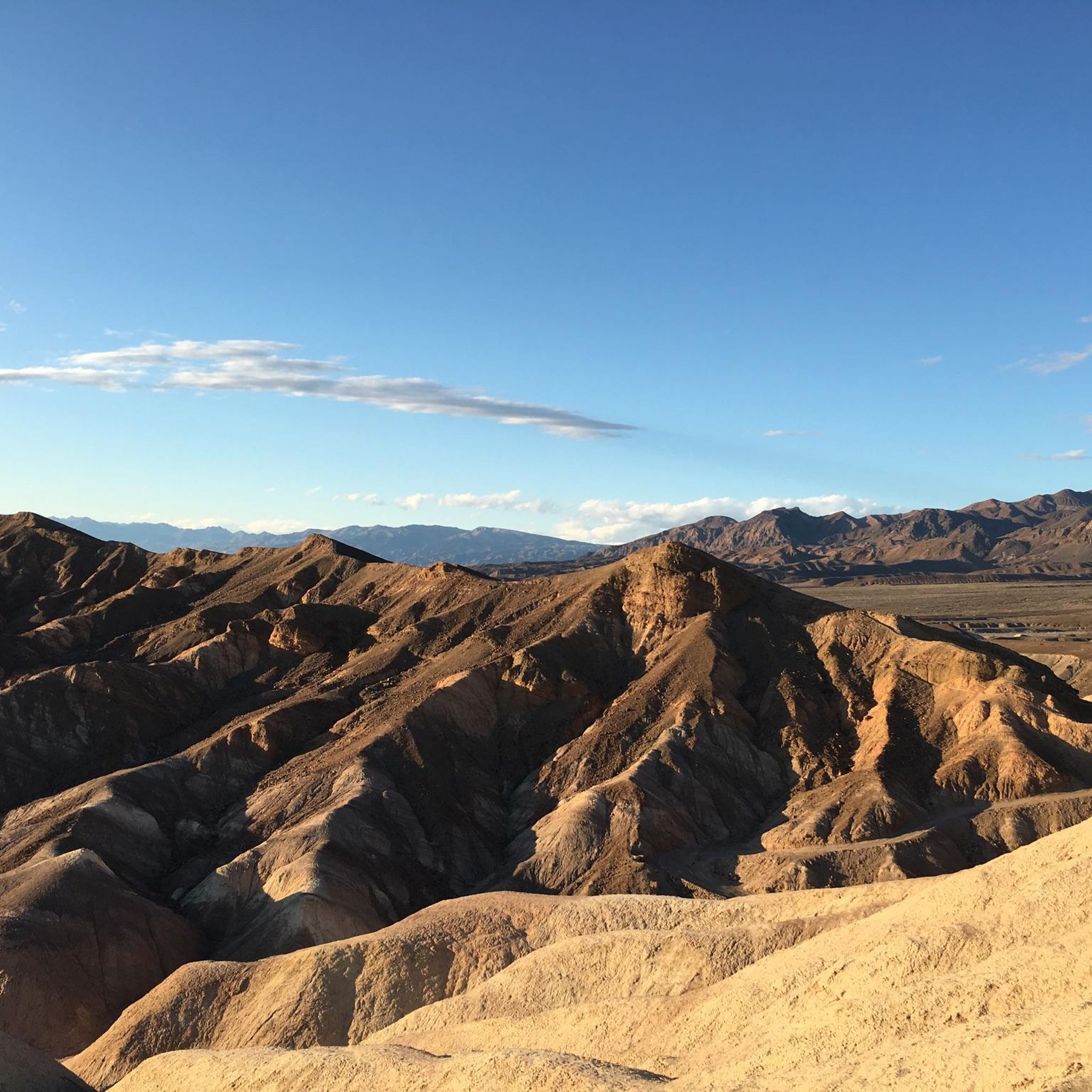
Zabriskie Point is one of the most popular spots in Death Valley National Park. It can be reached by several trails, including the Zabriskie Point Trial, which is not too challenging. The viewpoint gives you a perfect view of the Furnace Creek formation, which is emblematic of the park.
0
0

Gower Gulch Trail leads to a maze of golden colored hills and winding narrow canyons. The Gower Gulch is about 1.5 miles one-way. The most popular routes like the Badlands Loop and Golden Canyon can be combined with one another for longer adventures. There is no water and the canyon can be very hot during to summer months.
0
0
Great viewpoint along the Desolation Canyon Trail. The trail is not as popular as other paths within Death Valley, so there is a good chance you will have the path to yourself and can take your time enjoying the wonderful view of Death Valley.
0
0
Frequently Asked Questions
How many running routes are available in the Greenwater Range?
This guide features 8 dedicated jogging routes in the Greenwater Range. All of these routes are rated as moderate, offering a good balance of challenge and accessibility for runners.
What kind of terrain can I expect on the jogging trails in the Greenwater Range?
Joggers in the Greenwater Range can expect a diverse landscape. Trails often wind through lush old-growth forests, follow scenic river valleys like the Greenwater River, and lead to serene bodies of water such as Lower and Upper Greenwater Lakes. While some sections are relatively flat, others involve more challenging climbs, providing varied terrain for different fitness levels.
Are there any family-friendly running routes in the Greenwater area?
Yes, the Greenwater Lakes Trail (#1177 and #1176) is often recommended as a family-friendly option. It offers a wide, gentle, and mostly flat path for the initial couple of miles, making it accessible for many, including those jogging with children.
Can I bring my dog on the running trails in the Greenwater Range?
The Greenwater Range, being part of the Mount Baker-Snoqualmie National Forest, generally allows dogs on trails, often requiring them to be on a leash. It's always best to check specific trail regulations before heading out, as rules can vary, especially in wilderness areas or near sensitive wildlife habitats.
What natural features or viewpoints can I see while running in the Greenwater Range?
Runners can enjoy several natural features. Many trails follow the Greenwater River, leading to picturesque spots like Lower and Upper Greenwater Lakes. On clear days, higher elevations or specific viewpoints may offer stunning peek-a-boo views of snow-capped peaks, including Mount Rainier. The area is also known for its old-growth forests and potential wildlife sightings.
Are there any circular running routes in the Greenwater Range?
While many trails are out-and-back, some sections or combinations of trails can form circular routes. For example, the Greenwater Lakes Trail can be extended to connect with other paths, potentially allowing for loop variations, though specific named circular routes are less common than linear ones.
What is the best time of year to go running in the Greenwater Range?
The Greenwater Range is beautiful year-round, but the best time for running is typically from late spring through early autumn. During these months, trails are generally free of snow, and the weather is milder. Fall offers stunning foliage, and summer provides shaded runs through the old-growth forests. Winter running is possible but requires appropriate gear and awareness of snow conditions.
How accessible are the trailheads in the Greenwater Range, and is parking available?
The Greenwater area is relatively accessible, located along State Route 410. Many trailheads, such as the Greenwater Lakes Trailhead, can be reached via Forest Road 70. Parking is generally available at designated trailheads, though it can fill up quickly during peak seasons. Always check for any specific parking passes or permits required for national forest lands.
Are there opportunities to spot wildlife while jogging in the Greenwater Range?
Yes, the forests and river valleys of the Greenwater Range are home to various wildlife. Joggers might spot deer and elk, especially during quieter times of day. In the fall, the Greenwater River offers a unique opportunity to observe spawning salmon, adding another dimension to your run.
What amenities are available near the Greenwater Range for runners?
The community of Greenwater, located along State Route 410, serves as a gateway to the surrounding wilderness. While it's a small community, you can find basic amenities such as lodging options, and potentially a few local eateries or cafes to refuel after your run. For more extensive services, larger towns are a short drive away.
Are there any permits required for running on trails in the Greenwater Range?
Some areas within the Mount Baker-Snoqualmie National Forest or specific wilderness areas may require a Northwest Forest Pass or other recreation passes for parking at trailheads. It's advisable to check the specific requirements for the trailhead you plan to use before your visit to avoid any issues.
What makes the Greenwater Range unique for trail running?
The Greenwater Range offers a unique trail running experience due to its location as a gateway to vast wilderness areas like the Mount Baker-Snoqualmie National Forest and Norse Peak Wilderness. Runners can immerse themselves in quiet old-growth forests, follow pristine rivers and lakes, and enjoy the potential for stunning views of Mount Rainier, all within a diverse and accessible trail network.
Most popular attractions in the Greenwater Range

Get inspired with the komoot mobile app


Explore more
Browse the best Running Trails & Routes in other regions.
