The best cycling routes around Saint-Vincent-Jalmoutiers
4.4
(12)
113
riders
48
rides
Touring cycling around Saint-Vincent-Jalmoutiers offers routes through the rolling landscapes of the Dordogne region, characterized by agricultural fields, woodlands, and small villages. The terrain typically features gentle ascents and descents, suitable for various fitness levels. Many routes follow quiet country roads, providing access to local points of interest and natural areas.
Best touring cycling routes around Saint-Vincent-Jalmoutiers
- The most popular touring cycling route is Saint-Aulaye loop from Saint-Aulaye, a 7.3 miles (11.7 km) trail that takes 41 minutes to…
Last updated: July 2, 2026
5.0
(2)
9
riders
38.8km
03:15
510m
510m
Hard bike ride. Very good fitness required. Mostly paved surfaces. Suitable for all skill levels.
4.0
(1)
6
riders
12.0km
00:43
70m
70m
Easy bike ride. Great for any fitness level. Mostly paved surfaces. Suitable for all skill levels.

Sign up for free
4.0
(1)
6
riders
11.7km
00:41
60m
60m
Easy bike ride. Great for any fitness level. Mostly paved surfaces. Suitable for all skill levels.
5
riders
7.66km
00:36
60m
60m
Easy bike ride. Great for any fitness level. Mostly paved surfaces. Suitable for all skill levels.
5
riders
45.9km
03:33
540m
540m
Hard bike ride. Very good fitness required. Mostly paved surfaces. Suitable for all skill levels.
Get access to more routes and recommendations from other explorers.
Sign up for free
Already have an account?
Our route recommendations are based on thousands of hikes, rides, and runs completed by other people on komoot.
Start today with a free account
Your next adventure awaits.
Login or Signup


Tips from the Community

A charming village and home to the largest underground church in Europe. It is officially listed as "one of the most beautiful villages in France." Located in the southern Charente region, it borders the Dordogne, renowned for its historic villages, castles, prehistoric caves, and breathtaking landscapes. In the heart of the village, a lovely square awaits you, lined with terraces and restaurants. Enjoy strolling through its narrow, cobbled, medieval, and romantic streets, lined with typical stone houses that give the village its special and picturesque character.
0
0

A visit is absolutely recommended, unique.
0
0

Church in the village of Bonnes, built in the 12th or 13th century. The chapels, the bell tower and its bell, and the portal date from the first half of the 16th century. These features led to the building's classification as a Historic Monument in 1995. A canopy attached to the main facade provides welcome shelter in rainy weather.
0
0


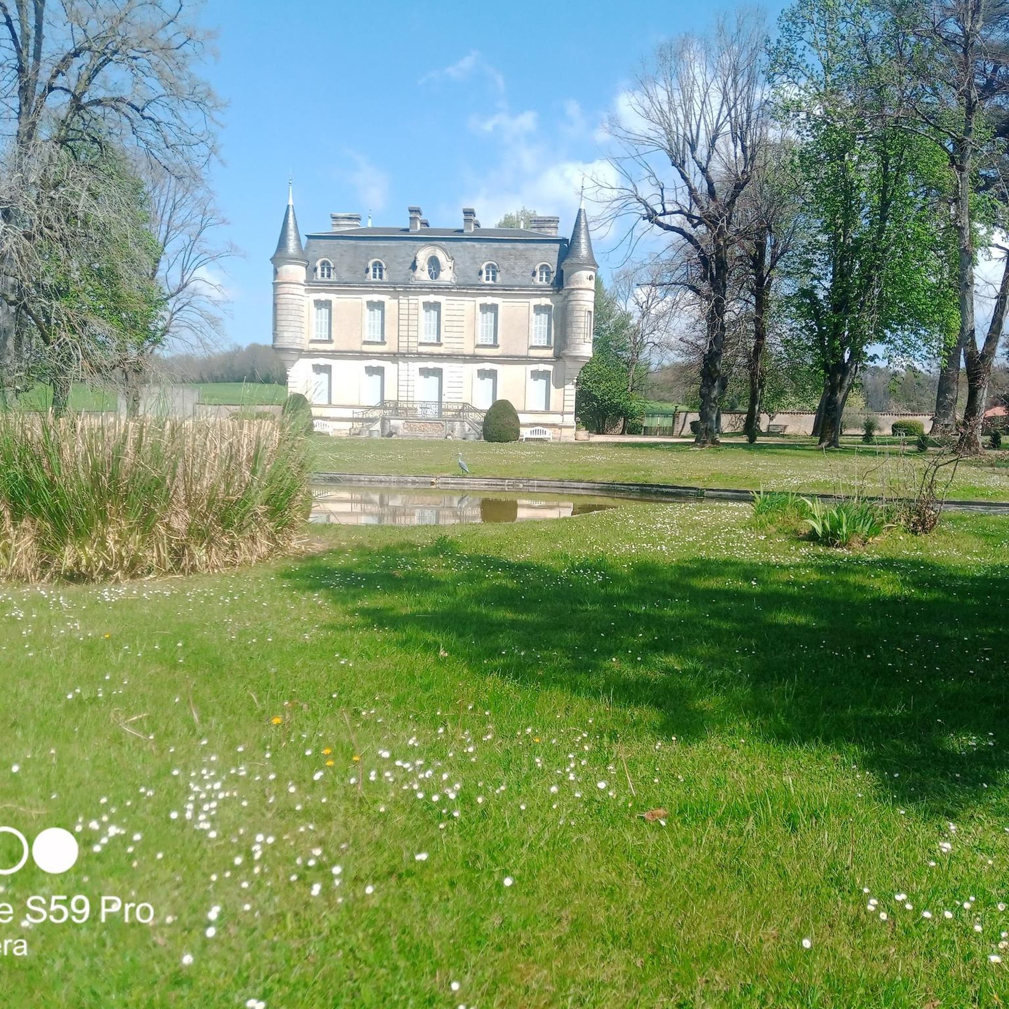
Built in the 10th and 11th centuries, the medieval castle overlooks the Dronne River and the Double Forest. Unfortunately, it is not open to the public as it now houses the Town Hall (except in summer during guided tours or as part of events such as "Châteaux en Fête" or the "Fête des Bastides"). However, during Town Hall opening hours, visitors can take a look at the ground floor and admire the imposing staircase.
0
0
Magnificent church of a former 12th-century priory, restored in the 19th century. The Saintonge-style façade, the forechoir, the bell tower, and the apse date from the Romanesque period. The Romanesque capitals of the façade and apse are very well preserved.
0
0

A stone's throw from Aubeterre-sur-Dronne, this overlooking position offers a superb view of the Dronne valley.
0
0
Superb commune certified “Most beautiful villages in France”. The white facades of the houses give the village squares a beautiful appearance. The village is known for its underground church of Saint-Jean in particular. The belvedere offers a breathtaking view of the red tiled roofs of the houses and their characteristic loggias which were once used to dry crops.
0
0
Frequently Asked Questions
How many touring cycling routes are available around Saint-Vincent-Jalmoutiers?
There are over 40 touring cycling routes in the Saint-Vincent-Jalmoutiers area, offering a variety of options for different skill levels and preferences.
Are there easy touring cycling routes suitable for beginners or families?
Yes, the region offers 10 easy touring cycling routes. A great option for a relaxed ride is the Sainte-Eulalie Church – Château de Saint-Aulaye loop from Les Essards, which is 7.5 miles (12.0 km) long and passes by historical landmarks.
What are the typical distances and durations for touring bike trails in this area?
Routes vary significantly. You can find shorter loops like the Étang de Petitonne loop from La Jemaye, which is 4.6 miles (7.4 km) and takes about 35 minutes. Longer, more challenging routes, such as the Étang du Tuquet – Étang de Petitonne loop from Ponteyraud, can extend to 28.6 miles (45.9 km) and take several hours.
What kind of terrain can I expect on touring cycling routes around Saint-Vincent-Jalmoutiers?
The terrain typically features gentle ascents and descents through the rolling landscapes of the Dordogne region. Routes often follow quiet country roads, agricultural fields, and woodlands, providing a pleasant and varied cycling experience.
Are there any circular touring cycling routes available?
Yes, many routes in the area are circular, allowing you to start and end at the same point. For example, the popular Saint-Aulaye loop from Saint-Aulaye is a 7.3-mile (11.7 km) circular trail.
What can I see along the touring cycling routes in Saint-Vincent-Jalmoutiers?
The routes often pass through charming villages and offer glimpses of local heritage. You might encounter historical sites like the Monolithic Church of Saint-Jean in Aubeterre-sur-Dronne or the town of Saint-Aulaye. Natural features like the river La Dronne are also part of the scenery.
What is the best time of year for touring cycling in Saint-Vincent-Jalmoutiers?
Spring and autumn generally offer the most pleasant conditions for touring cycling, with milder temperatures and beautiful scenery. Summers can be warm, so early morning or late afternoon rides are advisable during peak season.
Are there options for more experienced touring cyclists looking for a challenge?
Yes, there are 14 difficult routes for experienced cyclists. The Étang du Tuquet – Étang de Petitonne loop from Ponteyraud is a challenging 28.6-mile (45.9 km) route with significant elevation gain, perfect for those seeking a longer and more demanding ride.
What do other touring cyclists enjoy most about cycling in Saint-Vincent-Jalmoutiers?
The area is highly rated by the komoot community, with an average score of 4.3 stars from over 10 reviews. Cyclists often praise the quiet country roads, the picturesque agricultural land, and the forested sections that define the region's routes.
Are there places to stop for refreshments or meals along the routes?
While specific cafes or pubs are not listed for every route, the region is dotted with small villages and towns like Aubeterre-sur-Dronne and Saint-Aulaye, where you can typically find local establishments to refuel and relax.
What should I bring for a touring cycling trip in Saint-Vincent-Jalmoutiers?
It's always recommended to carry water, snacks, a basic repair kit, and appropriate clothing for the weather conditions. Sun protection is essential during warmer months, and a fully charged phone with GPS capabilities is advisable for navigation.
Most popular routes around Saint-Vincent-Jalmoutiers
Most popular attractions around Saint-Vincent-Jalmoutiers

Get inspired with the komoot mobile app


Explore more
Browse the best Cycling routes in other regions.
