The best walks and hikes around Sainte-Croix-À-Lauze
4.6
(1730)
13,443
hikers
143
hikes
Hiking around Sainte-Croix-À-Lauze offers diverse landscapes within the Alpes-de-Haute-Provence, characterized by limestone gorges, plateaus, and forests. The region features dramatic natural landmarks such as the Gorges d'Oppedette and the colorful Provençal Colorado of Rustrel. These Sainte-Croix-À-Lauze hiking routes traverse varied terrain, from river valleys to elevated viewpoints overlooking the Luberon. The area provides numerous Sainte-Croix-À-Lauze hiking viewpoints landmarks natural attractions for outdoor exploration.
Best hiking trails around Sainte-Croix-À-Lauze
- The most popular hiking route is Above the Calavon River – Oppedette Gorge loop from Oppedette, a 2.7 miles (4.3 km) trail that takes 1 hour 23 minutes to complete. This route explores the dramatic limestone formations of the Gorges d'Oppedette.
- Another top favourite among local hikers is Gorges d'Oppedette – L'Échelle Cave Tunnel loop from Oppedette, a moderate 3.4 miles (5.4 km) path. This trail offers an immersive experience within the gorges, including a cave tunnel.
- Local hikers also love the Viens – View of the Luberon Valley loop from Viens, a 2.6 miles (4.2 km) trail leading through varied terrain with views of the picturesque Luberon Valley, often completed in about 1 hour 14 minutes.
- Hiking around Sainte-Croix-À-Lauze is defined by deep limestone gorges, expansive plateaus, and fragrant lavender fields. The network offers options for easy, moderate, and difficult trails, catering to various experience levels.
- The routes in Sainte-Croix-À-Lauze are highly rated by the komoot community with an average score of 4.5 stars from over 1200 reviews. More than 9000 hikers have used komoot to explore Sainte-Croix-À-Lauze's varied terrain.
Last updated: July 8, 2026
4.5
(22)
105
hikers
4.28km
01:24
110m
110m
Moderate hike. Great for any fitness level. Mostly accessible paths. Sure-footedness required.
5.0
(20)
53
hikers
4.91km
01:22
90m
90m
Easy hike. Great for any fitness level. Easily-accessible paths. Suitable for all skill levels.

Sign up for free
4.0
(2)
26
hikers
5.42km
01:56
140m
140m
Moderate hike. Great for any fitness level. Mostly accessible paths. Sure-footedness required.
5.0
(1)
13
hikers
4.22km
01:14
120m
120m
Easy hike. Great for any fitness level. Easily-accessible paths. Suitable for all skill levels.
4.7
(3)
16
hikers
1.49km
00:29
40m
40m
Moderate hike. Great for any fitness level. Mostly accessible paths. Sure-footedness required.
Get access to more routes and recommendations from other explorers.
Sign up for free
Already have an account?
Our route recommendations are based on thousands of hikes, rides, and runs completed by other people on komoot.
Start today with a free account
Your next adventure awaits.
Login or Signup

Tips from the Community

There had been a lot of rain in the last few days. The west side of the walk is very hard in places and the path at the bottom of the metal stairs had washed away and the hand holds could not be reached. It was very dangerous as were several sections where the path is on an angle. This was for a distance of about 500 metres either side of the metal ladder. In places the path is only 30-50 cm wide with a vertical drop of 50-75 metres and certain death if you slip. Not suitable for children or people who are not experienced mountain walkers. A strong walking pole was very useful.
0
0
Left bank accessible to all Right bank accessible but difficult, especially since we wanted to take a "shortcut" and went through the cave tunnel. It's doable, of course, but it was very difficult to climb steeply, sometimes with metal bars to hold onto, thankfully. But we were happy to get back to our car; we'd walked almost 8 km! You need to be well-equipped with shoes!!
0
0

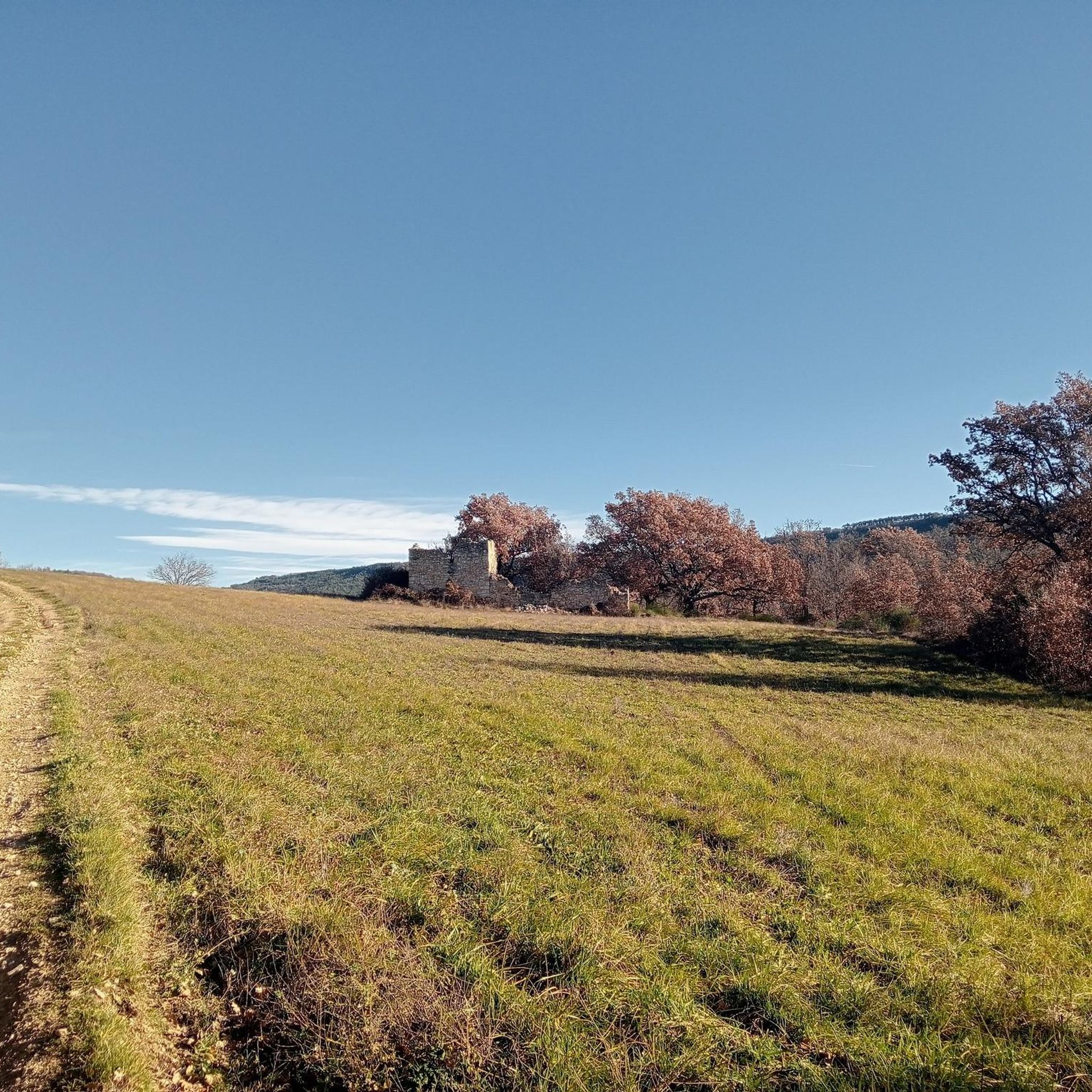
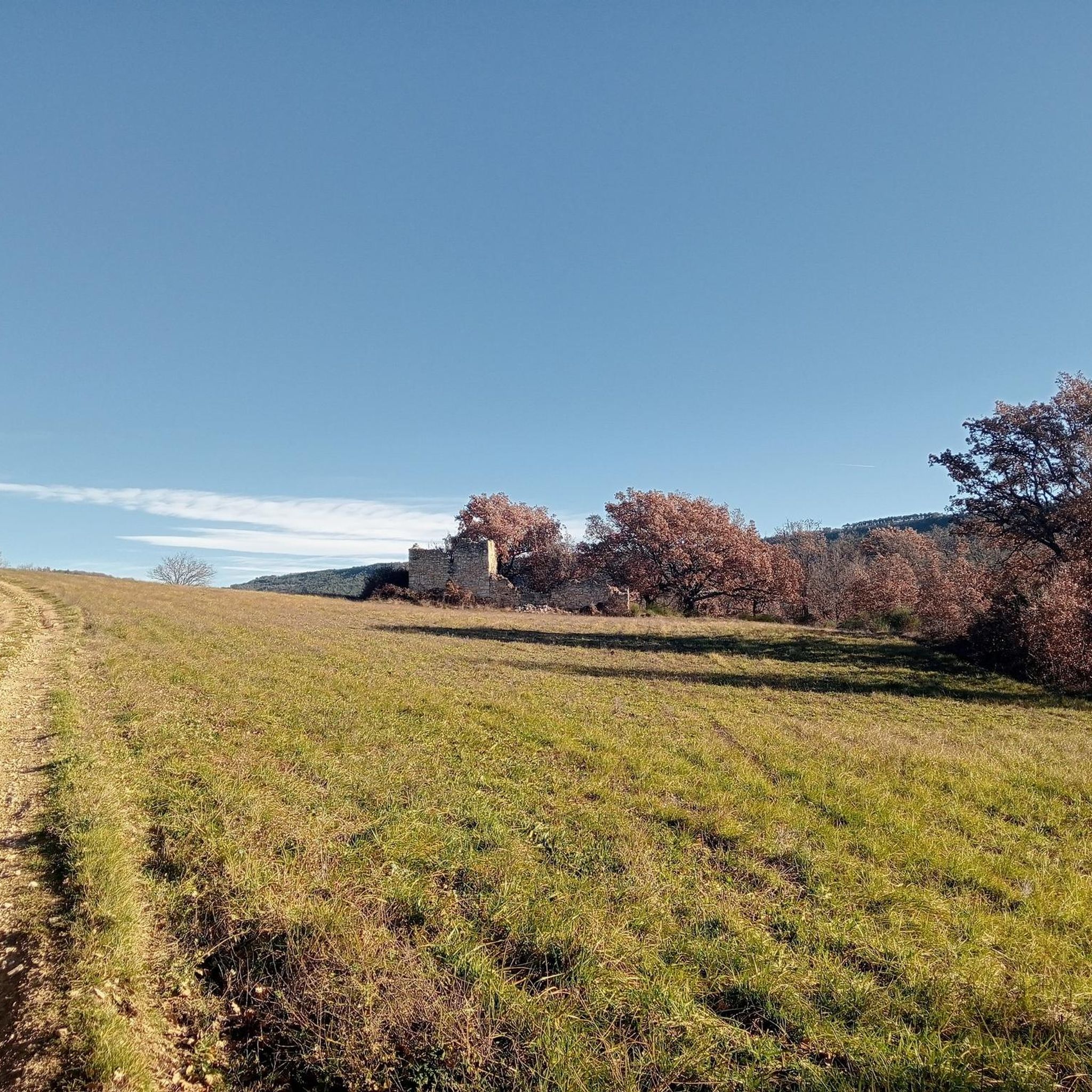
The narrow trail is a wonderful ride between gnarled trees. You will only occasionally be able to see the hilly landscape of Provence through the dense foliage. You will also come across a borie right on the trail. This small building is a typical southern French dry stone wall from the 18th and 19th centuries that you can find almost everywhere in Provence. It offers wonderful protection in bad weather conditions.
0
0

The route marking of T1 is wildly misleading (!) The paths up and down the Gorge are a mix between T1, T2, T3 and sometimes just about T4. That's in fine weather. Take care of each other and help the others. There were quite a number of small kids of age 3 to 8 today. As all others write: it's a beautiful place and the descent into the Gorge gives a ton a great views. Take your time and be careful
2
0
The route marking of T1 is wildly misleading (!) The paths up and down the Gorge are a mix between T1, T2, T3 and sometimes just about T4. That's in fine weather. Take care of each other and help the others. There were quite a number of small kids of age 3 to 8 today
1
0
The route marking of T1 is wildly misleading (!) The paths up and down the Gorge are a mix between T1, T2, T3 and sometimes just about T4. That's in fine weather. Take care of each other and help the others. There were quite a number of small kids of age 3 to 8 today
2
0

Following the uplift of the Lure mountain, it was the Calavon river that shaped these magnificent gorges. The word Calavon means stone river. The watercourse is indeed often dry, leaving only a river of stones.
1
0
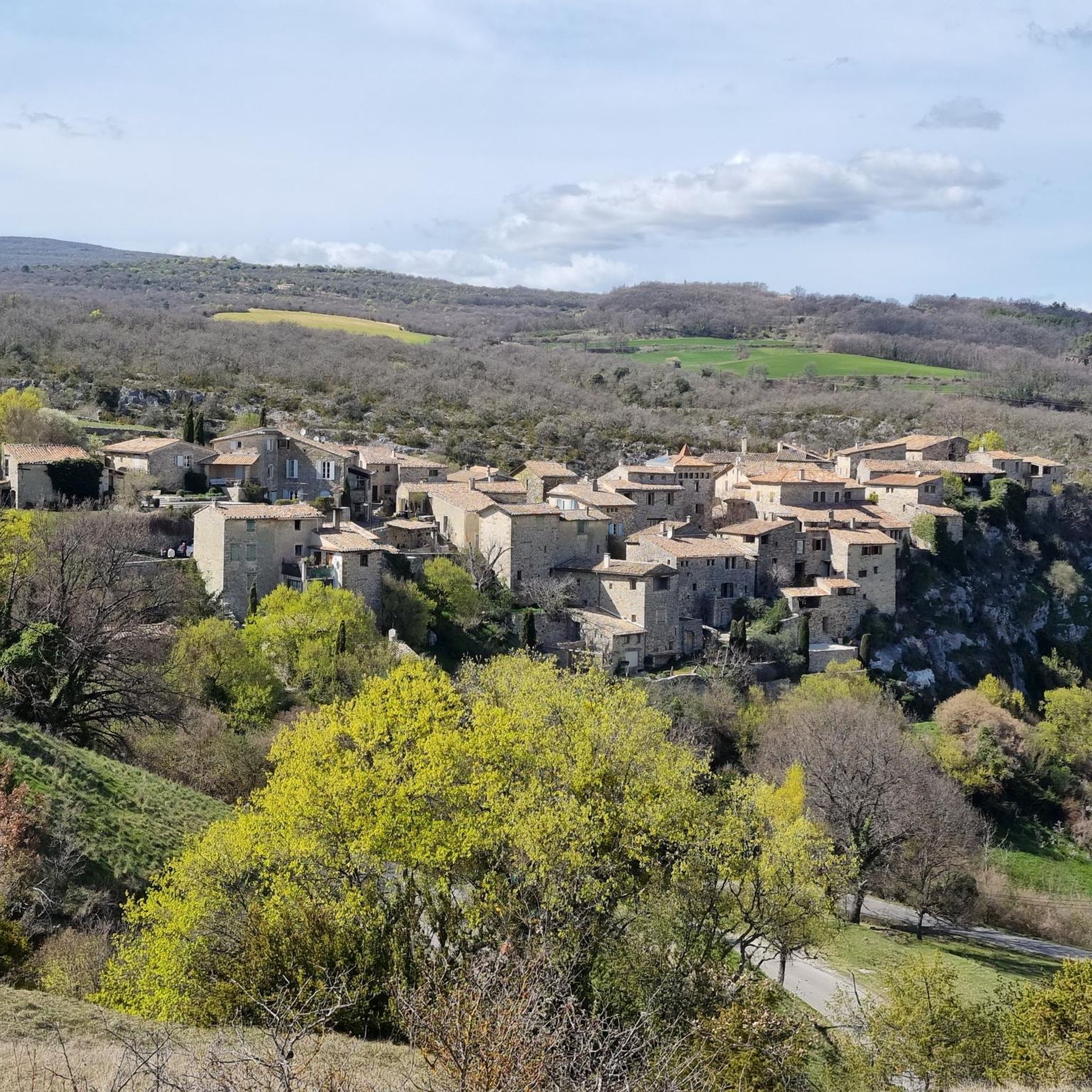
This magnificent village faces the Luberon massif. As it is high up, it offers remarkable views of the region. It is also good to stroll through its narrow streets sheltered from the sun.
1
0
Frequently Asked Questions
How many hiking trails are available around Sainte-Croix-À-Lauze?
There are over 120 hiking trails in the Sainte-Croix-À-Lauze region, offering a wide range of options for all skill levels. These routes traverse diverse landscapes, from dramatic gorges to expansive plateaus.
What kind of terrain can I expect on hikes in Sainte-Croix-À-Lauze?
The terrain around Sainte-Croix-À-Lauze is quite varied. You'll find paths winding through deep limestone gorges, across open plateaus, and through fragrant forests. Some trails offer gentle walks, while others involve more challenging ascents and descents, particularly within the gorges.
Are there any easy hiking trails suitable for beginners or casual walkers?
Yes, Sainte-Croix-À-Lauze offers a good selection of easy trails. Out of the over 120 routes, 41 are classified as easy, making them perfect for beginners or those looking for a relaxed stroll. An example is the Viens – View of the Luberon Valley loop from Viens, which is 2.6 miles (4.2 km) long and offers scenic views.
What natural attractions or landmarks can I see while hiking in the area?
The region is rich in natural beauty. You can explore the stunning Oppedette Gorge with its impressive limestone formations, or visit the colorful Provençal Colorado of Rustrel, known for its unique ocher landscapes. Some trails also lead to features like the L'Échelle Cave Tunnel.
What is the best time of year to go hiking in Sainte-Croix-À-Lauze?
The Alpes-de-Haute-Provence region, including Sainte-Croix-À-Lauze, is beautiful for hiking from spring through autumn. Spring brings wildflowers, and summer offers vibrant lavender fields on the Valensole Plateau. Autumn provides pleasant temperatures and colorful foliage. Summers can be hot, so early mornings or late afternoons are best for hiking during that season.
Are there any circular hiking routes available?
Yes, many of the trails around Sainte-Croix-À-Lauze are circular, allowing you to start and end at the same point. For instance, the Oppedette – Gorges d'Oppedette loop from Sainte-Croix-à-Lauze is a moderate 7.5-mile (12.1 km) circular route that takes you through the dramatic gorges.
Are the hiking trails around Sainte-Croix-À-Lauze suitable for families with children?
Many trails in the region are suitable for families, especially the easier routes. The diverse landscapes, including the colorful Provençal Colorado and the impressive Gorges d'Oppedette, offer engaging scenery for children. Look for shorter, less strenuous options, such as the Above the Calavon River loop from Oppedette, which is a shorter moderate trail.
What do other hikers enjoy most about the trails in Sainte-Croix-À-Lauze?
The trails in Sainte-Croix-À-Lauze are highly regarded by the komoot community, with an average rating of 4.5 stars from over 1200 reviews. Hikers frequently praise the dramatic natural features like the Gorges d'Oppedette, the stunning views of the Luberon Valley, and the overall diversity of the Provençal landscapes.
Is there parking available near the trailheads?
Yes, many popular trailheads in the Sainte-Croix-À-Lauze area, particularly those leading into the Gorges d'Oppedette or near villages like Oppedette and Viens, typically have designated parking areas. It's advisable to check specific route details for parking information before you go.
Can I bring my dog on the hiking trails in Sainte-Croix-À-Lauze?
Generally, dogs are welcome on many hiking trails in the region, especially if kept on a leash. However, it's always best to check local regulations for specific natural parks or protected areas, such as parts of the Gorges d'Oppedette, as rules can vary. Ensure your dog is well-behaved and that you clean up after them.
Are there opportunities for wild swimming near the hiking routes?
While Sainte-Croix-À-Lauze itself is inland, the famous Lac de Sainte-Croix is relatively nearby. This large artificial lake, known for its turquoise waters, offers numerous spots for swimming and other water sports. It's a popular destination to cool off after a hike, particularly during warmer months.
Most popular routes around Sainte-Croix-À-Lauze
Most popular attractions around Sainte-Croix-À-Lauze

Get inspired with the komoot mobile app


Explore more
Browse the best Hikes in other regions.
