The best walks and hikes around La Guillermie
4.5
(151)
946
hikers
106
hikes
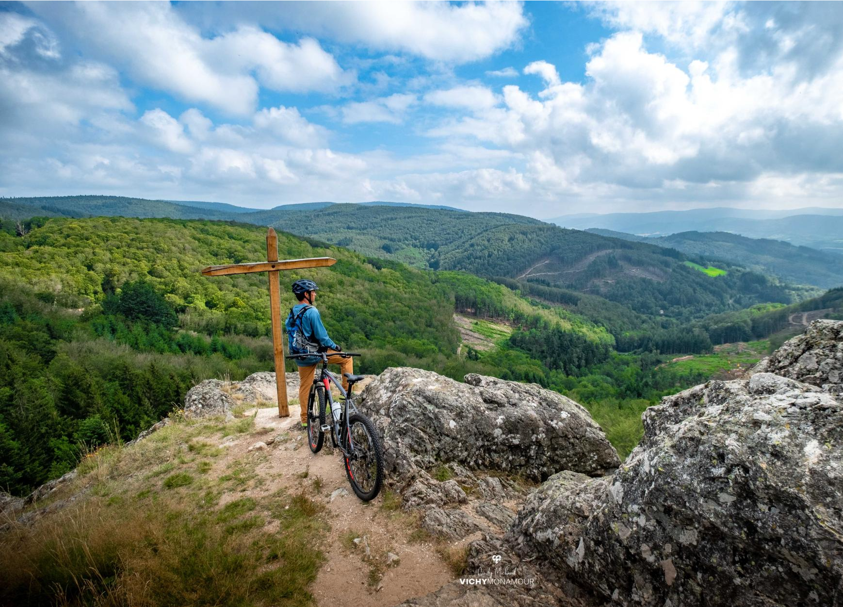
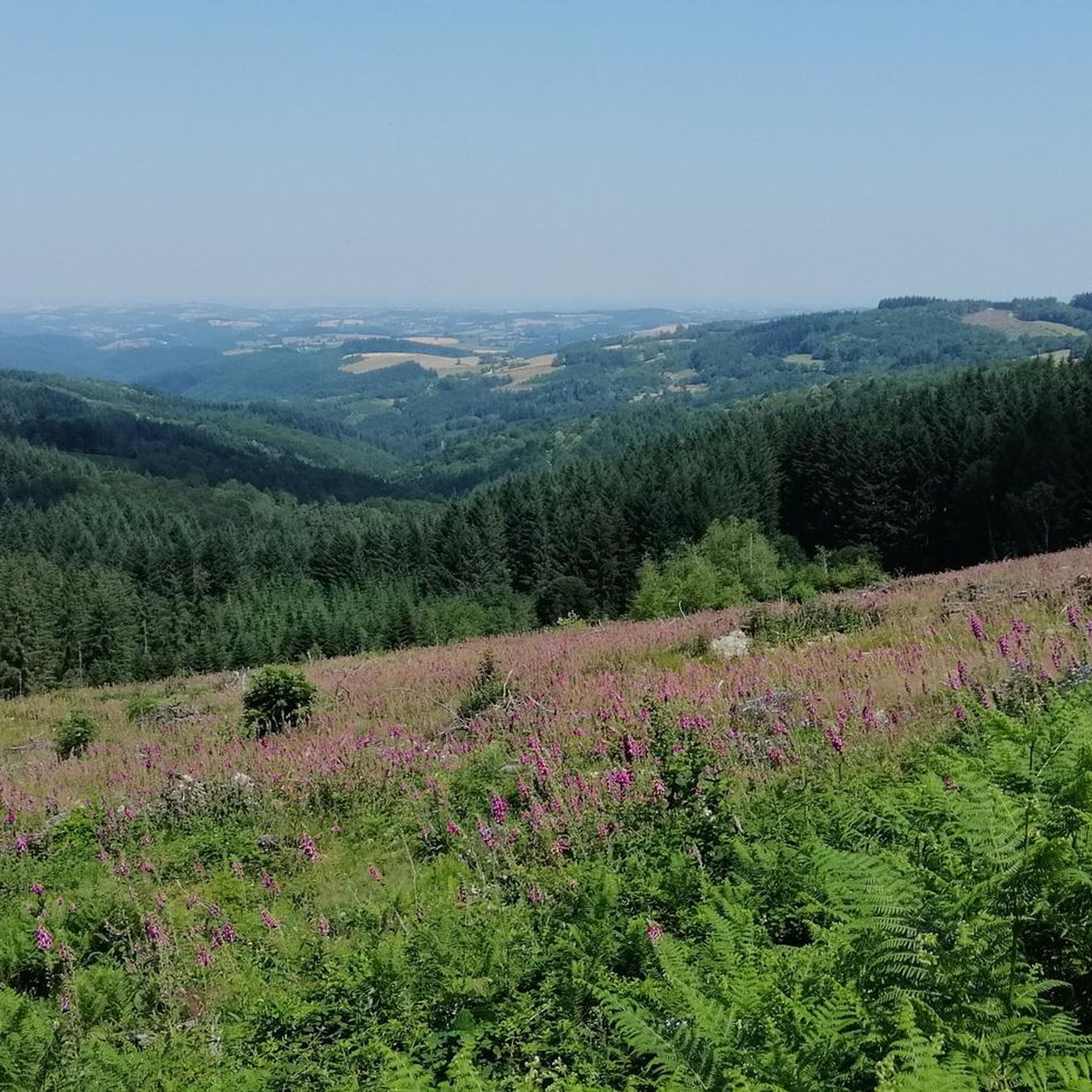
Hiking around La Guillermie offers diverse landscapes, from tranquil countryside to forested paths and elevated perspectives. The region is characterized by lush green meadows, hedgerows, and dense coniferous forests, providing a rich natural environment for exploration. Hikers can experience river valleys and mid-mountain ranges, with opportunities to view the surrounding volcanic terrain, including the distant Chaîne des Puys.
Best hiking trails around La Guillermie
- The most popular hiking route is Rocher des Cheirs loop from La Guillermie, a 3.2…
Last updated: July 4, 2026
4.9
(11)
51
hikers
10.7km
03:19
400m
400m
Moderate hike. Good fitness required. Easily-accessible paths. Suitable for all skill levels.
3.7
(3)
7
hikers
7.39km
02:22
300m
300m
Moderate hike. Good fitness required. Easily-accessible paths. Suitable for all skill levels.

Sign up for free
3.0
(2)
7
hikers
6.39km
01:51
160m
160m
Easy hike. Great for any fitness level. Easily-accessible paths. Suitable for all skill levels.
7
hikers
5.09km
01:30
140m
140m
Easy hike. Great for any fitness level. Easily-accessible paths. Suitable for all skill levels.
4.5
(2)
7
hikers
10.6km
03:05
290m
290m
Moderate hike. Good fitness required. Easily-accessible paths. Suitable for all skill levels.
Get access to more routes and recommendations from other explorers.
Sign up for free
Already have an account?
Our route recommendations are based on thousands of hikes, rides, and runs completed by other people on komoot.
Start today with a free account
Your next adventure awaits.
Login or Signup

Other adventures around La Guillermie

Tips from the Community

As you walk along the track that runs through the forest towards the Saint-Vincent rock, the trees part for a moment to reveal the wind turbines.
0
0

Saint-Vincent Rock is an imposing volcanic rock that offers breathtaking views of the surrounding forests and valleys. It is a natural wonder that dates back millions of years, when lava erupted from a fissure. Later, the sea receded, and tectonic movement lifted the lava, creating the impressive rock that stands today. You can explore the ruins of an ancient castle that once crowned the rock and admire a statue of the Virgin and Child, called "Our Lady of Up There," installed in 2012.
0
0

What the runner walking quickly past encounters off the path are the modern heirs of the historic windmills, because centuries ago our ancestors were clever enough to harness the power of the elements for their own purposes. They used the wind captured in the blades to drive the heavy millstones, so that grain could be ground into flour, for example. While in the past, attention was paid to the architecture of each individual mill, this modern and unaesthetic variant - which is used to generate electricity - has simply been built en masse in the landscape. These wind farms, which are designed for efficiency, are not without controversy, because on the one hand, no consideration is given to the landscape when they are built, and above all, the slender blades become a death trap for birds.
1
0

the climb is quite steep for beginners
0
0

At the crest of Chemin de la Ligue, the tops of the trees are not the only ones nourished by the wind. Here, you walk at the foot of the wind turbines. Immense, they impress as much by their size as by the monotonous sound they emit.
0
0
The Rocher Saint-Vincent is an imposing volcanic rock that offers breathtaking views of the surrounding forests and valleys. The Rocher Saint-Vincent is a natural curiosity that dates back millions of years, when lava gushed out of a crack and formed a green horn. Later, the sea receded and a tectonic movement lifted the horn, creating the impressive rock that stands today. You can explore the ruins of an ancient castle that crowned the rock, and admire a statue of the Virgin and Child, called "Notre-Dame de là-haut", which was installed in 2012.
3
0
Saint-Vincent rock is an imposing volcanic rock that offers breathtaking views of the surrounding forests and valleys. It is a natural curiosity that dates back millions of years, when lava gushed out of a crack. Later, the sea receded and a tectonic movement lifted the lava, creating the impressive rock that stands today. You can explore the ruins of an ancient castle that once crowned the rock and admire a statue of the Virgin and Child, called “Notre Dame de là-haut”, installed in 2012.
4
0
Being this close to a wind turbine is an awesome experience you will never forget.
4
0
Frequently Asked Questions
How many hiking trails are available around La Guillermie?
There are over 100 hiking trails around La Guillermie, offering a wide range of options for different skill levels. You'll find everything from easy strolls to more challenging moderate routes.
What kind of terrain can I expect on hikes near La Guillermie?
The terrain around La Guillermie is quite varied, featuring lush green meadows, dense coniferous forests, and hedgerows. You'll encounter river valleys and mid-mountain ranges, with elevated viewpoints offering panoramic views of the volcanic Chaîne des Puys.
Are there any family-friendly hiking options in La Guillermie?
Yes, La Guillermie offers several easy routes suitable for families. For example, the Rocher des Cheirs loop from La Guillermie is an easy 5.1 km trail that takes about 1 hour 29 minutes, providing varied landscapes and views without significant difficulty.
What are some notable natural features or viewpoints I can discover on the trails?
Hikers can enjoy expansive views extending to the distant Puys range from elevated sections like the Rocher des Cheirs. The region also features two streams feeding into the Sichon river and vast coniferous forests. From higher points, you can see the distinctive volcanic cones of the Chaîne des Puys. The Puy de Montoncel, the highest point in the Allier, also offers spectacular panoramic views.
Are there any circular hiking routes available?
Yes, many routes around La Guillermie are circular. A popular option is the Le Rez de Sol Loop, a moderate 10.7 km path within the Livradois-Forez Regional Natural Park. Another is the Puy de Montoncel – Puy de Montoncel loop from Lavoine, which is 10.6 km long.
What do other hikers say about the trails in La Guillermie?
The routes in La Guillermie are highly rated by the komoot community, with an average score of 4.4 stars from over 120 reviews. Hikers often praise the diverse landscapes, well-maintained paths, and the opportunity to experience both tranquil forests and expansive views of the volcanic terrain.
Are there any attractions or landmarks near the hiking trails?
Beyond the natural beauty, you can find interesting landmarks. The Puy de Montoncel offers stunning views, while the Saint-Vincent Rock is a notable natural monument. For history enthusiasts, there's Château de Montgilbert and Châteldon Castle nearby. You can also find several lakes, such as Lake Saint-Clément and Plan d'Eau des Prades, which can be explored.
What is the best time of year to go hiking in La Guillermie?
La Guillermie is a rewarding destination for hikers throughout much of the year. Spring and autumn offer pleasant temperatures and vibrant scenery, with autumn showcasing beautiful foliage. Summer is also popular, though some trails might be warmer. The region's mid-mountain character means it can also be suitable for winter sports in areas like Col de la Loge des Gardes, but general hiking is best outside of heavy snow periods.
Are dogs allowed on the hiking trails around La Guillermie?
Generally, dogs are welcome on many trails in the Auvergne-Rhône-Alpes region, especially on leash. However, specific rules may apply in certain protected areas like the Livradois-Forez Regional Natural Park. It's always advisable to keep your dog on a leash to protect local wildlife and ensure a pleasant experience for all hikers.
Where can I find parking for hiking trailheads in La Guillermie?
Many popular trailheads, such as the starting point for the Rocher des Cheirs loop, are accessible directly from La Guillermie village. Parking is typically available near these starting points, though it's always good to check specific route details for precise parking information.
Are there any cafes or restaurants in La Guillermie village after a hike?
La Guillermie is a small village, but the surrounding area and nearby towns offer options for refreshments. While specific establishments in La Guillermie itself might be limited, you can often find cafes and restaurants in larger villages or towns within a short drive, providing a place to relax and refuel after your hike.
What is the typical elevation gain on hikes in this region?
The elevation gain varies significantly depending on the trail's difficulty. Easy routes like the Rocher des Cheirs loop have a moderate gain of around 140 meters. Moderate trails, such as the Le Rez de Sol Loop, can involve climbs of around 400 meters, while routes leading to higher points like Col de la Loge des Gardes or Puy de Montoncel will have more substantial elevation changes.
Most popular attractions around La Guillermie

Get inspired with the komoot mobile app


Explore more
Browse the best Hikes in other regions.
