The best walks and hikes around Saint-André-En-Morvan
4.5
(952)
3,986
hikers
203
hikes
Hiking around Saint-André-En-Morvan offers a diverse landscape within the Morvan Regional Natural Park. The area is characterized by its rolling hills, dense woodlands, and significant water features such as Lake Crescent and the Cure Valley. These natural elements provide varied terrain for outdoor activities. The region's topography includes moderate ascents and descents, making it suitable for a range of hiking abilities.
Best hiking trails around Saint-André-En-Morvan
- The most popular hiking route is Château Bazoches — loop in the Morvan Regional…
Last updated: July 5, 2026
4.0
(4)
9
hikers
14.8km
04:07
280m
280m
Moderate hike. Good fitness required. Easily-accessible paths. Suitable for all skill levels.
3.3
(4)
18
hikers
20.8km
05:58
510m
510m
Hard hike. Very good fitness required. Easily-accessible paths. Suitable for all skill levels.

Sign up for free
5.0
(3)
19
hikers
10.5km
03:01
250m
250m
Moderate hike. Good fitness required. Easily-accessible paths. Suitable for all skill levels.
4.8
(4)
23
hikers
29.6km
08:35
770m
770m
Hard hike. Very good fitness required. Easily-accessible paths. Suitable for all skill levels.
4.5
(4)
13
hikers
8.84km
02:30
190m
190m
Moderate hike. Good fitness required. Easily-accessible paths. Suitable for all skill levels.
Get access to more routes and recommendations from other explorers.
Sign up for free
Already have an account?
Our route recommendations are based on thousands of hikes, rides, and runs completed by other people on komoot.
Start today with a free account
Your next adventure awaits.
Login or Signup
Tips from the Community

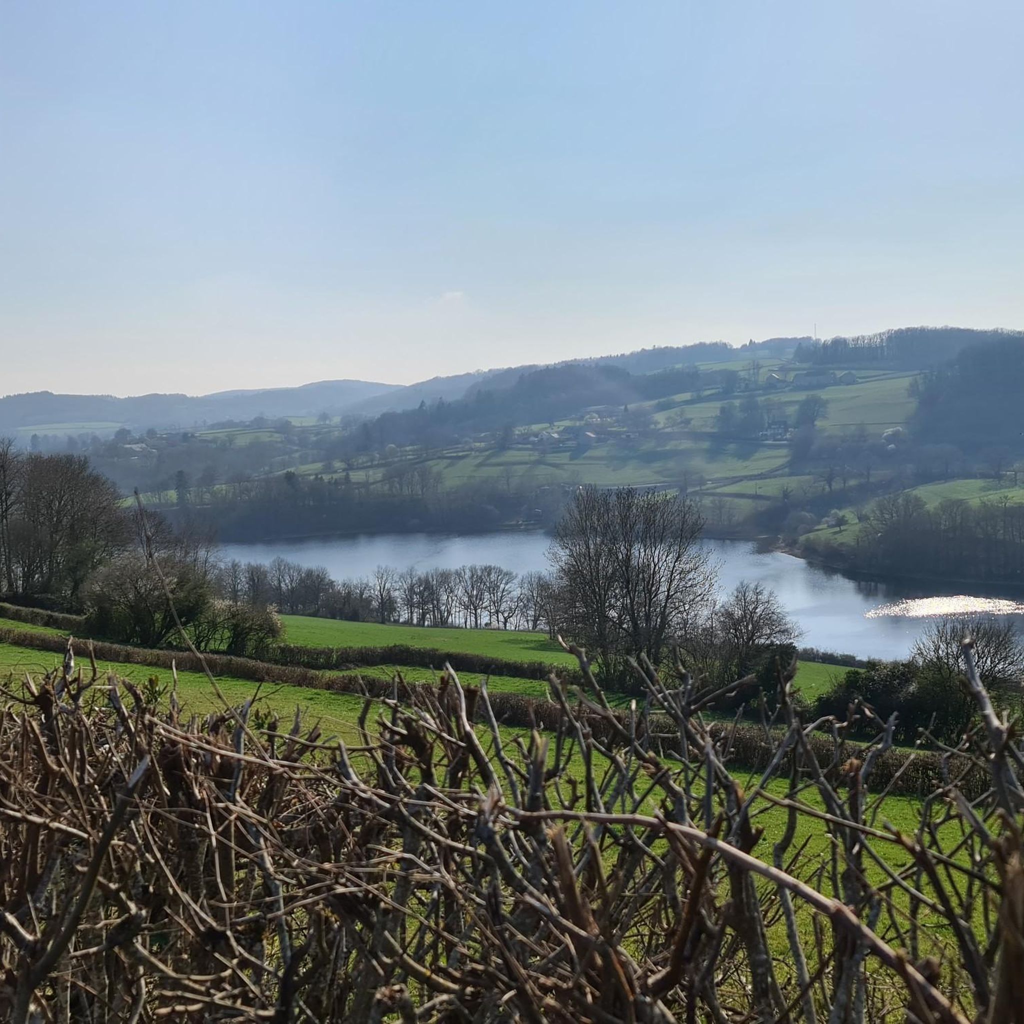
Crescent Lake is one of the six large lakes of the Morvan. It owes its name to its crescent shape and offers a magnificent natural setting.
0
0

Crescent Lake owes its name to its crescent shape. It is popular with local fishermen and also with swimmers who can visit its beach to cool off. Camping is also permitted. This lake, with its exceptionally bucolic setting, was chosen as the location in 2015 by Michel Gondry for filming his movie Microbe and Gazoil.
1
0

There is no possibility of touring the lake by mountain bike along the banks, but rather by taking the road. However, check that the road that passes over the dam is open (temporarily closed until June 25, 2025 for us!).
1
0


The Crescent Dam was built between 1929 and 1932. A gravity dam, it is 330 meters long and 37 meters high. Its width at the base is 24 meters and at the crest 3.5 meters. It was built on the initiative of SA Compagnie HydroElectrique de la Cure and was owned by the City of Paris until 1946. The dam was built to regulate the waters of the Yonne and Seine rivers and thus prevent flooding in Paris, while also producing electricity. More than 165 hectares of cultivated land, hamlets, mills, and paths were flooded to allow the creation of the reservoir (maximum depth of 40 meters). It occupies four municipalities and two departments, and is fed by the Cure and Chalaux rivers. The structure was partly financed by war reparations owed by Germany to France after the First World War. This is why much of the dam's mechanisms are German-made. The road across it is narrow and only allows passage for one vehicle. Fortunately, there is very little traffic.
1
0
Straddling the departments of Nièvre and Yonne, with an area of 138 ha, Lac du Crescent owes its name to its "crescent" shape. This lake is formed by a hydroelectric dam built in 1930 and financed as German war damage linked to the 1st World War. The dam is 330 m long, 37 m high and the capacity of the lake is 14 million m3. The Crescent reservoir is fed by the most famous trout rivers in the Morvan: the Cure and the Chalaux. It is therefore a good fishing spot, like all the neighboring lakes of the Morvan, but a swimming area has also been set up on the side of the Yonne in the town of Chastellux sur Cure.
0
0


This superb Crescent lake is a dam lake which is located on the course of the Cure. All in length, it is suitable for swimming.
1
0
Frequently Asked Questions
How many hiking trails are available around Saint-André-En-Morvan?
There are over 180 hiking routes in the Saint-André-En-Morvan area, offering a diverse range of experiences. These include 74 easy trails, 89 moderate routes, and 22 more challenging options.
Are there easy hiking trails suitable for beginners or families?
Yes, the region offers many easy trails perfect for beginners or families. You can find 74 routes classified as easy, often leading through woodlands or along lake shores. For example, the Lake Crescent – Lac du Crescent loop from Chastellux-sur-Cure is a moderate 6.6-mile (10.7 km) trail that is popular for its scenic lake views and relatively gentle terrain.
What are some options for longer, more challenging hikes?
For those seeking a greater challenge, the area provides several difficult routes. The Lake Crescent – Cure Valley loop from Domecy-sur-Cure is a demanding 17.9-mile (28.9 km) hike with significant elevation changes, offering extensive views of the Cure Valley and Lake Crescent.
Can I bring my dog on the hiking trails?
Generally, dogs are welcome on most hiking trails in the Morvan Regional Natural Park, including those around Saint-André-En-Morvan. However, it is always recommended to keep them on a leash, especially when passing through agricultural areas or near wildlife, and to respect local signage.
When is the best time of year to go hiking in Saint-André-En-Morvan?
The best time for hiking in Saint-André-En-Morvan is typically from spring to autumn (April to October). During these months, the weather is generally mild and pleasant, with lush greenery in spring and vibrant colors in autumn. Summer offers warmer temperatures, ideal for enjoying the lakes.
What kind of natural attractions can I see along the hiking trails?
The trails often lead past beautiful natural features. You can explore areas like the Cousin Valley, or visit serene spots like Étang Chaumail and Étang du Moulin du Bois. The region is also known for its significant water features, including Lake Crescent and its shores.
Are there any interesting landmarks or historical sites to discover?
Yes, some routes incorporate historical elements. For instance, the difficult Lake Crescent – Chastellux-sur-Cure Castle loop from Chastellux-sur-Cure offers views of Lake Crescent and passes by historical sites, including the impressive Château de Chastellux.
Is parking available at the trailheads?
Many popular trailheads and starting points in the Morvan Regional Natural Park, including those near Saint-André-En-Morvan, offer designated parking areas. It's advisable to check specific route details on komoot for information on parking availability at your chosen starting point.
What do other hikers enjoy most about hiking in Saint-André-En-Morvan?
The area is highly rated by the komoot community, with an average score of 4.5 stars from over 800 reviews. Hikers often praise the diverse landscape, including the extensive forest trails, scenic lake views, and tranquil river valleys. The variety of routes suitable for different ability levels is also frequently highlighted.
Are there circular hiking routes available?
Yes, many of the hiking routes around Saint-André-En-Morvan are designed as circular loops, allowing you to start and end at the same point. An example is the Château Bazoches — loop in the Morvan Regional Natural Park, a moderate 9.2-mile (14.8 km) trail.
Are there any trails that offer good viewpoints?
The Morvan Regional Natural Park is characterized by rolling hills, and many trails offer elevated sections with scenic viewpoints over the forested landscape, valleys, and lakes. While not explicitly named as 'viewpoint trails,' routes with higher elevation gain, such as the more difficult loops around Lake Crescent, often provide expansive vistas.
Is public transport an option to reach trailheads?
Public transport options in the immediate vicinity of Saint-André-En-Morvan and within the Morvan Regional Natural Park can be limited. While some larger towns might have bus services, reaching specific trailheads often requires a car. It's recommended to plan your transport in advance if relying on public services.
Most popular routes around Saint-André-En-Morvan
Most popular attractions around Saint-André-En-Morvan

Get inspired with the komoot mobile app


Explore more
Browse the best Hikes in other regions.
