The best mountain hikes around Vira (Gambarogno)
4.8
(7)
42
hikers
6
hikes
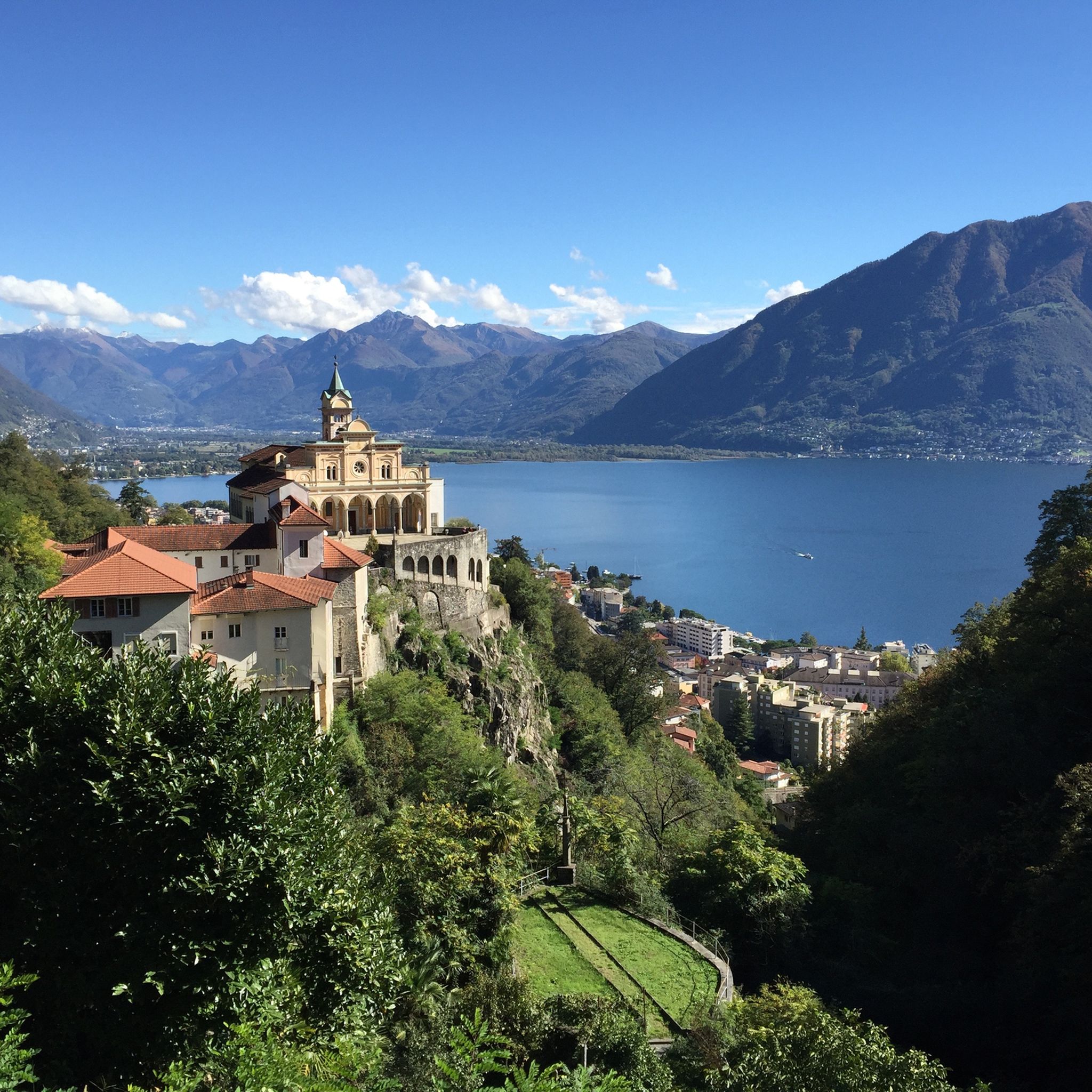
Mountaineering routes around Vira (Gambarogno) are situated on the south-eastern shore of Lake Maggiore in Switzerland's Ticino region, offering a diverse Alpine environment. The landscape features continuous scenic views of Lake Maggiore, extensive chestnut groves, and prominent peaks such as Monte Gambarogno (1734 m), Monte Tamaro (1961 m), and Sassariente Summit (1767 m). The region includes the wild Cedullo Valley with its waterfall and the Alpe di Neggia, a crucial starting point for many mountain excursions.
Best mountaineering routes around…
Last updated: July 11, 2026
4.0
(2)
11
hikers
9.56km
04:28
690m
690m
Hard mountaineering route. Good fitness required. Sure-footedness, sturdy shoes and alpine experience required.
5.0
(1)
7
hikers
6.49km
03:21
530m
520m
Moderate mountaineering route. Good fitness required. Mostly accessible paths. Sure-footedness required.

Sign up for free
5.0
(3)
8
hikers
Moderate mountaineering route. Good fitness required. Mostly accessible paths. Sure-footedness required.
6
hikers
9.19km
03:46
580m
580m
Moderate mountaineering route. Good fitness required. Mostly accessible paths. Sure-footedness required.
5.0
(1)
4
hikers
8.78km
03:34
500m
500m
Moderate mountaineering route. Good fitness required. Mostly accessible paths. Sure-footedness required.
Our route recommendations are based on thousands of hikes, rides, and runs completed by other people on komoot.
Start today with a free account
Your next adventure awaits.
Login or Signup
Tips from the Community

Perfect end after a hike for refreshments. Small menu with soup, polenta, risotto and homemade cake. https://www.montimotti.ch
0
0

Scenically a very great tour. Top Top Top
0
0

Which direction would I like to take? Always so many possibilities to choose from here.
0
0
Always a beautiful destination for those starting from the valley or from Arosio.
0
0

Alpe Foppa is located at around 1500 meters above sea level and is a popular destination above Rivera. It is easily accessible by cable car to Monte Tamaro or on foot via various hiking trails. The Alp offers a magnificent view of the Ticino Alps and Lake Lugano. It is also known for the impressive chapel Santa Maria degli Angeli. In summer, hiking trails invite exploration, and in winter, snowshoe routes do the same. The combination of nature, tranquility, and architecture makes Alpe Foppa particularly attractive.
4
0

The Cugnasco-Monti di Motti road was built as a military road during the First World War. After a 12 km climb on a narrow but well-maintained road, you reach Monti di Motti, a magnificent cluster of houses on a small lake with breathtaking views of the Verzasca Valley, the Magadino Plain, Monte Tamaro and Lake Maggiore. The grotto and the lake make this mountain an ideal destination for families who want to spend a day surrounded by nature. Several interesting excursions start from here, including one to the picturesque Sassariente
1
0
very pretty here, very pretty
0
0

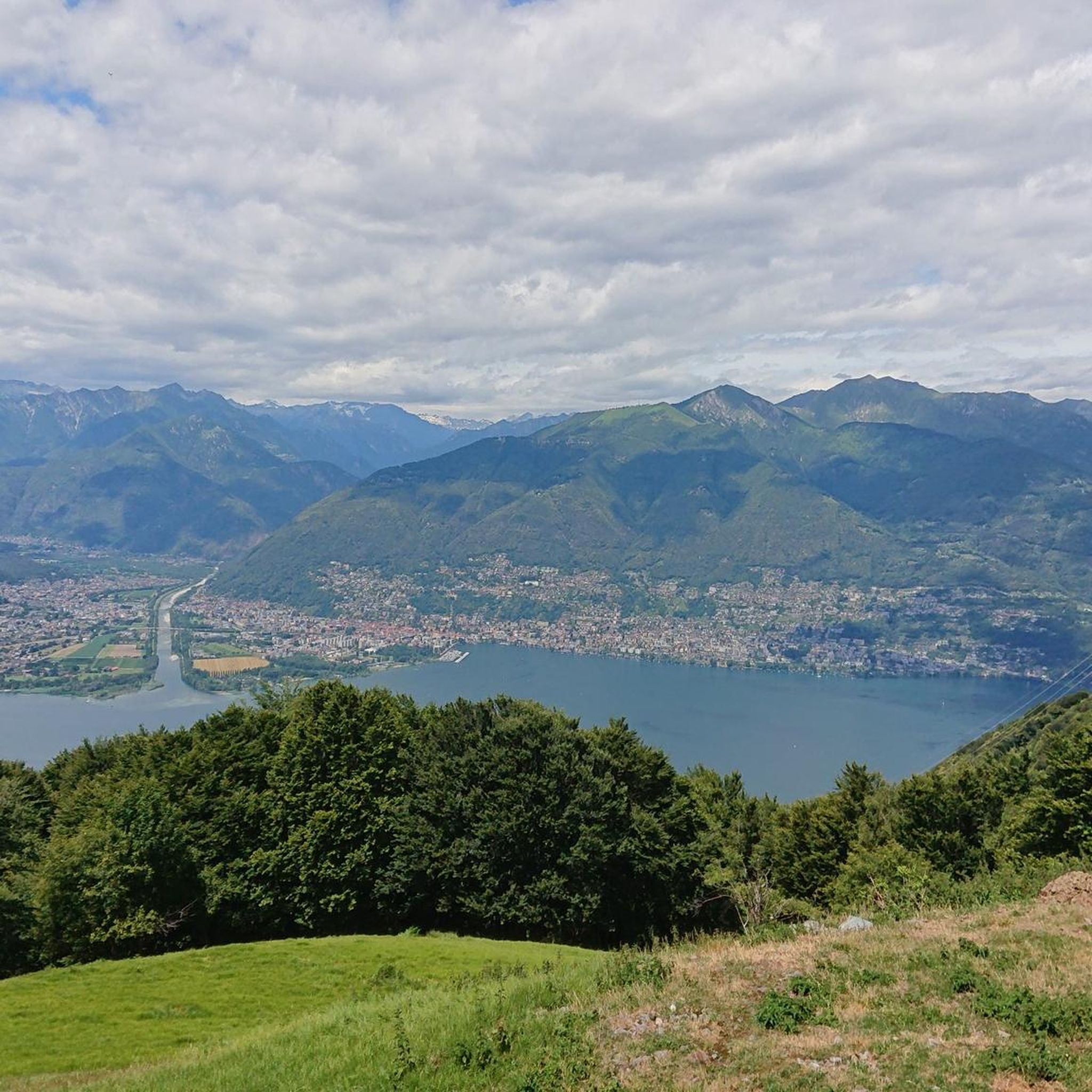
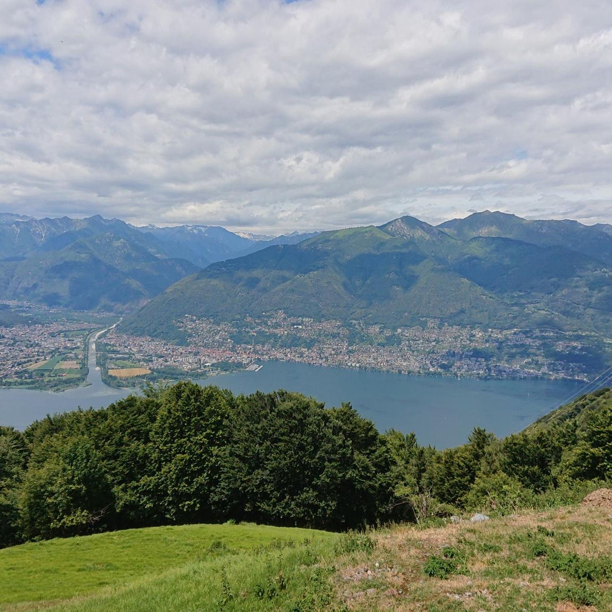
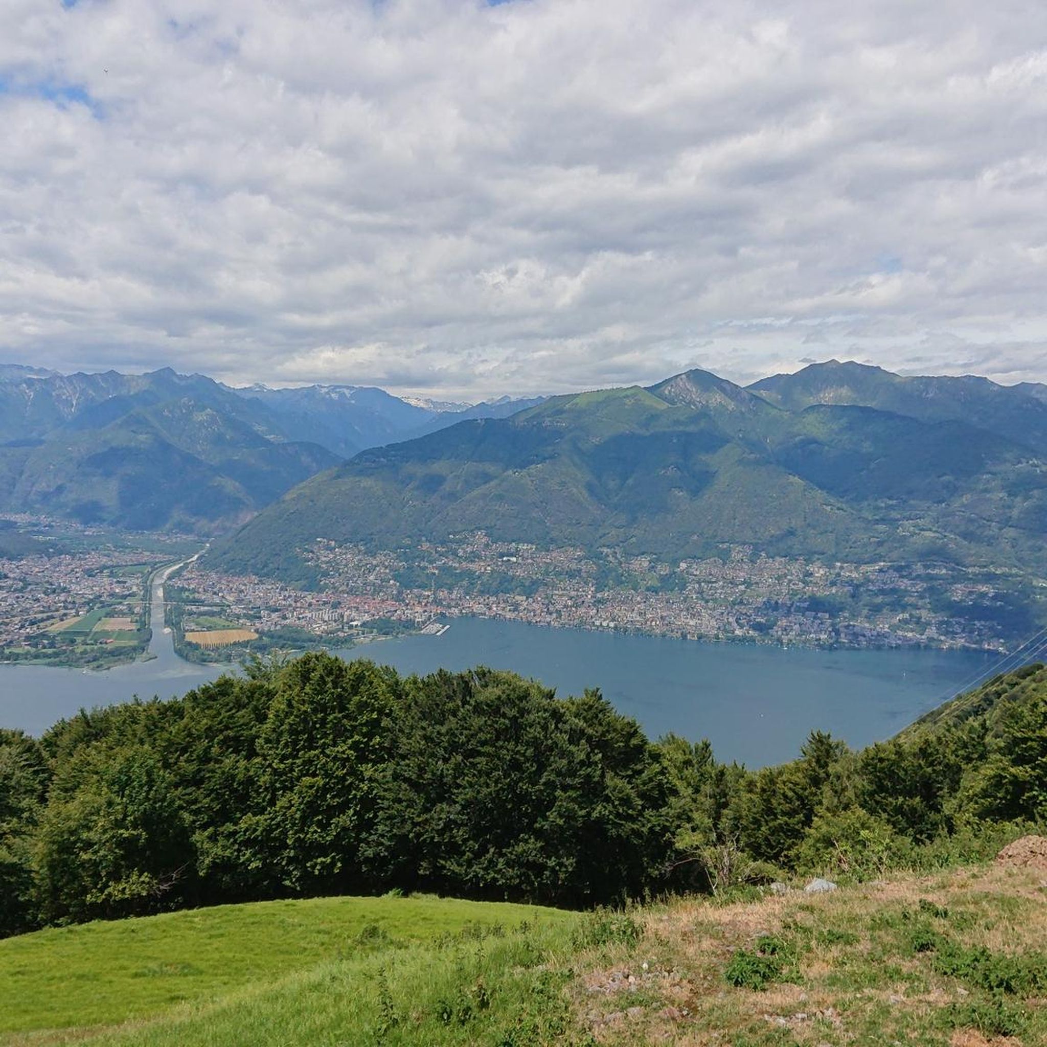
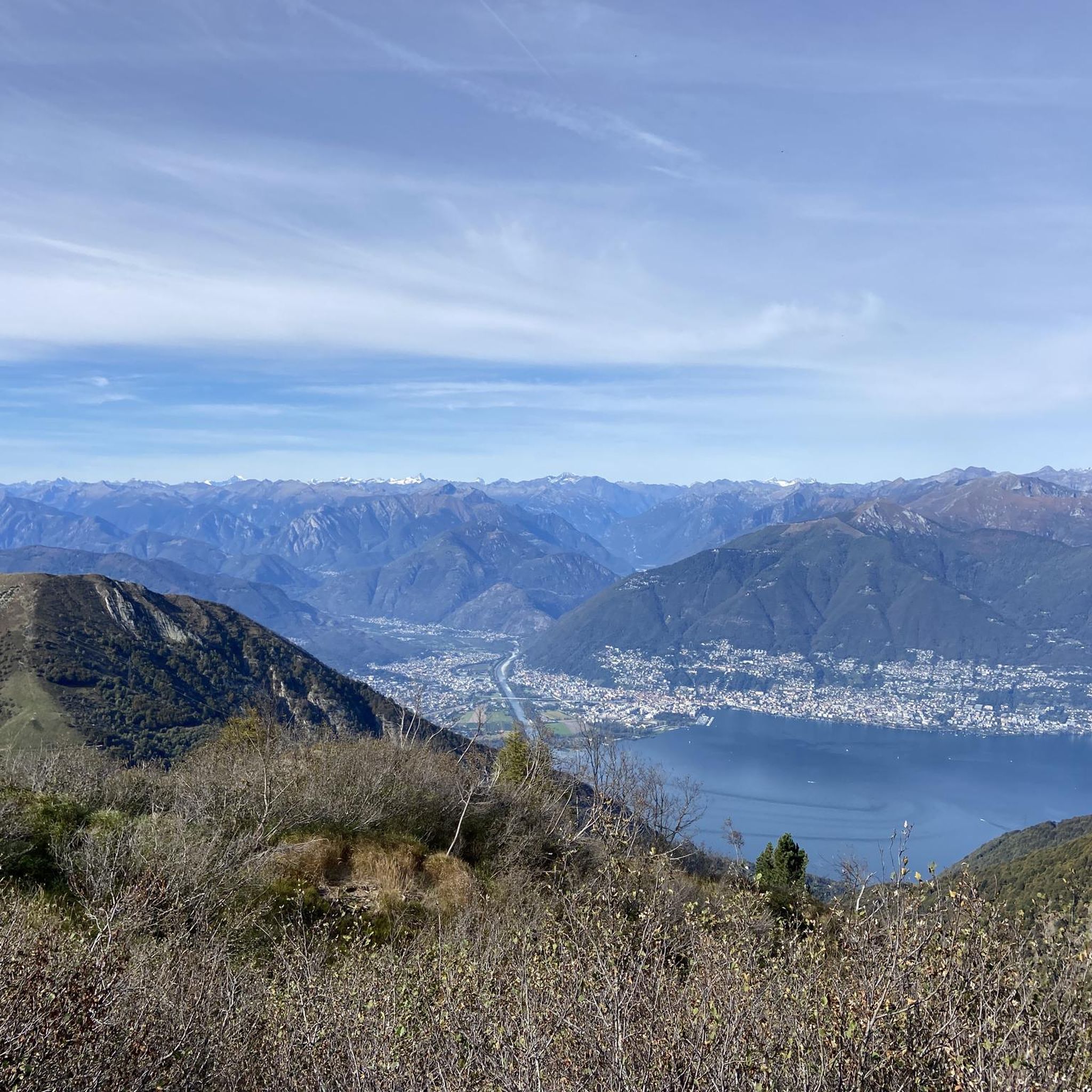
View of Lake Maggiore and the Monte Rosa mountain range
0
0
Frequently Asked Questions
What kind of terrain can I expect on mountaineering routes around Vira (Gambarogno)?
The mountaineering routes in Vira (Gambarogno) offer a diverse Alpine environment, characterized by high peaks, extensive chestnut groves, and continuous scenic views of Lake Maggiore. You'll encounter varied mountain terrain, from challenging ascents to more moderate paths. For example, the Summit of Mount Gambarogno – Alpe di Neggia Pass (1,395 m) loop from Indemini is a difficult route traversing such varied terrain, while the Alpe di Neggia Pass (1,395 m) – Summit of Mount Gambarogno loop from Monte Gambarogno offers a moderate challenge with significant elevation gain.
Are there any family-friendly mountaineering options in Vira (Gambarogno)?
While many mountaineering routes in Vira (Gambarogno) are rated moderate to difficult, the region's extensive network of trails includes options suitable for various fitness levels. For families looking for a less strenuous mountain experience, consider exploring parts of the 200 kilometers of hiking and biking trails, which range from easy walks to more challenging excursions. Always check the specific route details for elevation and duration to ensure it matches your family's capabilities.
Can I bring my dog on the mountaineering trails?
Generally, dogs are welcome on hiking and mountaineering trails in Switzerland, but it's always advisable to keep them on a leash, especially in nature protection areas, near livestock, or in crowded sections. Ensure your dog is fit enough for the chosen route and carry enough water for both of you. Specific rules might apply in certain areas, so look for local signage.
Are there circular mountaineering routes available?
Yes, Vira (Gambarogno) offers several circular mountaineering routes. A popular option is the Alpe di Neggia Pass (1,395 m) – Summit of Mount Gambarogno loop from Monte Gambarogno, which takes about 4 hours 10 minutes. Another challenging circular path is the Summit of Mount Gambarogno – Alpe di Neggia Pass (1,395 m) loop from Indemini. For an incomparable viewpoint, consider the Sassariente Summit Cross loop from Gordola.
What natural features or landmarks can I see while mountaineering?
The region is rich in natural beauty and points of interest. You'll enjoy continuous scenic views of Lake Maggiore and extensive chestnut groves. Notable peaks like Monte Gambarogno, Monte Tamaro, and Sassariente Summit offer breathtaking panoramic views. You might also encounter the wild Cedullo Valley, home to an impressive waterfall, and the picturesque Gambarogno Botanical Gardens. For specific landmarks, consider visiting Monte Tamaro or Sassariente Summit.
When is the best time of year for mountaineering in Vira (Gambarogno)?
The spring and autumn months are generally ideal for mountaineering in Vira (Gambarogno), offering pleasant temperatures and vibrant landscapes. Spring brings the blooming magnolias in the Gambarogno Botanical Gardens, while autumn showcases the beauty of the chestnut groves. Summer can also be suitable, especially for higher altitude routes, but be prepared for warmer weather. Winter mountaineering is possible, particularly in areas like Alpe di Neggia which features a ski lift, but requires appropriate gear and experience.
How accessible are the mountaineering routes by public transport?
Vira (Gambarogno) is part of Switzerland's well-connected public transport network. Many trailheads, including those leading to Monte Gambarogno from Alpe di Neggia or Indemini, can be reached by bus services. It's recommended to check local bus schedules in advance, especially for routes to more remote mountain villages, to plan your journey effectively.
Is parking available near the trailheads?
Yes, parking is generally available near popular trailheads and starting points for mountaineering routes. For instance, Alpe di Neggia is a crucial starting point for many mountain excursions and typically offers parking facilities. When planning your tour, it's always a good idea to check specific route descriptions for detailed parking information to ensure convenience.
Do I need any special permits for mountaineering in this region?
For general mountaineering and hiking on marked trails in the Vira (Gambarogno) region, special permits are typically not required. However, if you plan to engage in specific activities like canyoning or enter designated nature reserves, it's always wise to check for any local regulations or permit requirements. Always respect local signage and environmental guidelines.
What do other mountaineers say about the routes in Vira (Gambarogno)?
The mountaineering routes in Vira (Gambarogno) are highly rated by the komoot community, with an average score of 4.9 stars from over 15 reviews. Mountaineers often praise the varied terrain, the breathtaking panoramic views of Lake Maggiore, and the challenging yet rewarding ascents to peaks like Monte Gambarogno. Over 90 mountaineers have used komoot to explore this region's diverse trails.
Are there any routes that feature waterfalls?
Yes, the region offers natural features including waterfalls. The wild Cedullo Valley, for example, is home to an impressive waterfall that can be a rewarding sight during your outdoor adventures. While not explicitly part of a mountaineering route listed here, exploring the Cedullo Valley can be a great addition to your trip.
Where can I find refreshments or accommodation after a mountaineering tour?
Vira (Gambarogno) and its surrounding villages offer various options for refreshments and accommodation. You'll find cafes and restaurants in Vira itself, known for its charming historic center. For a unique experience, Alpe di Cedullo is known for its locally produced goat cheese, and there are often mountain huts or guesthouses in the alpine areas. For broader information on the region, you can visit MySwitzerland.com.
What are the difficulty levels of mountaineering routes in Vira (Gambarogno)?
The mountaineering routes around Vira (Gambarogno) cater to a range of experience levels. You'll find a mix of moderate and difficult trails. For instance, the Alpe di Neggia Pass (1,395 m) – Summit of Monte Tamaro loop from Monte Gambarogno is a moderate route, while the Sassariente Summit Cross loop from Gordola is rated as difficult. Out of the 12 available tours, 4 are moderate and 8 are difficult, ensuring options for experienced mountaineers seeking a challenge.
Most popular routes around Vira (Gambarogno)
Most popular attractions around Vira (Gambarogno)

Get inspired with the komoot mobile app


Explore more
Browse the best Mountain Hikes & Routes in other regions.
