The best walks and hikes around Hagendingen
4.4
(406)
2,435
hikers
205
hikes
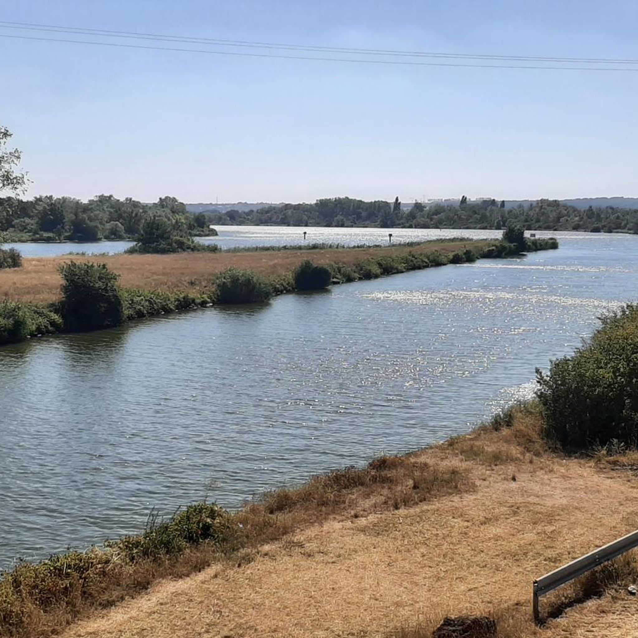
Hiking around Hagendingen offers routes through a landscape shaped by complex geological processes, resulting in distinctive features. The region, situated at an elevation of 154 meters above sea level, provides views of the surrounding area. Its hydrological systems support diverse ecosystems, contributing to the natural environment. While specific detailed hiking infrastructure is not extensively documented, the area presents natural beauty for outdoor exploration.
Best hiking trails around Hagendingen
- The most popular hiking route is Lac du Bois de Coulange loop…
Last updated: October 5, 2026
5.0
(7)
43
hikers
9.78km
02:37
110m
110m
Moderate hike. Good fitness required. Easily-accessible paths. Suitable for all skill levels.
4.5
(4)
30
hikers
13.3km
03:27
80m
80m
Moderate hike. Good fitness required. Easily-accessible paths. Suitable for all skill levels.

4.0
(2)
17
hikers
8.52km
02:17
100m
100m
Moderate hike. Good fitness required. Easily-accessible paths. Suitable for all skill levels.
5.0
(1)
20
hikers
7.20km
01:55
80m
80m
Easy hike. Great for any fitness level. Easily-accessible paths. Suitable for all skill levels.
4.7
(3)
18
hikers
13.7km
03:36
120m
120m
Moderate hike. Good fitness required. Easily-accessible paths. Suitable for all skill levels.
Get access to more routes and recommendations from other explorers.
Already have an account?
Our route recommendations are based on thousands of hikes, rides, and runs completed by other people on komoot.
Start today with a free account
Your next adventure awaits.


Tips from the Community


The Bois de Coulange lake is a 3-hectare lake surrounded by a forest area which offers various activities such as walking, cycling, picnicking and pedal boats. Access to the lake is only on foot or by bike, to ensure a peaceful atmosphere. You can also rent a Segway, a self-balancing electric vehicle, to explore the forest trails. The lake is open from April to September and has a small restaurant on site. The Bois de Coulange lake is an ideal place to enjoy nature.
3
0
Frequently Asked Questions
How many hiking trails are available around Hagendingen?
There are over 160 hiking routes around Hagendingen. These include a mix of 58 easy, 96 moderate, and 6 difficult trails, offering options for various skill levels.
What kind of terrain can I expect on hikes in Hagendingen?
Hagendingen's landscape is shaped by complex geological processes, resulting in distinctive features and diverse ecosystems. You can expect varied terrain, often with hydrological systems and views from its elevation of 154 meters above sea level. The routes generally offer a mix of easy and moderate paths.
Are there many circular hiking routes in Hagendingen?
Yes, many of the trails in Hagendingen are circular routes. For example, you can explore the Lac du Bois de Coulange loop from Talange or the Lac du Bois de Coulange loop from Silvange, both offering varied natural surroundings.
What do other hikers enjoy the most about hiking in Hagendingen?
The hiking routes in Hagendingen are highly rated by the komoot community, with an average score of 4.5 stars from over 270 reviews. Hikers often praise the diverse ecosystems and hydrological systems, as well as the variety of easy and moderate routes available for exploration.
Are there any interesting landmarks or places to explore near the hiking trails?
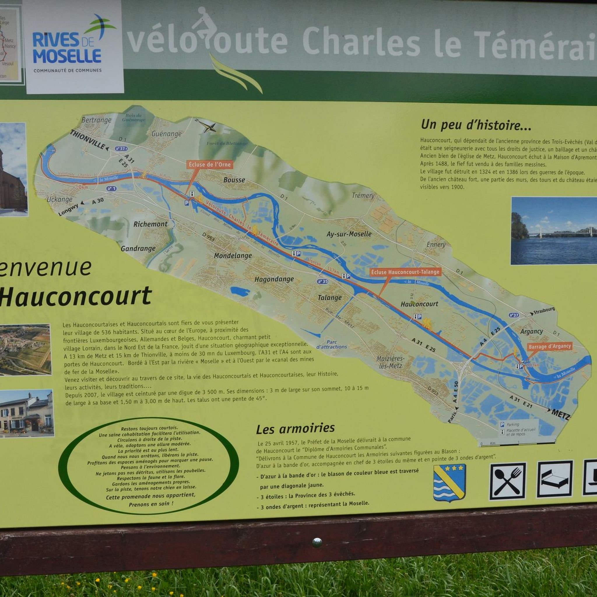
Yes, around Hagendingen, you can find several points of interest. These include the Charles le Téméraire cycle route, the U4 - Blast Furnace Park (Uckange), and the Path along the banks of the Moselle. These offer additional opportunities for exploration beyond the hiking paths.
Are there any easy hiking trails suitable for families in Hagendingen?
Hagendingen offers 58 easy routes, many of which are suitable for families. An example is the Polar bear – Clamp monkey loop from Silvange, which is a shorter, less strenuous option for a pleasant walk.
What is the best time of year to go hiking in Hagendingen?
While specific seasonal conditions are not detailed, the region's diverse ecosystems and hydrological systems suggest that spring and autumn would offer pleasant temperatures and vibrant natural scenery. Summer can also be suitable, but it's always advisable to check local weather forecasts.
Are there any dog-friendly hiking trails in Hagendingen?
Many natural areas and trails in France are generally dog-friendly, especially if dogs are kept on a leash. While specific rules for Hagendingen are not detailed, the varied terrain and natural surroundings of routes like the Talange loop from Talange can be enjoyed with a well-behaved dog.
Are there options for longer hikes in the Hagendingen area?
Yes, for those seeking longer excursions, Hagendingen offers several moderate routes. The Talange loop from Talange is a good example, covering about 7 miles (11.3 km) and typically taking around 2 hours 52 minutes to complete.
What are the elevation changes like on the trails around Hagendingen?
The trails around Hagendingen feature varied elevation changes. For instance, the Lac du Bois de Coulange loop from Talange has an elevation gain of about 105 meters, while the Polar bear – Clamp monkey loop from Silvange has a gentler gain of around 29 meters, reflecting the mix of easy and moderate difficulties.
Is there parking available near the trailheads in Hagendingen?
While specific parking locations for each trailhead are not detailed, it is common for hiking areas in France to have designated parking, especially near popular starting points in towns like Talange or Silvange, which are mentioned as starting points for several loops.
Can I reach the hiking trails in Hagendingen using public transport?
Information on specific public transport links to trailheads in Hagendingen is not extensively documented. However, as Hagondange is a commune, it likely has local public transport options that could connect to areas near some of the hiking routes. It's advisable to check local transport schedules for the towns mentioned as starting points, such as Talange or Silvange.
Most popular routes around Hagendingen
Most popular attractions around Hagendingen

Get inspired with the komoot mobile app


Explore more
Browse the best Hikes in other regions.
