The best running trails around Romilly-Sur-Seine
3.0
(1)
158
runners
37
runs
Jogging around Romilly-sur-Seine offers access to varied natural settings within the alluvial plain of the Seine valley. The region is characterized by its winding riverbanks, canals, and cultivated plains, providing largely flat and accessible running routes. While direct forests are not within the town, nearby woodlands and expansive open plains offer diverse terrain for runners. The landscape is generally low-lying, with minimal elevation changes, making it suitable for a range of running abilities.
Best jogging routes around Romilly-sur-Seine
- The most…
Last updated: June 25, 2026
13
runners
10.7km
01:07
30m
30m
Moderate run. Good fitness required. Mostly paved surfaces. Suitable for all skill levels.
5
runners
12.7km
01:18
20m
20m
Moderate run. Good fitness required. Mostly paved surfaces. Suitable for all skill levels.

Sign up for free
2
runners
14.1km
01:28
20m
20m
Moderate run. Good fitness required. Mostly paved surfaces. Suitable for all skill levels.
3
runners
7.18km
00:45
10m
10m
Moderate run. Good fitness required. Mostly paved surfaces. Suitable for all skill levels.
3
runners
7.57km
00:47
30m
30m
Moderate run. Good fitness required. Mostly paved surfaces. Suitable for all skill levels.
Get access to more routes and recommendations from other explorers.
Sign up for free
Already have an account?
Our route recommendations are based on thousands of hikes, rides, and runs completed by other people on komoot.
Start today with a free account
Your next adventure awaits.
Login or Signup
Popular around Romilly-Sur-Seine

Tips from the Community

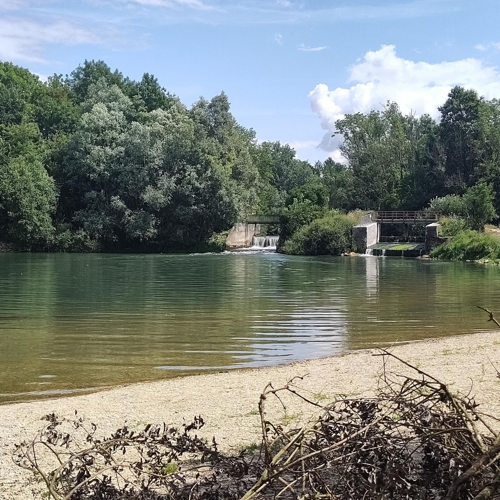
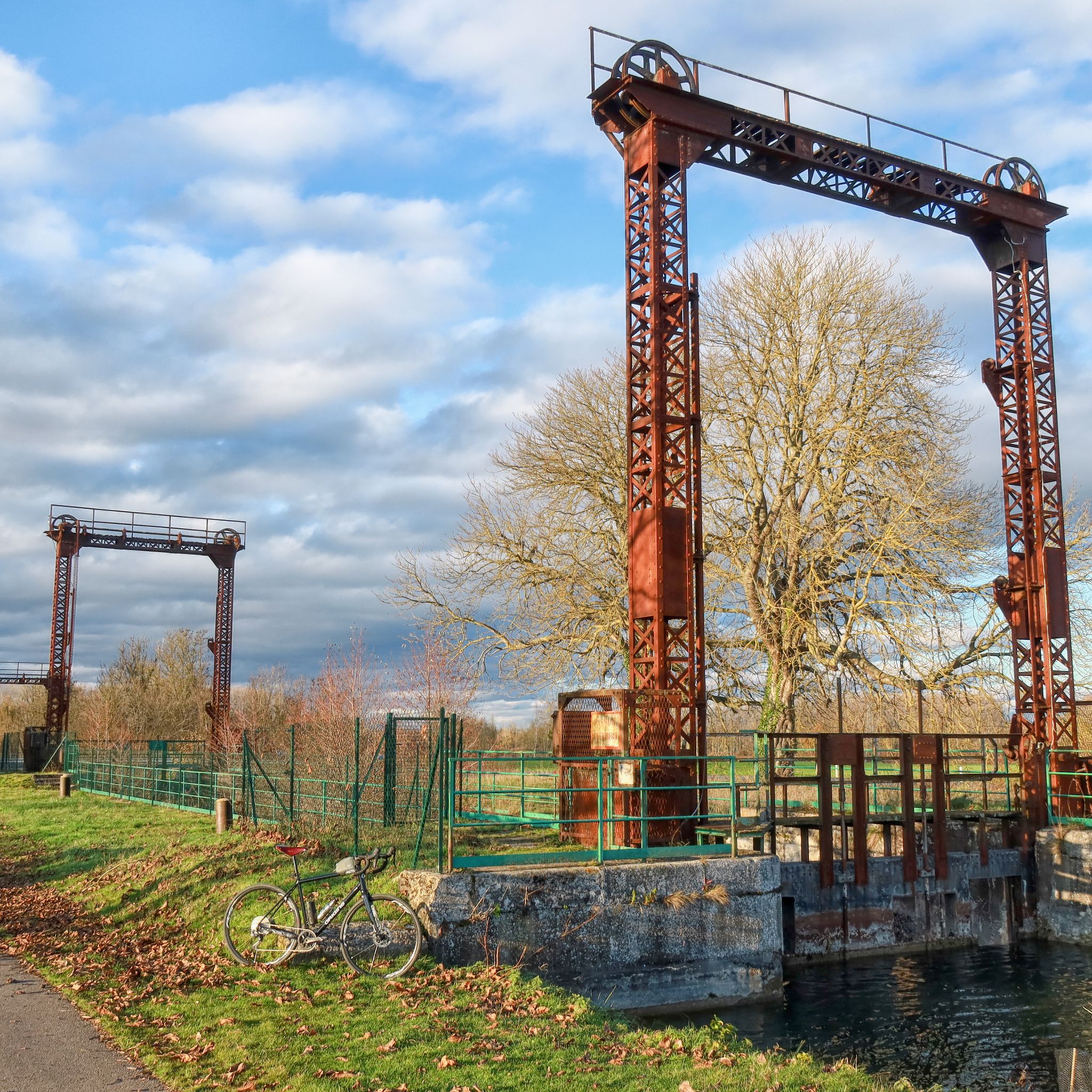
The Aiguilles dam of Romilly-Sur-Seine is a hydraulic structure which regulates the level of the Seine to facilitate navigation. It is made of wooden beams called trusses and vertical planks called needles, which rise or lower depending on the flow of the river.
3
0
Frequently Asked Questions
What kind of terrain can I expect on the running routes around Romilly-sur-Seine?
The running routes in Romilly-sur-Seine are primarily characterized by their largely flat and accessible terrain. You'll find yourself jogging along the winding banks of the Seine River, tranquil canals like the Upper Seine Canal, and across expansive cultivated plains. While direct forests are not within the town, the region offers diverse natural settings suitable for various running abilities.
How challenging are the running trails in Romilly-sur-Seine?
The running trails around Romilly-sur-Seine are generally considered moderate in difficulty, featuring gentle gradients and minimal elevation changes. This makes them suitable for a wide range of runners, from those looking for a casual jog to those seeking a longer, steady run. For example, the Running loop from Maizières-la-Grande-Paroisse is a moderate 11 km route.
Are there any interesting landmarks or natural features to see along the running routes?
Yes, several routes offer scenic views and points of interest. You might encounter the The needle dam, which is part of the popular The needle dam – Needles dam loop from Romilly-sur-Seine. Other natural highlights include the Lake Between the Seine and the Canal du Moulin, known for its beautiful views, and the historic Upper Seine Canal.
Are the running routes in Romilly-sur-Seine suitable for families?
Many of the running routes in Romilly-sur-Seine are well-suited for families due to their generally flat and accessible nature. Paths along the riverbanks and canals provide tranquil settings away from urban bustle, making for a pleasant experience for all ages. Routes like the Running loop from Romilly-sur-Seine are shorter and offer an easy introduction to the area's landscapes.
Can I bring my dog on the running trails around Romilly-sur-Seine?
While specific regulations for dogs on every trail are not detailed, the natural settings of Romilly-sur-Seine, including riverbanks and open plains, are generally welcoming for runners with dogs. It's always recommended to keep your dog on a leash, especially in areas with wildlife or near agricultural land, and to carry waste bags to maintain the cleanliness of the paths.
What is the best time of year to go running in Romilly-sur-Seine?
Romilly-sur-Seine is pleasant for outdoor activities throughout much of the year. Spring and autumn offer mild temperatures and beautiful scenery, with spring bringing blooming flora and autumn showcasing vibrant foliage. Summer can be warm, but routes along the river and canals often provide a refreshing breeze. Winter runs are also possible, though paths might be damp.
Are most of the running routes circular or point-to-point?
Many of the popular running routes in Romilly-sur-Seine are designed as circular loops, offering convenient starting and ending points. Examples include the Running loop from Hameau de Lion and the The needle dam loop from Romilly-sur-Seine, allowing you to return to your starting location without needing additional transport.
How do other runners rate the trails in Romilly-sur-Seine?
The running routes in Romilly-sur-Seine are highly regarded by the komoot community, holding an average rating of 4.0 stars from numerous reviews. Over 100 runners have used komoot to explore the area's varied terrain, often praising the tranquil settings, accessible paths, and scenic views of the waterways and plains.
Are there options for longer distance running in the area?
Yes, Romilly-sur-Seine offers several routes suitable for longer distance running. For instance, The needle dam – Needles dam loop from Romilly-sur-Seine is a substantial 14.6 km (9.1 miles) trail, providing a good challenge for those looking to cover more ground. The interconnected network of paths along the Seine and canals also allows for extended runs.
What kind of natural landscapes are prominent for running in this region?
The region is defined by its diverse natural settings within the alluvial plain of the Seine valley. You'll primarily encounter picturesque riverbanks along the Seine, tranquil canals like the Canal du Moulin, and expansive cultivated plains. While large forests are a short distance away, the immediate area offers a mix of open countryside and waterside paths, providing a varied and pleasant running experience.
Are there any easy running routes for beginners in Romilly-sur-Seine?
While all listed routes are classified as 'moderate,' their generally flat terrain and minimal elevation changes make many of them accessible for beginners. Shorter loops, such as the 7.1 km (4.4 miles) Running loop from Hameau de Lion, are excellent choices for those new to running or looking for a less strenuous workout.
Are there any specific routes that offer views of the Seine River?
Many of the running routes in Romilly-sur-Seine incorporate the scenic Seine River. The The needle dam – Needles dam loop from Romilly-sur-Seine, for example, leads through riverine landscapes, offering beautiful views of the Seine and its surroundings. The winding riverbanks provide picturesque and often flat paths ideal for jogging.
Most popular attractions around Romilly-Sur-Seine

Get inspired with the komoot mobile app


Explore more
Browse the best Running Trails & Routes in other regions.
