The best MTB trails around Champillet
4.7
(7)
54
riders
6
rides
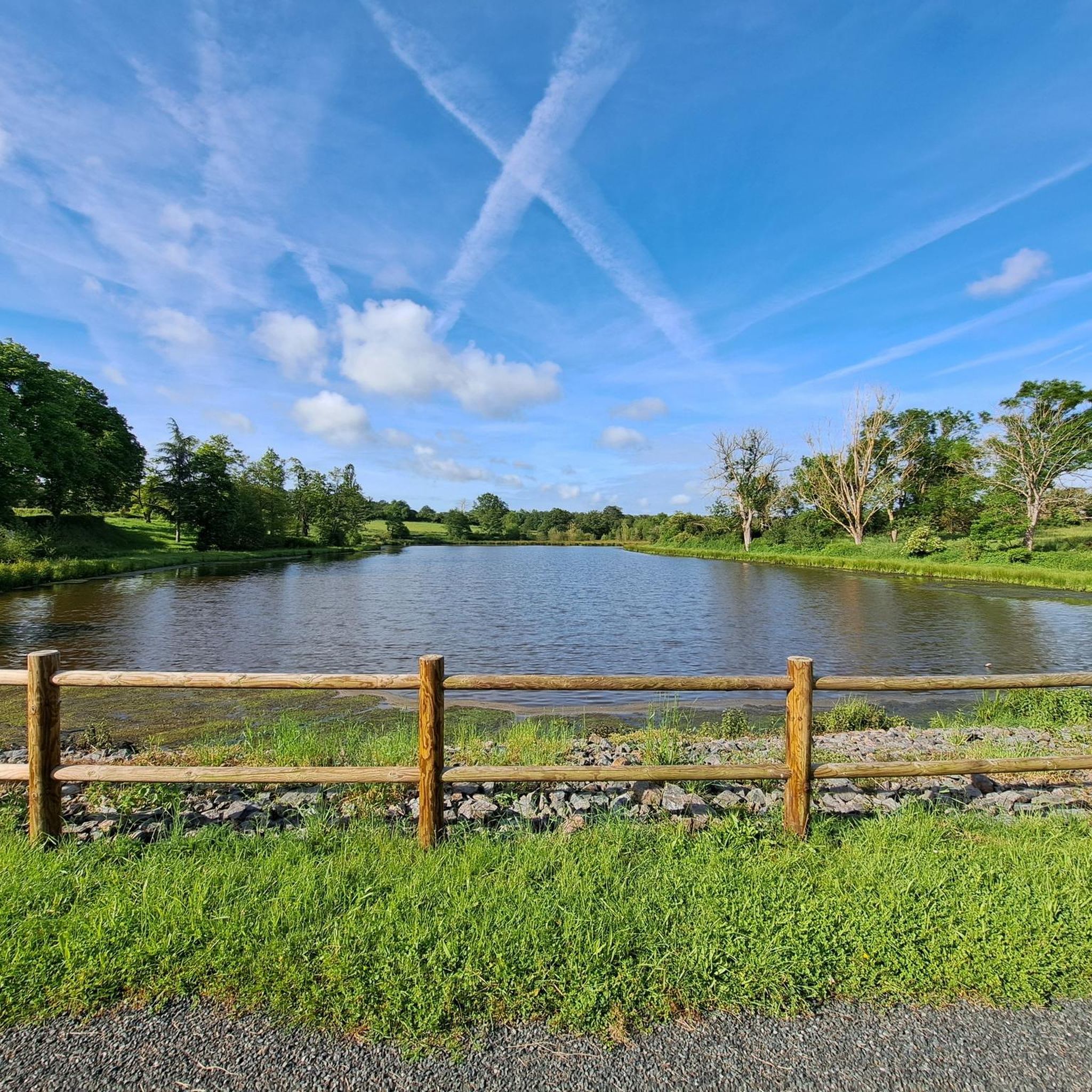
Mountain bike trails around Champillet, France, traverse a varied landscape characterized by rolling hills and a mix of paved and unpaved surfaces. The region features a rural setting with open fields, forests, and the scenic Indre river. Elevation gains on routes typically range from 200 to over 600 meters, offering diverse challenges for mountain bikers. The area also includes natural features like Champillet Lake, providing points of interest along many routes.
Best mountain bike trails around Champillet
- The most popular…
Last updated: October 4, 2026
5.0
(1)
8
riders
Moderate mountain bike ride. Good fitness required. Advanced riding skills necessary.
4.0
(1)
5
riders
76.5km
05:33
860m
860m
Hard mountain bike ride. Very good fitness required. Advanced riding skills necessary.

5.0
(1)
9
riders
Moderate mountain bike ride. Good fitness required. Advanced riding skills necessary.
4.5
(2)
10
riders
Moderate mountain bike ride. Good fitness required. Advanced riding skills necessary.
9
riders
32.9km
02:25
290m
290m
Moderate mountain bike ride. Good fitness required. Advanced riding skills necessary.
Our route recommendations are based on thousands of hikes, rides, and runs completed by other people on komoot.
Start today with a free account
Your next adventure awaits.

Tips from the Community

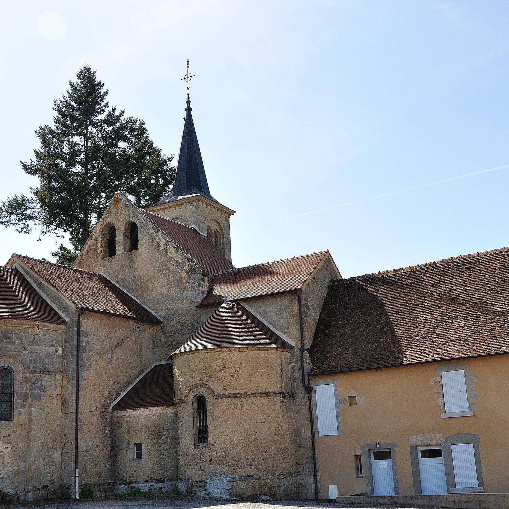
In the heart of La Châtre stands the Église Saint-Germain. Graceful, but with a past that has literally collapsed. In 1896, the bell tower collapsed, dragging the entire church down with it. What you see now is a rebirth in stone. Step back in the square for a moment, look up at the new tower, and imagine the chaos of that time. Inside, the stained-glass windows bathe the light in warm hues, as if the church itself is trying to say, "I'm here again."
3
0


Very beautiful viewpoint and an emblematic castle of the region
1
0

An imposing 15th century medieval castle, which withstood the Hundred Years' War and the Wars of Religion, as well as the Revolution, it was saved from ruin by its current owner in 1982. This castle was the setting for George Sand's novel "The Miller of Angibault" under the name of Château de Blanchemont.
0
0

A beautiful church with a great statue of St. James
1
0
A truly impressive complex. Very well preserved and restored. You can visit the castle for a small fee. It is definitely worth it. Just for the view from the top floor
1
0

Sub-prefecture of Indre, in the 11th century, the town was a feudal castle, seat of a barony of Lower Berry. At the beginning of the 17th century the town became a city of garrisons and magistrates who built beautiful private mansions. In 1737, the former Chauvigny keep became a royal prison.
0
0

Nice castle, which you can visit on your own with a description in the language of your choice. A bit bizarre because you come across all kinds of things, but definitely worth it. Entrance fee adult: 7 euros p.p. There are a number of walking routes near the church: 4, 7, 14, 20 km long. The one from 14 is a beautiful route around the village.
0
0
Frequently Asked Questions
What kind of terrain can I expect on mountain bike trails around Champillet?
The mountain bike trails around Champillet feature a varied landscape with rolling hills and a mix of paved and unpaved surfaces. You'll encounter rural settings, open fields, and forests, often alongside the scenic Indre river. Elevation gains typically range from 200 to over 600 meters, offering diverse challenges.
Are there mountain bike trails suitable for beginners or families in Champillet?
Yes, there are options for easier rides. For instance, the Highest point Indre – Camping de Ligny🤗 loop from Sensas'Parc is an easy 21.5 km route that could be suitable for those looking for a less challenging experience.
What are some scenic points of interest I might see while mountain biking near Champillet?
Many routes offer views of the Indre river and the surrounding rural countryside. You might also pass by natural features like Champillet Lake. For cultural interest, consider routes that lead near historical sites such as the George Sand and Black Valley Museum or various local churches like Saint-Germain Church of La Châtre.
Are there any circular mountain bike routes in the Champillet area?
Yes, all the mountain bike routes listed for the Champillet area are circular loops. For example, you can explore the Sentier au Bord de l'Indre🤗 – Petit Gué sur la Couarde🤗 loop from La Châtre, which is a moderate 51.2 km ride.
What is the typical duration for mountain bike rides around Champillet?
Ride durations vary depending on the route and your pace. For example, a moderate 33.2 km route like the Sentier au Bord de l'Indre🤗 loop from La Châtre typically takes about 2 hours and 25 minutes. Longer routes, such as the 50.6 km Sentier au Bord de l'Indre🤗 – Petit Gué sur la Couarde🤗 loop from Sainte-Sévère-sur-Indre, can take around 4 hours.
What do other mountain bikers say about the trails in Champillet?
The trails in Champillet are highly rated by the komoot community, with an average score of 3.9 stars from more than 6 reviews. Mountain bikers often appreciate the varied terrain and the scenic rural landscapes, especially along the Indre river.
Can I bring my dog on the mountain bike trails in Champillet?
While specific regulations for dogs on mountain bike trails are not always posted, the rural nature of the Champillet region generally makes it suitable for outdoor activities with well-behaved dogs. Always keep your dog under control, especially near livestock or other trail users, and be mindful of local signage.
What is the best season for mountain biking in Champillet?
The region around Champillet is generally pleasant for outdoor activities from spring through autumn. Spring offers lush greenery, while autumn provides beautiful foliage. Summer can be warm, so early morning or late afternoon rides are often preferred. Always check local weather conditions before heading out.
Are there any facilities like cafes or accommodation near the mountain bike trails?
While specific cafes directly on the trails are not highlighted, the surrounding towns and villages like La Châtre offer various amenities. For accommodation, Camping Val Vert en Berry is a nearby option for those looking to stay close to nature.
Where can I find parking for mountain biking in Champillet?
Many of the routes start from towns or villages like La Châtre or Sainte-Sévère-sur-Indre, where public parking is typically available. It's advisable to check the starting point of your chosen route on komoot for specific parking recommendations or general areas where you can safely leave your vehicle.
How many mountain bike trails are available around Champillet?
There are 5 mountain bike trails currently available around Champillet, offering a range of distances and difficulties for different skill levels.
Most popular attractions around Champillet

Get inspired with the komoot mobile app


Explore more
Browse the best MTB trails in other regions.
