The best cycling routes around Vabres
4.6
(74)
559
riders
94
rides
Touring cycling around Vabres offers routes through varied landscapes, characterized by hilly plains and river valleys. The region features a mix of wooded hills and open areas, providing diverse terrain for cyclists. Elevations can be significant, with routes often traversing the Dourdou valley and offering panoramic views. The area's natural features include rivers and distinctive red earth landscapes.
Best touring cycling routes around Vabres
- The most popular touring cycling route is View of the Garabit Viaduct – Ruynes-en-Margeride loop from…
Last updated: June 29, 2026
4.5
(6)
41
riders
57.9km
04:10
1,190m
1,190m
Hard bike ride. Very good fitness required. Mostly paved surfaces. Suitable for all skill levels.
5.0
(2)
14
riders
Hard bike ride. Very good fitness required. Mostly paved surfaces. Suitable for all skill levels.

Sign up for free
5.0
(1)
13
riders
46.4km
04:00
1,020m
1,020m
Hard bike ride. Very good fitness required. Mostly paved surfaces. Suitable for all skill levels.
3.5
(2)
12
riders
34.3km
02:37
550m
550m
Hard bike ride. Very good fitness required. Mostly paved surfaces. Suitable for all skill levels.
4.6
(5)
7
riders
44.5km
03:00
710m
720m
Hard bike ride. Very good fitness required. Mostly paved surfaces. Suitable for all skill levels.
Get access to more routes and recommendations from other explorers.
Sign up for free
Already have an account?
Our route recommendations are based on thousands of hikes, rides, and runs completed by other people on komoot.
Start today with a free account
Your next adventure awaits.
Login or Signup

Tips from the Community

Historical wealth - Magnificent landscapes - Slightly difficult hike, good physical condition required.
0
0

Mont Mouchet is a peak that is part of the Margeride massif. There, you'll find very rocky areas and other more wooded areas, composed of beech and fir forests. As a result, the landscapes are fabulous. Mont Mouchet is also a site classified as a High Place of the Resistance in Auvergne. From here, you can enjoy a superb 360° panorama.
0
0
The Mont Mouchet Museum and Memorial pay tribute to Lucien and Pierrot, who, in 1944, joined one of France's five maquis. They committed to preventing the German army stationed to the south from advancing toward Normandy. Through a tour of authentic objects, documents, photos, and videos, you will discover the historical events that brought Mont Mouchet to life.
0
0
Very nice hike, I recommend starting in the opposite direction in order to finish by going down the scree rather than going up... otherwise the hike is mainly on shaded paths...
0
0


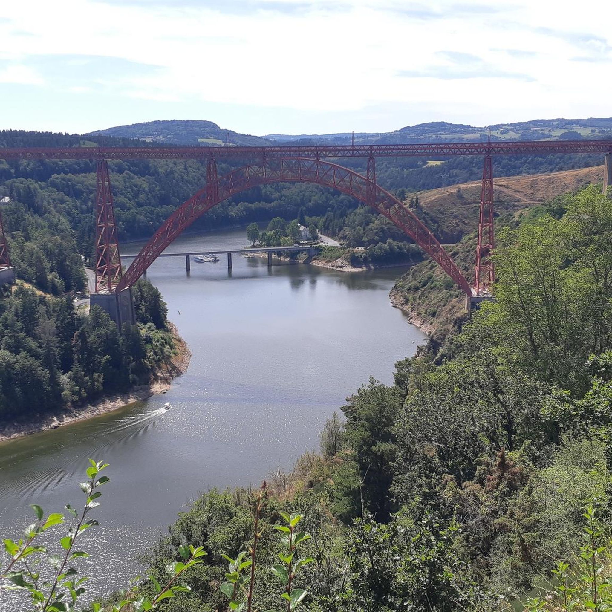
Superb view of the Garabit viaduct, allowing you to cross the Truyère gorges. This metal structure, created by Gustave Eiffel, is 565 meters long and rises to 122 meters above the water. It was at one time the “highest viaduct in the world”!
0
0

Impressive viaduct designed by Eiffel. Go as close as possible for snaps.
0
0

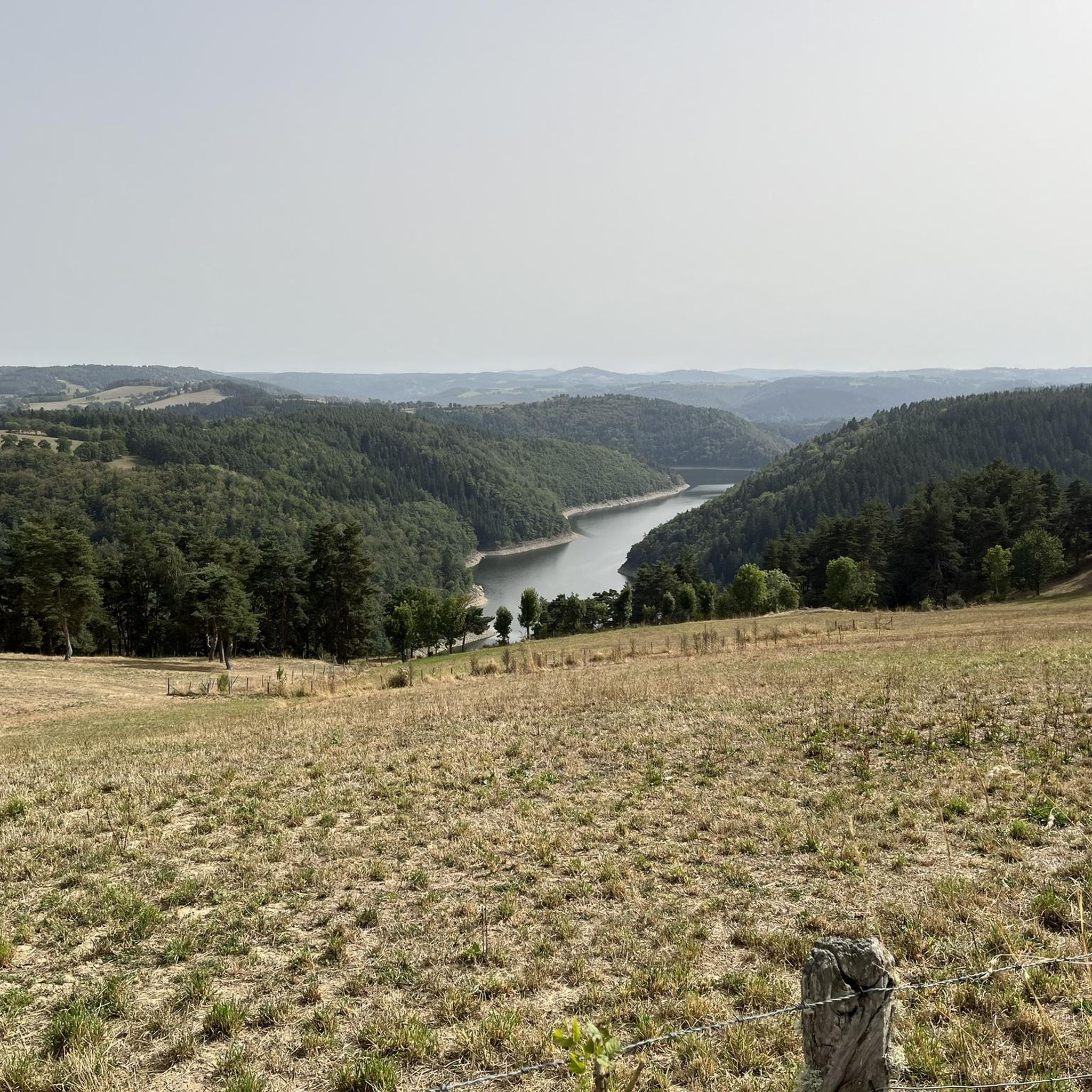
Mont Mouchet, like many other isolated and wild places in France (whether for example the Vercors plateau or the Albion plateau) served as a maquis for resistance fighters during the Second World War. It culminates at 1,497 meters in the Margeride massif. It offers very beautiful views of the unspoiled landscape that surrounds it. It borders three very sparsely populated departments of France: Haute-Loire, Cantal and Lozère.
0
0
Frequently Asked Questions
How many touring cycling routes are available around Vabres?
There are over 90 touring cycling routes around Vabres. The majority of these, about 70, are classified as difficult, offering significant elevation changes and challenging terrain. There are also around 20 moderate routes for those seeking a less strenuous ride.
What kind of landscapes can I expect on a touring cycling route near Vabres?
Touring cycling around Vabres offers a diverse range of landscapes. You'll encounter hilly plains, river valleys, and distinctive red earth landscapes, particularly in the Aveyron department. Routes often traverse the Dourdou valley, providing serene riverside scenery, and feature wooded hills, especially towards Vabre in the Tarn department, which is known for its 'panoramas verdoyants' (green landscapes) and 'hautes collines boisées' (high wooded hills).
Are there any family-friendly touring cycling routes in the Vabres area?
While many routes around Vabres are classified as difficult, there are moderate options that could be suitable for families with some cycling experience. For example, the Garabit Viaduct – View of the Garabit Viaduct loop from Ruynes-en-Margeride is a moderate 18.6 km route that takes about 1 hour 19 minutes, offering scenic views without extreme difficulty.
What are some notable landmarks or viewpoints along the touring cycling routes?
Many routes offer stunning views and pass by significant landmarks. The View of the Garabit Viaduct – Ruynes-en-Margeride loop from Ruynes-en-Margeride provides excellent views of the historic Garabit Viaduct. Another route, Ruynes-en-Margeride – Summit of Mont Mouchet loop from Ruynes-en-Margeride, ascends to the Summit of Mont Mouchet, offering extensive panoramic views. In Vabres-l'Abbaye, the Peyralbe viewpoint provides a spectacular 360-degree panorama of the Dourdou Valley.
What is the best season for touring cycling in Vabres?
The region's diverse landscapes, including river valleys and wooded hills, make spring and autumn particularly pleasant for touring cycling. During these seasons, the weather is generally milder, and the natural scenery is vibrant with spring blooms or autumn colors. Summer can also be enjoyable, but it's advisable to start earlier in the day to avoid the midday heat.
Are there any circular touring cycling routes available?
Yes, many of the touring cycling routes around Vabres are designed as loops, allowing you to start and end at the same point. Examples include the Ruynes-en-Margeride – Pinols loop from Ruynes-en-Margeride, which is a longer, challenging ride, and the Mont Mouchet Memorial loop from Ruynes-en-Margeride, offering a historical point of interest.
What do other touring cyclists say about the routes in Vabres?
The touring cycling routes in Vabres are highly rated by the komoot community, with an average score of 4.7 stars from over 50 reviews. Cyclists often praise the varied terrain, the scenic river valleys, and the challenging ascents that lead to rewarding panoramic views.
Are there options for advanced touring cyclists seeking a challenge?
Absolutely. The Vabres area is particularly well-suited for advanced touring cyclists, with about 70 of the 93 available routes classified as difficult. These routes often feature significant elevation gains and longer distances. The Ruynes-en-Margeride – Summit of Mont Mouchet loop from Ruynes-en-Margeride, for instance, covers 46.4 km with over 1000 meters of elevation gain, providing a substantial challenge.
What are the typical distances and durations for touring cycling routes in Vabres?
Route distances vary significantly, from shorter moderate loops around 18 km to longer, more challenging rides exceeding 59 km. Durations can range from approximately 1 hour 19 minutes for shorter routes to over 4 hours for the most extensive loops, depending on your pace and the route's difficulty.
Are there any historical sites or cultural attractions to explore near the cycling routes?
Yes, the region is rich in history. In Vabres-l'Abbaye, you can find the remains of medieval fortifications and the Romanesque stone bridge, Pont Vieux, built in 1270. The Notre-Dame de Bethléem chapel, dating from the late 15th century, is another historical point of interest. Nearby attractions also include the town of Saint-Flour and the Valadour Footbridge.
What are the typical elevation profiles for touring cycling routes in Vabres?
The Vabres area is characterized by its 'vallonnée' (hilly) plains and mountainous terrain, meaning significant elevation changes are common. Difficult routes often feature over 700 meters of ascent, with some, like the Ruynes-en-Margeride – Summit of Mont Mouchet loop from Ruynes-en-Margeride, exceeding 1000 meters of climbing. Even moderate routes can include noticeable climbs, so be prepared for undulating terrain.
Most popular attractions around Vabres

Get inspired with the komoot mobile app


Explore more
Browse the best Cycling routes in other regions.
