The best running trails around Réjaumont
4.1
(12)
282
runners
43
runs
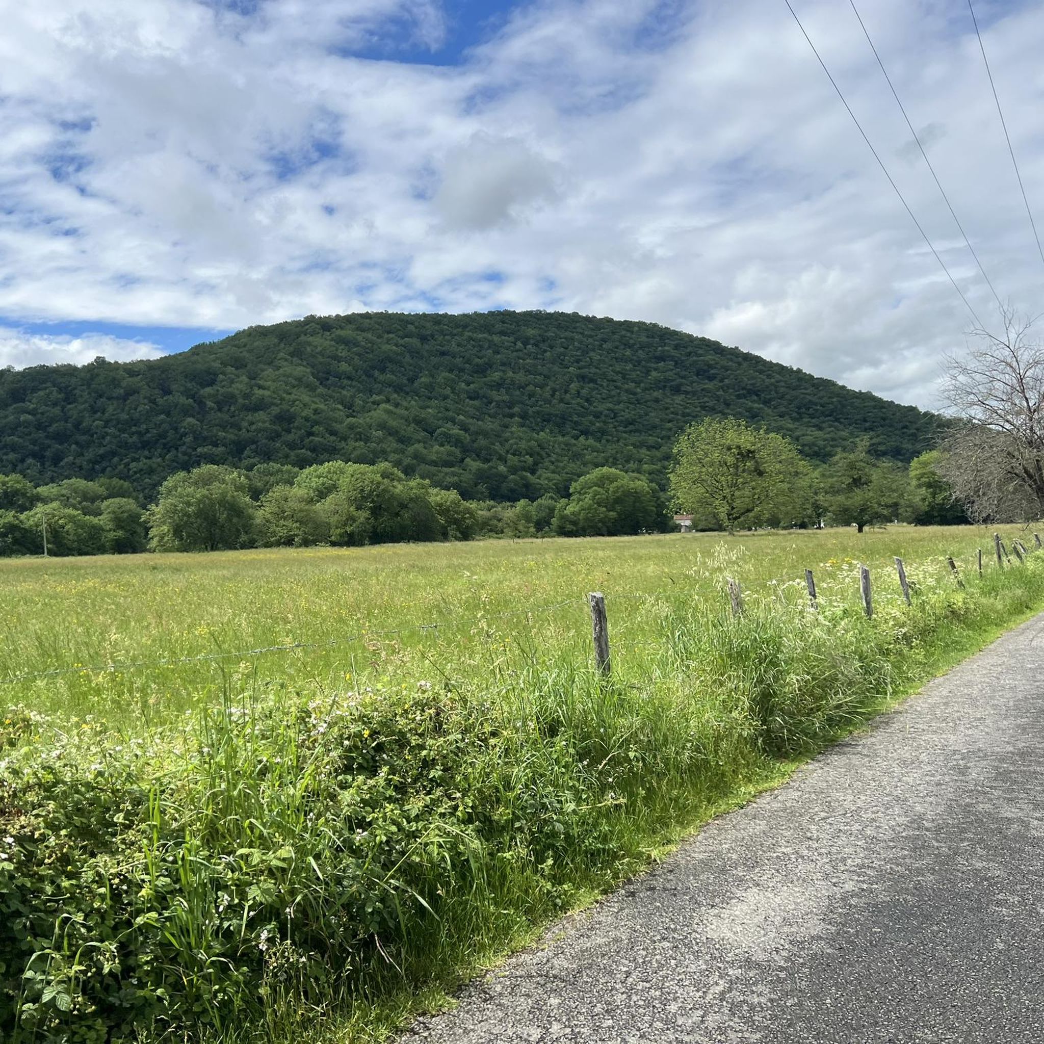
Jogging around Réjaumont offers access to diverse natural landscapes within the Gers department of the Occitanie region. The area is characterized by cultivated fields, the tranquil Ousse river, and the significant Forest of Réjaumont, which is the second largest woodland in the department. These features provide a varied terrain for running, ranging from gentle paths to routes with moderate elevation changes. The region's emphasis on outdoor sports ensures well-maintained trails suitable for runners.
Best jogging routes around Réjaumont
- The most…
Last updated: July 4, 2026
4.0
(1)
9
runners
11.9km
01:16
70m
70m
Moderate run. Good fitness required. Mostly paved surfaces. Suitable for all skill levels.
4.0
(1)
13
runners
9.71km
01:09
230m
230m
Moderate run. Good fitness required. Mostly paved surfaces. Suitable for all skill levels.

Sign up for free
3.0
(1)
10
runners
7.95km
00:53
30m
30m
Moderate run. Good fitness required. Mostly paved surfaces. Suitable for all skill levels.
8
runners
9.73km
01:09
200m
200m
Moderate run. Good fitness required. Mostly paved surfaces. Suitable for all skill levels.
8
runners
10.1km
01:11
200m
200m
Moderate run. Good fitness required. Mostly paved surfaces. Suitable for all skill levels.
Get access to more routes and recommendations from other explorers.
Sign up for free
Already have an account?
Our route recommendations are based on thousands of hikes, rides, and runs completed by other people on komoot.
Start today with a free account
Your next adventure awaits.
Login or Signup


Tips from the Community

Lannemezan, although located at an altitude of 600 meters, has a mountain climate. This is due to the proximity of the Pyrenean chain. The mountains are clearly visible on a clear day. The town has some quite interesting buildings to discover, but above all it has first-rate natural areas due to its numerous waterways.
0
0
Frequently Asked Questions
What makes Réjaumont a great place for running?
Réjaumont, nestled in the Gers department, offers a serene natural setting ideal for runners. Its appeal stems from the significant Forest of Réjaumont, the second largest woodland in the department, which is traversed by the tranquil Ousse river. The area features well-maintained trails through cultivated fields and dense woodlands, providing diverse and picturesque routes for all levels of runners. You can find more information about the forest on the Tourisme Gers website.
How many running routes are available around Réjaumont?
There are over 35 running routes available around Réjaumont, catering to various preferences and fitness levels. These include 3 easy routes, 33 moderate routes, and 2 difficult routes, ensuring a suitable option for every runner.
Are there any easy running routes for beginners or casual joggers?
Yes, Réjaumont offers 3 easy running routes perfect for beginners or those looking for a more relaxed jog. These paths typically feature gentler terrain and shorter distances, allowing for an enjoyable experience without significant challenge.
What do other runners think about the trails in Réjaumont?
The running routes in Réjaumont are highly regarded by the komoot community, boasting an average rating of 4.2 stars from over 10 reviews. More than 240 runners have already explored the varied terrain using komoot, often praising the quiet woodlands and well-maintained paths.
Are there any circular running routes in Réjaumont?
Yes, many of the running routes around Réjaumont are circular, offering convenient starting and ending points. For example, the popular Running loop from Pinas is a 4.3-mile (6.9 km) circular trail, and the Tumulus T1 et T2 loop from Pinas is a moderate 5.0-mile (8.0 km) loop.
Can I bring my dog on the running trails in Réjaumont?
While specific leash rules for every trail are not detailed, the natural environment of Réjaumont, particularly the Forest of Réjaumont, generally welcomes dogs. It's always recommended to keep your dog under control, preferably on a leash, to ensure the safety and enjoyment of all trail users and local wildlife.
Are there family-friendly running routes in Réjaumont?
Yes, with 3 easy routes available, Réjaumont offers options suitable for families. These routes are typically shorter and have less elevation gain, making them ideal for a leisurely run or walk with children. The natural surroundings provide a pleasant environment for outdoor family activities.
What kind of scenery can I expect on the jogging routes?
Jogging routes in Réjaumont offer diverse scenery, characterized by cultivated fields, the serene Ousse river, and dense woodlands, especially within the Forest of Réjaumont. You'll experience a mix of open rural landscapes and shaded forest paths, providing a refreshing natural backdrop for your run.
Are there any interesting landmarks or attractions near the running trails?
While the focus is on natural beauty, there are a few points of interest nearby. You might encounter the historic village of Galan or the town of Lannemezan. The Path Between the Lake and the Neste is also a notable highlight for those exploring the wider area.
Is parking available near the running trails in Réjaumont?
Yes, many running routes in Réjaumont, especially those starting from villages like Pinas or Clarens, offer convenient parking access. It's advisable to check the starting point of your chosen route for specific parking information, but generally, you'll find suitable spots to leave your vehicle.
What is the best time of year to go running in Réjaumont?
The best time of year for running in Réjaumont is generally during spring and autumn when the weather is mild and comfortable. Summers can be warm, but the shaded forest trails offer some respite. Winters are typically mild, making year-round running possible, though some paths might be muddy after rain.
How long do the running routes typically take to complete?
The duration of running routes in Réjaumont varies depending on the distance and your pace. For example, the Running loop from Lannemezan, which is about 4.6 miles (7.4 km), typically takes around 45-50 minutes. Longer routes like the La Tourbière loop from Clarens, at 6.0 miles (9.7 km), can take about 1 hour 10 minutes.
Most popular attractions around Réjaumont

Get inspired with the komoot mobile app


Explore more
Browse the best Running Trails & Routes in other regions.
