The best walks and hikes around Saint-Barthélemy-Le-Meil
4.5
(194)
1,124
hikers
87
hikes
Hiking around Saint-Barthélemy-Le-Meil offers diverse natural features within the Ardèche region of France. The landscape is characterized by trout streams, dense undergrowth, and varied terrain suitable for country walks. Panoramic views are available from locations such as the hamlet of Burianne, extending towards the Alps and Mont Blanc on clear days. The area provides access to the broader Parc naturel régional des Monts d'Ardèche, ensuring a range of hiking trails around Saint-Barthélemy-Le-Meil.
Best hiking trails around Saint-Barthélemy-Le-Meil
- The most popular…
Last updated: June 30, 2026
4.4
(14)
42
hikers
5.73km
01:51
250m
250m
Easy hike. Great for any fitness level. Easily-accessible paths. Suitable for all skill levels.
3.8
(4)
19
hikers
8.64km
02:48
380m
380m
Moderate hike. Good fitness required. Easily-accessible paths. Suitable for all skill levels.

Sign up for free
13
hikers
9.65km
03:08
430m
430m
Moderate hike. Good fitness required. Easily-accessible paths. Suitable for all skill levels.
5.0
(1)
12
hikers
5.62km
01:38
150m
150m
Easy hike. Great for any fitness level. Easily-accessible paths. Suitable for all skill levels.
5.0
(1)
12
hikers
8.23km
02:07
40m
40m
Moderate hike. Good fitness required. Easily-accessible paths. Suitable for all skill levels.
Get access to more routes and recommendations from other explorers.
Sign up for free
Already have an account?
Our route recommendations are based on thousands of hikes, rides, and runs completed by other people on komoot.
Start today with a free account
Your next adventure awaits.
Login or Signup

Tips from the Community


The Chervil Bridge, located in Ardèche, is an elegant structure spanning the Eyrieux River between Saint-Sauveur-de-Montagut and Les Ollières-sur-Eyrieux. Built at the beginning of the 20th century, it is distinguished by its unique reinforced concrete arch, a testament to the first major technical advances of the time. Nestled in a remarkable natural setting, this bridge offers a picturesque view of the valley and is an iconic landmark for walkers along the Dolce Via.
0
0

A small station for repairing and charging bicycles - with shady seating - near a small cafe/restaurant about 50m
1
0


Rest area for both your own consumption and the drinks and snacks offered.
0
0
Possibility of starting from the 3 stations in the region and thus completing one of the 3 sections of +_ 30km outward and possibly return depending on the time or desires. Accessible to all, be careful however it climbs all the time coming from the Rhône. Superb landscapes and very secure routes, accessible to all levels, gravel and vtc, quite a bit of gravel.
0
0

Collanges Lake is a 48-hectare artificial lake (which also serves as a water control dam for the Eyrieux Valley). Swimming is prohibited, but fishing is permitted (category 2). For swimming, you can visit the Eyrium aquatic center, with its 1,650 m² nestled in unspoiled nature, a large swimming pool, beaches, and games.
0
1

Here you have a bike shop that sells a lot of spare parts and equipment in case you need them. We also do repairs. It's always useful to have some on the way just in case, so be sure to add it to your route planning!
0
0
Frequently Asked Questions
How many hiking trails are available around Saint-Barthélemy-Le-Meil?
There are over 80 hiking routes in the Saint-Barthélemy-Le-Meil area, catering to various skill levels. You'll find 14 easy trails, 50 moderate paths, and 16 more challenging routes to explore.
What kind of terrain can I expect on hikes in Saint-Barthélemy-Le-Meil?
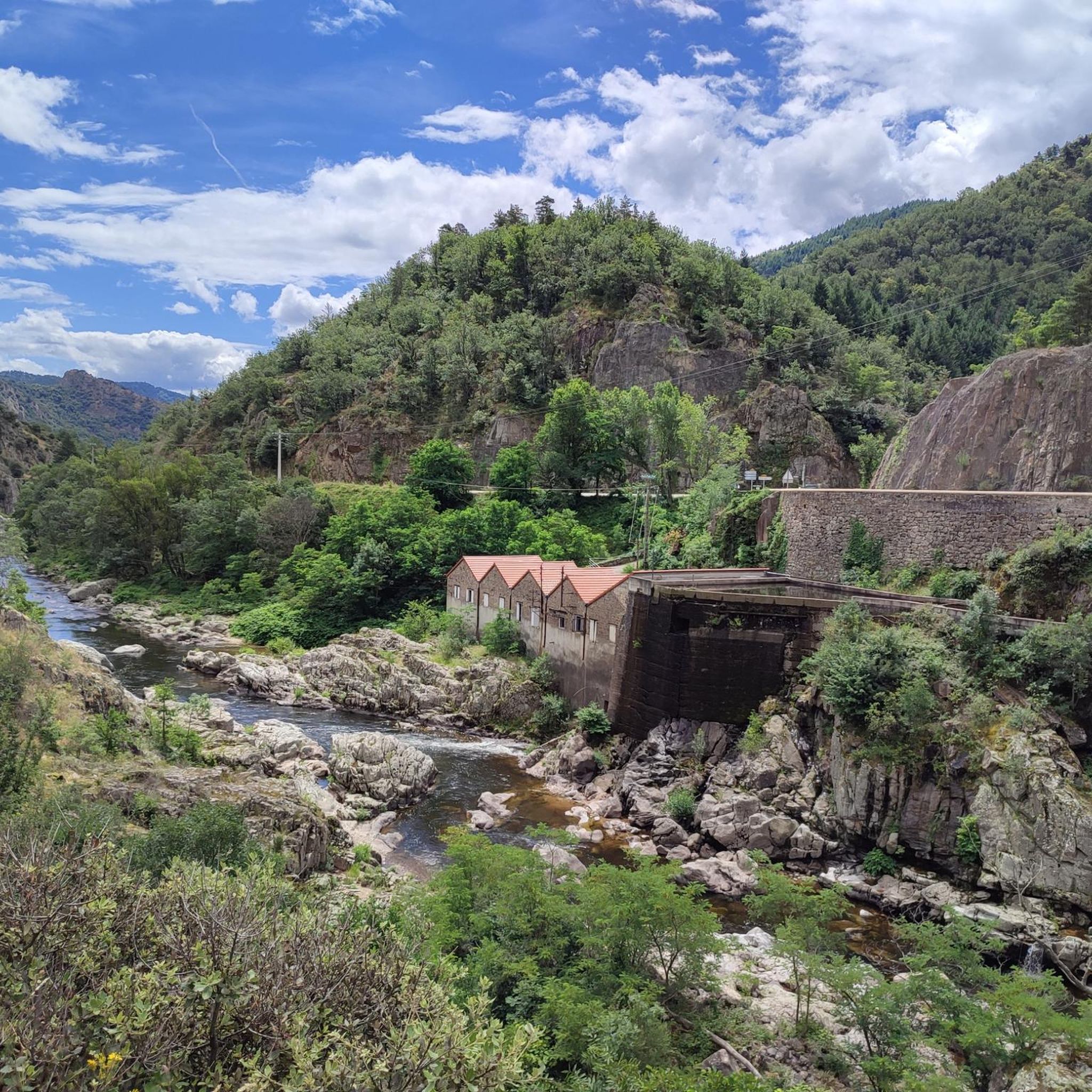
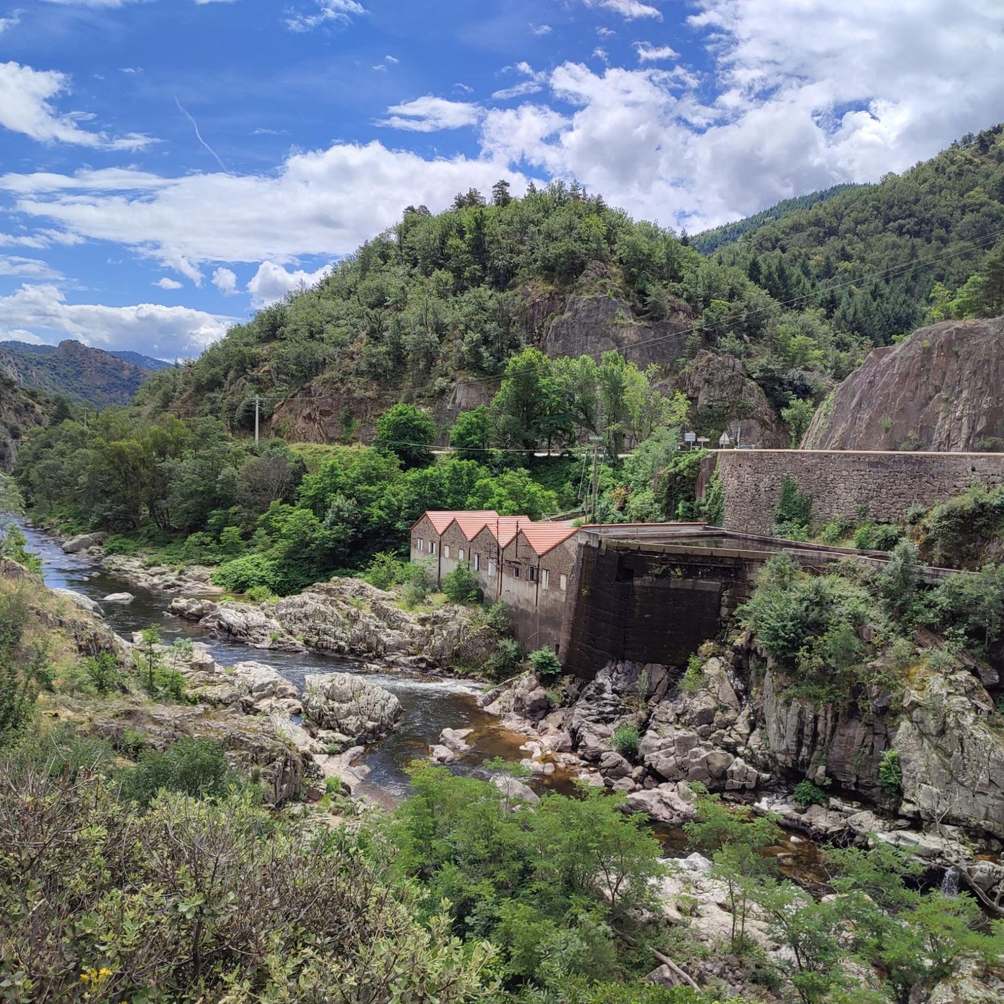
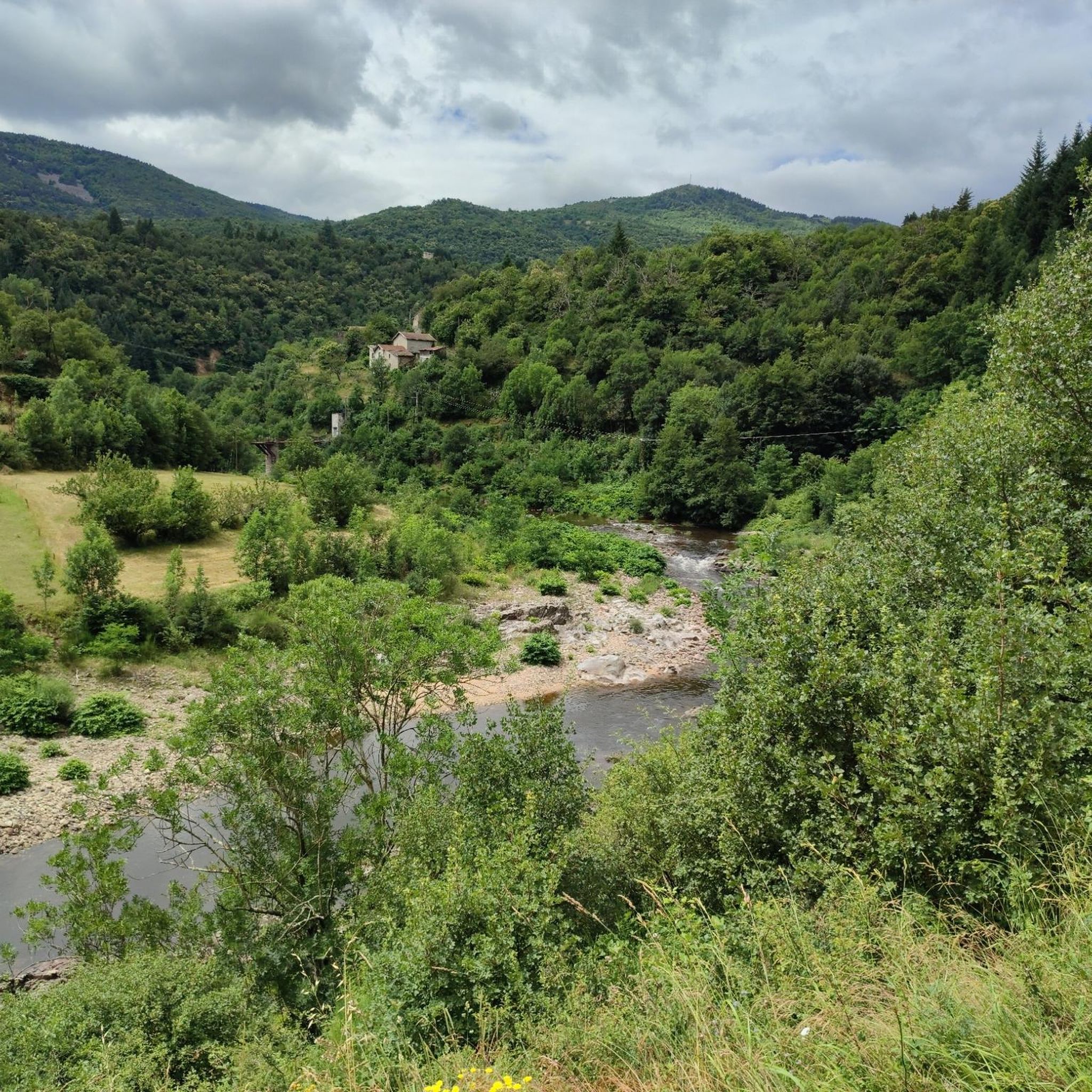
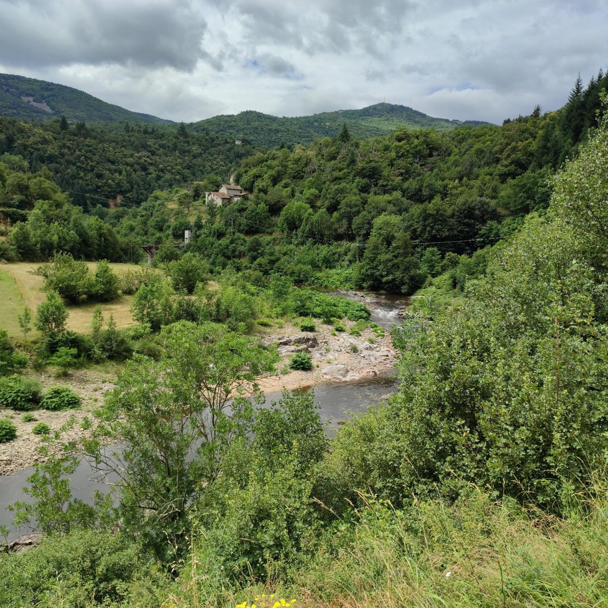
The terrain around Saint-Barthélemy-Le-Meil is diverse, featuring pleasant country walks along trout streams, through dense undergrowth, and within pine forests. You can also expect varied landscapes with opportunities for panoramic views.
Are there any family-friendly hiking options in Saint-Barthélemy-Le-Meil?
Yes, Saint-Barthélemy-Le-Meil offers several easy routes suitable for families. One such option is the Château de la Chèze – Pine forest loop from Le Cheylard, an easy 5.7 km trail that takes about 1 hour 51 minutes to complete through a pleasant pine forest.
Where can I find scenic viewpoints on hikes near Saint-Barthélemy-Le-Meil?
For breathtaking views, consider the hamlet of Burianne, which offers extensive vistas reaching the Alps, including the 'Three Burners' Diois and even Mont Blanc on clear days. Additionally, the View From Rocher du Cheylard loop from Saint-Cierge-sous-le-Cheylard is a moderate 9.7 km trail specifically known for its scenic outlooks.
What natural attractions can I discover while hiking in the region?
The area is rich in natural beauty. You can explore trout streams, discover undergrowth abundant with mushrooms and blueberries, and enjoy the diverse landscapes of the Ardèche. For specific natural highlights, consider visiting Lac des Collanges or seeking out viewpoints like the View of the Eyrieux Valley and the View of the Monts d'Ardèche.
Are there any circular hiking routes available?
Many of the trails around Saint-Barthélemy-Le-Meil are designed as loops, offering convenient circular walks. Examples include the Château de la Chèze – Pine forest loop from Le Cheylard and The Chervil Bridge – Water power loop from Pont de Chervil, which explores the area's water features.
What do other hikers say about the trails in Saint-Barthélemy-Le-Meil?
The hiking routes in Saint-Barthélemy-Le-Meil are highly regarded by the komoot community, holding an average rating of 4.5 stars from over 180 reviews. Hikers often praise the varied terrain, from peaceful pine forests to scenic viewpoints, and the well-maintained paths.
Are there any historical landmarks or points of interest to see?
Yes, the region has several points of interest. You might encounter the former feudal area of Burianne, or explore man-made monuments like the Le Cheylard train station. For a glimpse into the past, Rochebonne Castle is also a notable landmark in the vicinity.
Are there any longer, more challenging hikes in the area?
For those seeking a longer and more challenging experience, there are 16 difficult routes available. A moderate option that offers a good distance is The Code Bar loop from Belsentes, which covers 13.9 km and typically takes around 4 hours to complete.
What is the best time of year to go hiking in Saint-Barthélemy-Le-Meil?
Saint-Barthélemy-Le-Meil benefits from a favorable microclimate, making it enjoyable for hiking across various seasons. Spring and autumn offer pleasant temperatures and vibrant natural colors, while summer is ideal for enjoying the region's streams and forests. Always check local weather conditions before heading out.
Are there any trails that feature water elements like rivers or streams?
Absolutely. The region is characterized by its trout streams, and many trails incorporate these natural water features. For example, The Chervil Bridge – Water power loop from Pont de Chervil is a moderate route specifically designed to explore the area's water elements.
Most popular routes around Saint-Barthélemy-Le-Meil
Most popular attractions around Saint-Barthélemy-Le-Meil

Get inspired with the komoot mobile app


Explore more
Browse the best Hikes in other regions.
