The best running trails around Obermaßfeld-Grimmenthal
4.4
(297)
2,389
runners
16
runs
Jogging around Obermaßfeld-Grimmenthal offers diverse natural landscapes, characterized by gentle hills, dense forests, and expansive fields. The region's proximity to the Thuringian Forest and the Werra River provides varied terrain for runners. Joggers can explore routes along riverbanks, through woodlands, and past tranquil features like the Grimmenthal-Stausee. The area's elevation, ranging from around 300 meters to over 500 meters, ensures a mix of inclines and declines.
Best jogging routes around Obermaßfeld-Grimmenthal
- The most popular jogging route is Fortified church in…
Last updated: July 1, 2026
15
runners
Hard run. Very good fitness required. Mostly paved surfaces. Suitable for all skill levels.
8
runners
Moderate run. Good fitness required. Mostly paved surfaces. Suitable for all skill levels.

Sign up for free
7
runners
12.3km
01:28
260m
260m
Moderate run. Good fitness required. Mostly paved surfaces. Suitable for all skill levels.
4.0
(3)
10
runners
Moderate run. Good fitness required. Mostly paved surfaces. Suitable for all skill levels.
12
runners
Moderate run. Good fitness required. Mostly paved surfaces. Suitable for all skill levels.
Get access to more routes and recommendations from other explorers.
Sign up for free
Already have an account?
Our route recommendations are based on thousands of hikes, rides, and runs completed by other people on komoot.
Start today with a free account
Your next adventure awaits.
Login or Signup
Popular around Obermaßfeld-Grimmenthal
Other adventures around Obermaßfeld-Grimmenthal

Tips from the Community


In the inner courtyard you can see three steel bells up close.
1
0

There are always beautiful stone bridges over the Werra. Often, there are brief information about the bridge along the side.
1
0

Beautiful cycle path and even suitable for racing bikes!
0
0

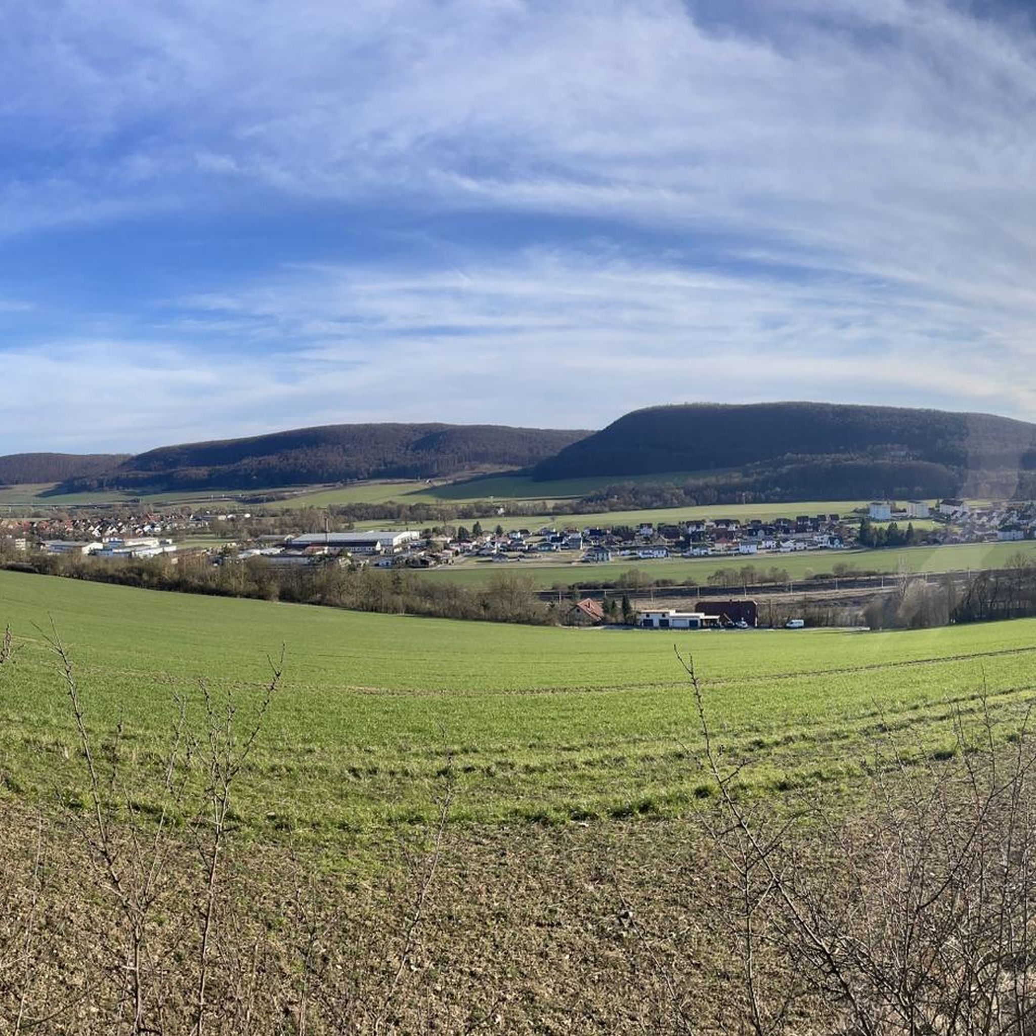
Wonderful view of Obermassfeld and surrounding areas
0
0

Here the dogs come flying out of the bushes and run after their mistresses... cute little place.
3
0

Einhausen goes back to a Celtic settlement that must have been here, as grave finds near the motorway prove. However, it was not officially mentioned for the first time as Egenenhusen until 1151. Einhausen was almost wiped out in the Thirty Years' War. Only 4 of 60 families remained. For hikers, there is a particular attraction in Einhausen to explore the church fortress, which can be entered even if the gate appears to be locked. The church itself can be opened by calling a cell phone number.
1
0
The first church in Einhausen was built in 1369. Information panels provide insights into the interior, as well as the historical burials and ancient grave goods. Those wishing to explore the churchyard shouldn't be deterred by the locked gate. The massive bolt can and may be opened! Within the fortified churchyard lie the cemetery, residential buildings, and the church itself. Although the church is locked, it will be opened upon request. The mobile phone number is posted on the door.
1
0
Frequently Asked Questions
How many running routes are available around Obermaßfeld-Grimmenthal?
There are currently over a dozen dedicated running routes around Obermaßfeld-Grimmenthal listed on komoot. These routes cater to various fitness levels, from easy paths to more challenging trails through the diverse landscape.
What kind of terrain can I expect on jogging trails in Obermaßfeld-Grimmenthal?
Jogging routes in Obermaßfeld-Grimmenthal feature a varied terrain, including gentle hills, dense forests, and expansive fields. You'll find a mix of forest and gravel paths, with some routes offering views from higher vantage points. The area's proximity to the Thuringian Forest and the Werra River ensures diverse running experiences.
Are there any easy or beginner-friendly running routes in the area?
Yes, Obermaßfeld-Grimmenthal offers several easier routes suitable for beginners or those looking for a more relaxed run. For instance, paths along the Untermaßfeld Fish Ponds provide a pleasant, flat option. While specific easy routes are not detailed in the top picks, komoot lists 2 easy routes out of 16 total, ensuring options for all levels.
Can I find routes with scenic viewpoints or natural attractions?
Absolutely. Many routes offer picturesque views and pass by natural attractions. You can enjoy idyllic runs along the Werra Riverbanks or explore trails that lead to features like the Grimmenthal-Stausee. For panoramic views, consider routes that offer a 'Blick auf Obermaßfeld-Grimmenthal' or explore highlights such as the Sternplatz and the Adolfstein Memorial.
Are there any circular running routes around Obermaßfeld-Grimmenthal?
Yes, many of the running routes in Obermaßfeld-Grimmenthal are designed as loops, allowing you to start and finish in the same location. An example is the moderate Fortified church in Einhausen – Historic Bridge Near Einhausen loop from Grimmenthal, which covers about 7 kilometers.
What do other runners say about the trails in Obermaßfeld-Grimmenthal?
The running routes in Obermaßfeld-Grimmenthal are highly regarded by the komoot community, boasting an average rating of 4.5 stars from over 280 reviews. Runners often praise the varied terrain, the beautiful natural scenery, and the well-maintained paths that make for an enjoyable experience.
Are there any historical landmarks or points of interest along the running trails?
Yes, the region is rich in history and offers several interesting landmarks. You might encounter historic bridges along the Werra River or pass by sites like the Hohe Schule Hillfort. The area also features the Artificial ruins in the English Garden, Meiningen, which can be explored nearby.
Are the running routes suitable for families?
While some routes feature challenging elevation gains, there are also easier, flatter paths that are well-suited for family outings. The paths along the Untermaßfeld Fish Ponds, for example, offer a pleasant and accessible environment for a relaxed run or stroll with children, allowing for wildlife observation.
Can I bring my dog on the running trails?
Generally, many outdoor trails in Germany, including those around Obermaßfeld-Grimmenthal, are dog-friendly. However, it's always recommended to keep your dog on a leash, especially in nature reserves or areas with wildlife, and to be mindful of other users. Always check local signage for specific regulations.
Are there any longer, more challenging running routes for experienced runners?
Yes, experienced runners will find several challenging options. The Fortified church in Einhausen – Bridge over Schwarza loop from Grimmenthal is a difficult 15.7 km trail, and the Historic Bridge Near Einhausen – Werra Riverside at Vachdorf loop from Grimmenthal offers another difficult 15.4 km path with views along the Werra River.
What is the elevation like on the running routes?
The elevation in Obermaßfeld-Grimmenthal ranges from around 300 meters to over 500 meters in surrounding areas. This means you can expect a good mix of inclines and declines, providing diverse challenges. For example, the Marienweg Trail – Zig-Zag Trail loop from Obermaßfeld-Grimmenthal includes significant elevation gain.
Are there any routes that follow the Werra River?
Yes, the Werra River is a prominent feature of the region, and several running routes follow its banks. The Werra Valley Cycle Path, known for its scenic beauty, is also suitable for running and offers idyllic routes with historic bridges and serene water views. The Hasel Railway Bridge loop from Grimmenthal is one such route that offers riverside sections.
Most popular routes around Obermaßfeld-Grimmenthal
Most popular attractions around Obermaßfeld-Grimmenthal

Get inspired with the komoot mobile app


Explore more
Browse the best Running Trails & Routes in other regions.
