The best cycling routes around Breuil
4.5
(55)
512
riders
130
rides
Touring cycling around Breuil offers routes through high-altitude alpine landscapes, characterized by dramatic peaks and glacial features. The region is situated at 2,050 meters above sea level, providing extensive views of snowfields, moraines, and meadows. Routes often feature the imposing Matterhorn as a backdrop and traverse the scenic Valtournenche Valley. The terrain includes both challenging climbs and more moderate paths suitable for various cycling abilities.
Best touring cycling routes around Breuil
- The most popular touring cycling route is Gueux Lake…
Last updated: October 10, 2026
4.4
(7)
21
riders
53.5km
03:26
660m
660m
Hard bike ride. Very good fitness required. Mostly paved surfaces. Suitable for all skill levels.
5.0
(1)
10
riders
53.3km
03:32
430m
430m
Moderate bike ride. Good fitness required. Mostly paved surfaces. Suitable for all skill levels.

15
riders
54.8km
04:40
820m
820m
Hard bike ride. Very good fitness required. Mostly paved surfaces. Suitable for all skill levels.
4.0
(1)
15
riders
11.3km
00:40
50m
50m
Easy bike ride. Great for any fitness level. Mostly paved surfaces. Suitable for all skill levels.
4.0
(1)
7
riders
25.8km
01:36
260m
260m
Moderate bike ride. Good fitness required. Mostly paved surfaces. Suitable for all skill levels.
Get access to more routes and recommendations from other explorers.
Already have an account?
Our route recommendations are based on thousands of hikes, rides, and runs completed by other people on komoot.
Start today with a free account
Your next adventure awaits.



Tips from the Community

cemetery located in the town of Bligny
0
0

Under the central arch is a calendar depicting the activities and tasks of agriculture and viticulture: grape pressing, harvesting, etc. A calendar can be seen here through the carved reliefs. Under the eastern arch, we can see a she-wolf suckling Romulus and Remus. According to legend, it was Remus who founded Reims. Finally, under the western arch, we can see Leda being seduced by Jupiter.
1
0
This ancient monument is one of the longest in the Roman world: it is approximately 32 meters long and 12 meters high! The Mars Gate was built towards the end of the 2nd century and is the only one of the four monumental arches providing access to the city of Durocortorum that has survived. It consists of three arcades. The central arch carried the city's major north-south axis, intended for the passage of carriages. The two side arcades were used by pedestrians.
1
0

The monument survived destruction because it was walled up inside the Archbishop's castle in the 13th century, which inadvertently preserved it for future generations.
3
1
The Porte de Mars is a 3rd-century Roman monument in Reims, France, representing the widest arch in the entire Roman world at 33 meters long and 13 meters high. Originally built as one of four monumental arches at the cardinal entrances to ancient Durocortorum, it's the only surviving example of these grand structures. The arch features three decorated archways with intricate relief carvings, including scenes of Romulus and Remus with the she-wolf, agricultural calendars showing Gallic harvesters, and mythological figures like Leda and Zeus.
3
1

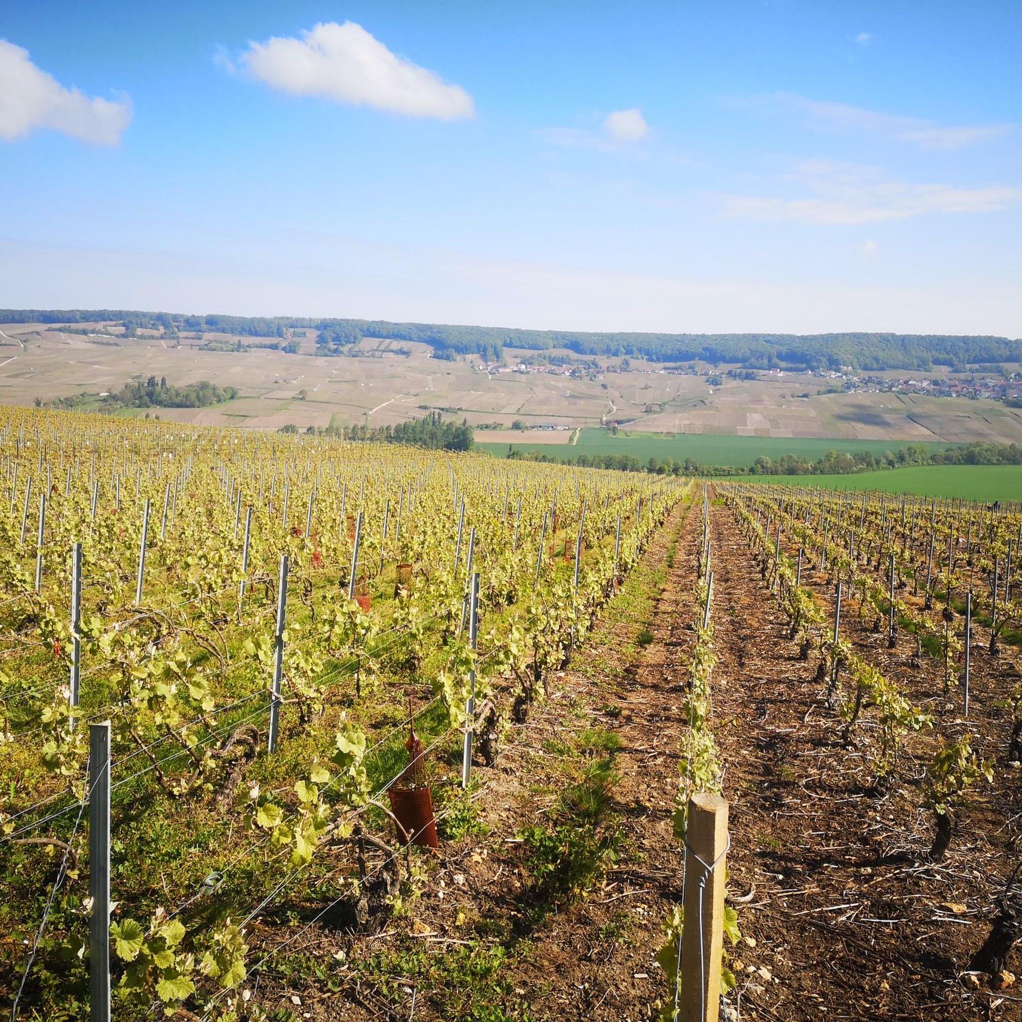
Beautiful cycle path along the water.
0
0

One of the most fascinating aspects of the Porte de Mars is the interior of the vaults, which, despite heavy wear, feature a rare depiction of a Gallic reaper as part of a calendar of agricultural labors. This series of medallions depicts various agricultural activities such as plowing, harvesting, and milling. Below the western arch, a square medallion depicts the legendary she-wolf suckling Romulus and Remus, watched by the shepherd Faustulus and Acca Larentia. This scene is said to symbolize the deep connection between Reims and Rome, with local legend stating that Reims was founded by Remus or his companions after their escape from Rome.
1
0

Frequently Asked Questions
How many touring cycling routes are available in Breuil?
Breuil offers a wide selection of touring cycling routes, with over 130 options available. These routes cater to various skill levels, including 17 easy, 69 moderate, and 45 difficult trails.
What kind of landscapes can I expect to see while touring cycling in Breuil?
Touring cycling in Breuil immerses you in stunning high-altitude alpine landscapes. You'll frequently encounter dramatic peaks, extensive snowfields, moraines, and lush meadows. The majestic Matterhorn (Monte Cervino) often serves as a breathtaking backdrop, and many routes traverse the scenic Valtournenche Valley. You might also spot picturesque glacial lakes like Lago Blu, famous for reflecting the Matterhorn.
What do other cyclists say about touring cycling in Breuil?
The touring cycling routes in Breuil are highly regarded by the komoot community, holding an impressive average rating of 4.4 stars from over 40 reviews. More than 600 touring cyclists have already explored the varied terrain of Breuil using komoot, praising the challenging climbs and stunning alpine scenery.
Are there any routes with significant elevation gain for experienced cyclists?
Yes, Breuil offers several challenging routes with significant elevation gain, perfect for experienced cyclists. For example, the Gueux Lake Park – Lavoir loop from Jonchery-sur-Vesle is a difficult 33.4-mile (53.8 km) trail with over 650 meters of ascent. Another demanding option is the Hourges Washhouse loop from Breuil-Romain, which spans 55 miles (88.5 km) and features over 800 meters of elevation gain.
Are there any circular touring cycling routes in Breuil?
Yes, many of the touring cycling routes in Breuil are designed as loops, allowing you to start and finish at the same point. Examples include the moderate Reims green corridor – L'hotel de ville loop from Vandeuil and the Gueux Lake Park – Châlons-sur-Vesle Sandpit loop from Breuil-Romain, both offering diverse landscapes.
What are some notable landmarks or attractions I can see along the touring cycling routes?
While cycling in Breuil, you can encounter several interesting landmarks and natural features. Keep an eye out for the picturesque Gueux Lake Park, the unique Châlons-sur-Vesle Sandpit, and the historic The Lagery Market Hall. The region's natural beauty also includes the iconic Matterhorn and the stunning Lago Blu.
Are there any family-friendly touring cycling routes in Breuil?
While Breuil is known for its challenging alpine terrain, there are easier routes suitable for families, particularly those with some cycling experience. The region's infrastructure, including the availability of e-bike rentals, can also make exploring more accessible for families looking to enjoy the scenic views together on less strenuous paths.
What is the best time of year to go touring cycling in Breuil?
The best time for touring cycling in Breuil is typically during the warmer months, from late spring to early autumn (June to September). During this period, the snow has largely melted from lower and mid-altitude routes, and the weather is generally more stable, allowing for comfortable cycling and clear views of the alpine scenery. Always check local weather conditions before heading out.
Is public transport available to access touring cycling routes in Breuil?
Breuil-Cervinia is accessible by public transport, primarily buses connecting from nearby towns and train stations in the Aosta Valley. While specific routes might not have direct public transport access, using the main bus lines to reach Breuil can be a starting point for many tours. It's advisable to check local bus schedules and policies regarding bicycle transport.
Are there options for easier or beginner touring cycling routes in Breuil?
Yes, Breuil offers 17 easy touring cycling routes, making it possible for beginners or those preferring a more relaxed ride to enjoy the area. These routes typically feature less elevation gain and are shorter in distance, allowing cyclists to experience the beautiful surroundings without excessive challenge. The availability of e-bike rentals in the region can also greatly assist less experienced riders on moderate terrain.
Can I find cafes or places to stop for refreshments along the touring cycling routes?
Given Breuil-Cervinia's popularity as an outdoor destination, you will find cafes, restaurants, and mountain huts in the main village and scattered throughout the broader Valtournenche Valley. While specific routes may vary in terms of refreshment stops, planning your tour to pass through villages or near known establishments will allow for breaks and refreshments.
Most popular attractions around Breuil

Get inspired with the komoot mobile app


Explore more
Browse the best Cycling routes in other regions.
